Remote Sensing, Climate Change, Offshore Wind, and Fishing
Project One: Detecting Ocean Bottom Trawling Using Remote Sensing
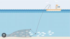
Bottom trawling is a fishing practice that captures species living on or near the ocean bottom by towing a heavily weighted net along the seafloor. It is one of the most destructive ways to catch fish. Bottom trawling harms benthic animals, releases carbon stored in seafloor sediments, and, when done repeatedly in the same area, has long-lasting cumulative impacts on the benthic ecosystem. Although bottom trawling has been banned by most countries, illegal bottom trawling is largely unrestrained due to enforcement challenges. The objective of this project is to evaluate the use of remotely sensed fishing vessel tracking data obtained through the automatic identification system to detect bottom trawling from middle water trawling.
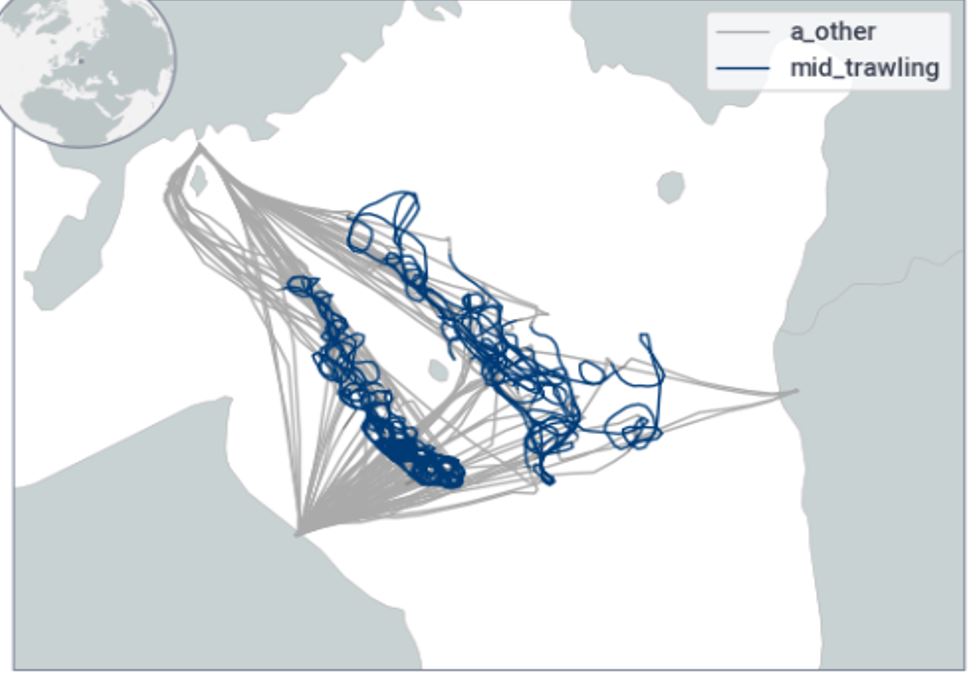
Movements of Mid-water trawlers from Satallite Observations. Machine Learning Algorithm is trained to detect mid- and bottom-water trawlers from difference in Speed, Movement Patterns and Other Factors.
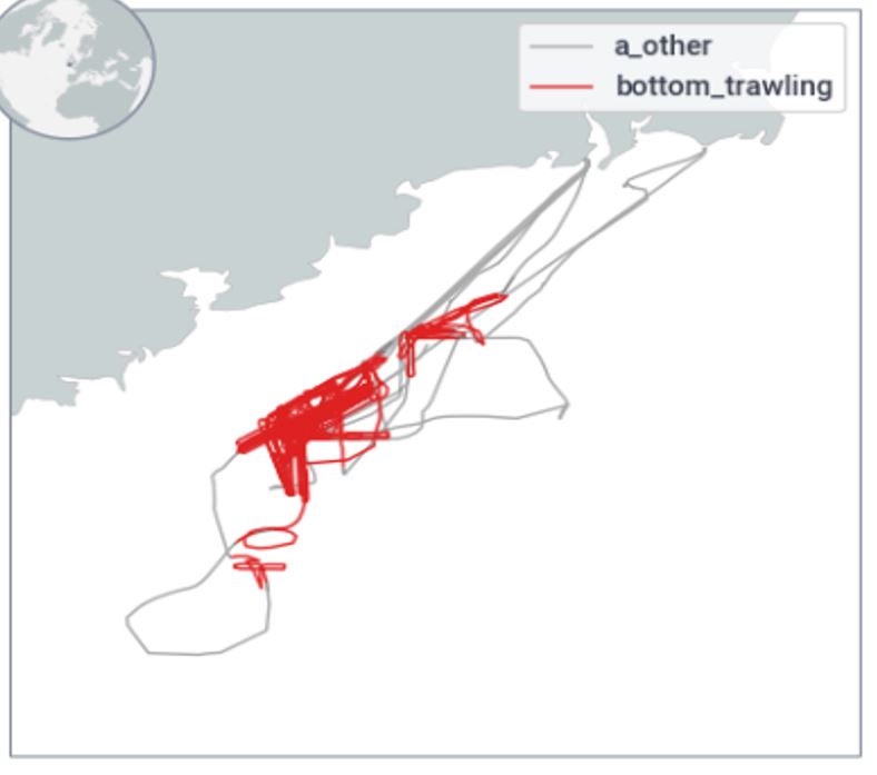
Movement of Bottom Trawlers from Satellite Observations
Global Fishing Watch (GFW), our partner for this project, uses a multimodal approach including the Automatic Identification System (AIS), vessel registry information, and expert onsite observations to provide detailed tracking data on fishing vessels (location, speed, bathymetry, movement patterns, vessel ID, country of flag). Fishing vessels have very distinct movement patterns according to the type of fishing they are conducting, and machine learning models can be used to identify fishing activities using their movement patterns. GFW's existing model performs well at classifying large fishing vessels using the most common gear types (longlines, trawls, and pelagic purse seines), but the model perform is unsatisfactory at differentiating between different kinds of trawling activities (midwater versus bottom trawling). The current GFW model was trained using data from a limited number of regions where little mid-water trawling occurs.
The WHOI team constructed a global database of fishing activities based on available records. We collected fishing records from 16 countries and regions, recording the number of available records, the sources of vessel information, the start and end dates of fishing activity, and the types of gear used. We then used this dataset to evaluate the performance of the existing GFW model, retrain it, and evaluate the performance of the new model. Following retraining with the new dataset, the overall accuracy of the GWF model improved by seven percentage points from 86 percent to 93 percent. In the case of bottom trawling, model precision—it’s ability to avoid falsely identifying a fishing activity as bottom trawling when it is actually something else—increased from 75 percent to 83 percent, an improvement of 6 percent.
Funding Agencies

Related Links and File
Project Two: The Future of Fishing in the High Seas under Climate Change
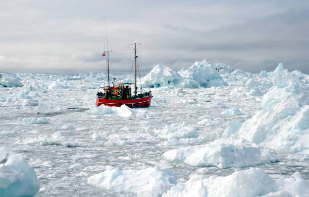
Fishing boats are breaking through icebergs in the Arctic Ocean
Fishing in the high seas (64% of the global ocean beyond national jurisdiction) has expanded with advanced technologies. Concerns on overfished species, fragile habitats, and biodiversity have led to the signing of the High Seas Treaty. The successful implementation of the treaty comes with the challenge of understanding the complex dynamics of ocean-human interactions affected by climate change. High-seas fisheries are an important economic resource, amounting to around 6% of global catch and 8% of the global fishing revenue in 2014.
High seas fishing is dominated by a few countries. The most prevalent gear type is drifting longlines (59% of the vessels and 68% of all fishing days), followed by squid jiggers, purse seines and trawlers. Catch in the high seas contains mainly high migratory species. Tuna and tuna-like species collectively accounted for 61% of the total high seas catch. Top importers of these species include countries in the European Union (EU), Japan, United States, Thailand, serving upscale markets like sashimi, as well as canned tuna and feed for aquaculture.
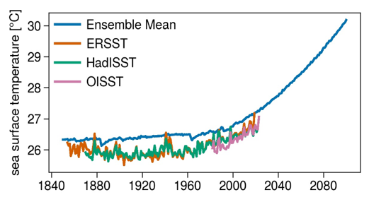
Temperature trends, multiple measure of Indian Ocean
We build an environmental niche model using a boosted regression tree (BRT) modeling approach. We estimate and validate the model with data from 2012-2020 of longline vessels in the Indian Ocean and project fishing grounds of longline vessels up to 2100. Based on the monthly fishing distribution forecast maps, we delineated the core suitable fishing grounds. We then forecasted the centroid (i.e., the "centre of gravity") of each core suitable fishing grounds, for each month between Jan 2020 until Dec 2100. By linking port locations to depict the projected fishing routes, average distance of traveling to fishing hotspots were simulated and compared at monthly and decadal levels across country and regions.
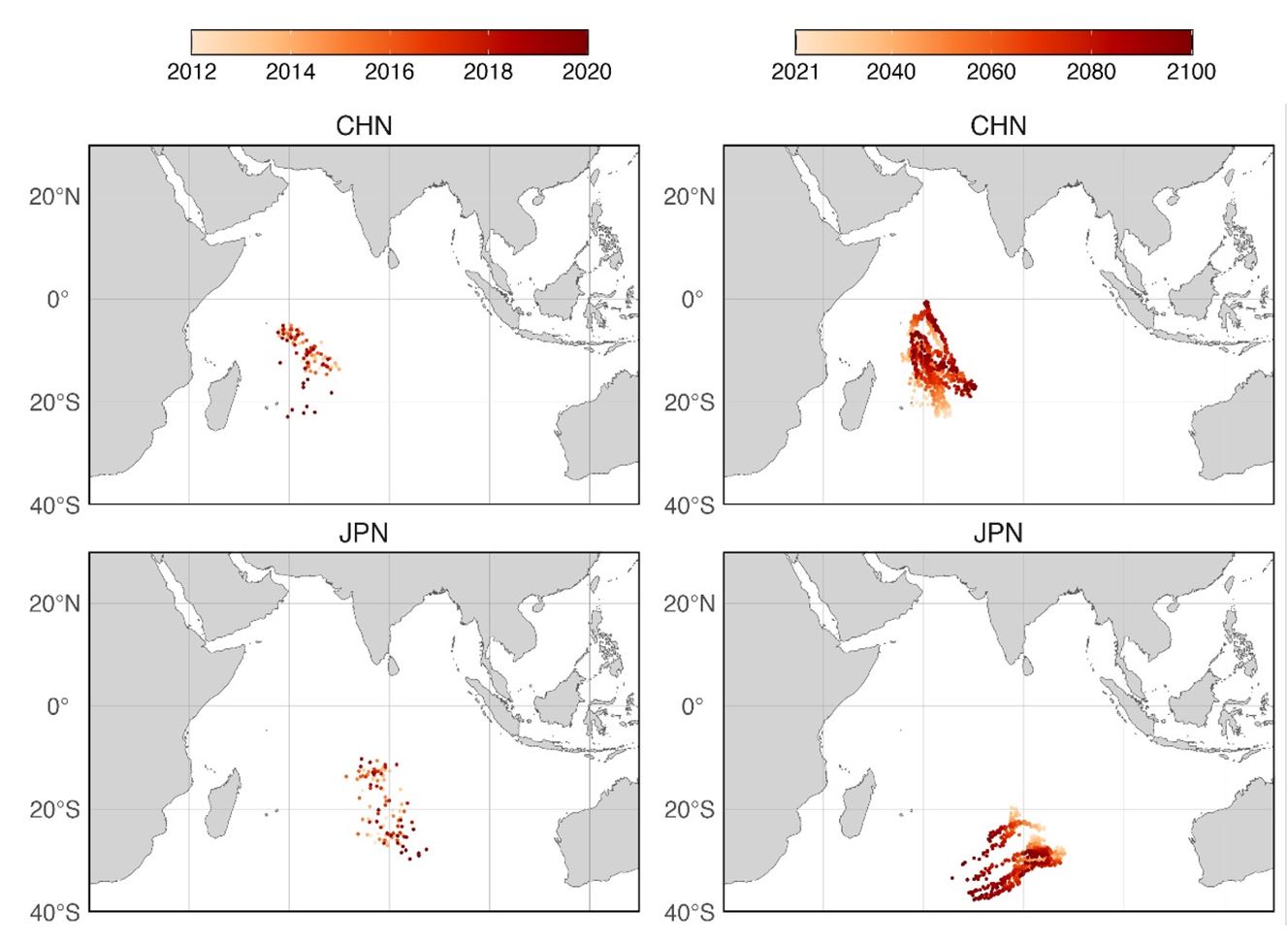
Center of Gravity of Fishing Locations, Indian Ocean, China and Japan
Chinese fleet concentrated in western Indian Ocean and moves southeastern between Austral winter and summer. China began longline fishing in the Indian Ocean in 1995. Between 2012-2020, the centers of gravity of fishing locations of Chinese vessels are graduating moving southwest in the Indian Ocean, with fishing locations in Austral winter to the southeast of that in Austral summer. The mean distance traveled was between 4000-6000 nmis and is higher in Austral winter. Japanese fleet fishing efforts avoided the concentrated fishing regions of Taiwan and China, distributed in two distinct sections, the west and east Indian Ocean. It also shows a shift toward south from Austral summer to winter. The mean traveled distance was also between 4000-6000 nmis and is higher in Austral winter.
Partners/Collaborators
Svenja Ryan, Physical Oceanography, WHOI
Camrin D. Braun, Biology, WHOI
Martin Arostegui, Biology, WHOI
Daniel P. Zitterbart, AOPE, WHOI
Tyler Clever, Global Fishing Watch
Fund This Project
Contact:
development@whoi.edu
Marine (Yaqin) Liu: yaqliu@whoi.edu
Related Links and File
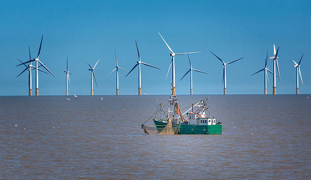
Project Three: Socioeconomic Impacts of Offshore Wind Energy Development on Commercial Fisheries
As the world transitions into an age of sustainability it is imperative that policy makers, stakeholders, and the public understand how the development of renewable energy interacts with existing industries that make up significant sectors of state economies. Principal among these inter-industry interactions is that between fishing and offshore wind. Multiple concerns arise including accessibility of quality fishing grounds, disruption of travel to and from fishing grounds, and disruption of fish distributions. These competing factors will combine in complex ways to determine whether fishermen alter their fishing behavior once installations are erected. When assessing the impact of offshore wind development on fishing in the U.S., the challenge of a “de facto” quantitative assessment lies in the fact that offshore wind development has not yet fully implemented and there is a lack of observations of fishing activities post offshore wind development in this region. Hence, the task of assessing the potential impact is essentially predicting the plausible impact.
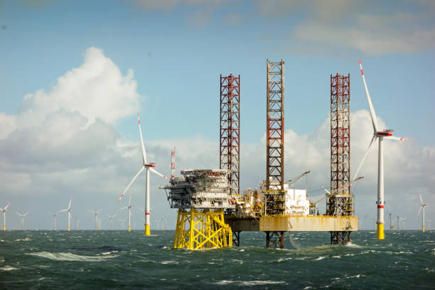
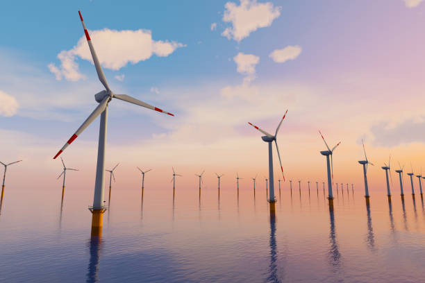
Wind farm on the horizont in north sea with jack up boat and offshore platform in wavy sea
Modeling of fishing vessel activities needs to be based on observations. For a certain period, both before and after offshore wind installations, observations on fishing locations and fishing hours are to be collected. Here we will use observations from the North Sea, where massive offshore wind installments was established in the last two decades. Econometric analysis can be applied to examine the causal impact of changes on fishing location and fishing hours per gear type. Spatial network analysis can be applied to examine changes in vessel interactions. The estimated causal impact parameters then can be transferred to model fishing activities changes where offshore wind is planned given observations of fishing activities and offshore blueprint in that region
Assessing future offshore impacts on fishing needs to account for climate change. The Northeastern U.S. coastline is warming faster than in most other regions. Key commercial and recreational species (e.g., American lobster, Atlantic cod, black sea bass, flounder) have shown range shifts in response to the changing environment in this region. Species range shifts have profound implications for fishing effort and fisheries economics. Changes in environmental conditions, including sea surface and bottom temperatures, ocean stratification, oxygen concentrations, and variations in local oceanic processes cause shifts in species distributions and fishing locations. Thus, it is important to separate the impact of climate change from that of offshore wind installation when quantifying the changes of fishing behavior due to offshore wind development.
We will build a vessel distribution model (VDM) to serve as the base to predict future offshore wind effects. A VDM model is a machine learning model that calibrates fishing vessel distribution given the physical environment (e.g., sea surface temperature, salinity, wind, etc.). This model will be built based on historical observations of temporal-spatial observations of fishing efforts. Using predictions of the physical environment from climate models, we can simulate future temporal-spatial maps of fishing efforts. This map will serve as the “counterfactual” – the baseline of fishing activities if offshore wind development does not occur. Based on this map, we can import the estimated causal effects from econometric analysis to simulate the changes on vessel route and fishing hours, and the network. In this way, we can show how offshore wind will impact fishing vessels given climate change.
Partners/Collaborators
Douglas Christel, Greater Atlantic Regional Fisheries Office, NOAA
Tyler Clever, Global Fishing Watch
Fund This Project
Contact:
development@whoi.edu
Marine (Yaqin) Liu: yaqliu@whoi.edu