2025 Journal Entries from the Field

CONTENTS
1. A BEGINNING
2. SOMEWHERE OUT THERE
3. SHIPS IN PURSUIT OF WATER
4. THE PIONEERS. PART ONE.
5. WEATHER
6. THE PIONEERS. PART TWO.
7. LIFE ABOARD
8. A GAMBLE, ALWAYS A GAMBLE
9. IN HARM'S WAY
10. DISCOVERING WATER
11. WHY
WHY
At sea, 17 September 2025 aboard the research ship Roger Revelle
“This must be the most comprehensive collection of CTD transects, collected within a few weeks, ever made in these waters” Email from Bob’s Faroese collaborator Hjálmar Hátún.
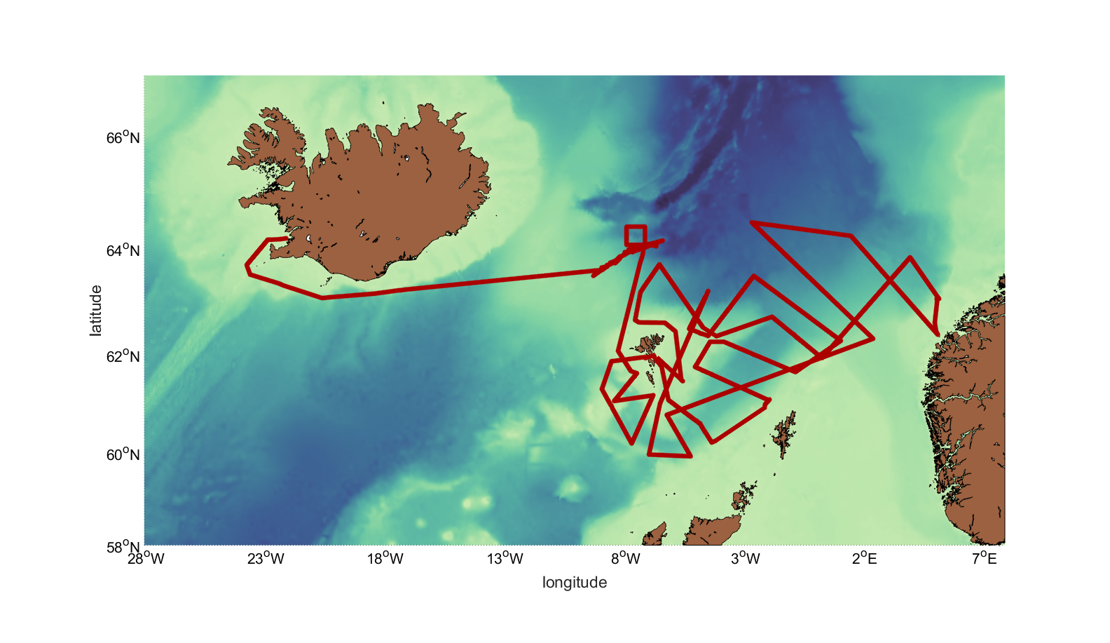
All these little currents going from there to here. All this expense, these 24-hours-a-day of physical and intellectual effort for five weeks. We retrieved ten moorings, made 348 CTD casts measuring a cumulative water depth of 318.6 kilometers, and covered 3,l83 nautical miles. In response to this enormous effort, a reasonable question arises: Why? Why this patch of ocean? Why study sea water and its movement at all, let alone in such meticulous detail?
Is it ultimately about climate? That would make sense. Most everyone knows that the ocean and its sister fluid, the air, are prime drivers of global climate. La Nina and El Nino are textbook examples of how ocean and atmosphere collaborate to determine climate at sea and on land in the eastern Pacific region, with effects felt as far afield as the Arctic. There are dozens of other examples. But since this study has been about the overflow waters in the Nordic Seas, let’s focus the “why bother?” question to that area.
Normally, there is a heat gain to the ocean in the tropics and a net heat loss in the high latitudes—but together the gain and loss on a basin-wide scale cancel each other out, and the net change is zero. Thus, the climate is in balance. But as I hope we’ve established by this point, the delicate link in the circle is here in the Nordic Seas: the return flow of cold depends on the tropical-origin water relinquishing its heat to the winter air, growing dense, and sinking. This system is called the Atlantic Meridional Overturning Circulation. You may have heard of AMOC. It’s gotten a lot of press lately:
Collapse of critical Atlantic current is no longer low-likelihood, study finds. Guardian, 8/28/25
Key Atlantic current could collapse soon ‘impacting the entire world,’ leading climate scientists warn. LiveScience 10/22/24
Given my lack of qualifications, I wouldn’t dare remark on the quality or accuracy of those modeling studies. But the very possibility of an AMOC collapse “impacting the entire world” might be good reason to pay for ships to go out here and take actual measurements. Then, if collapse is actually in the offing, we’ll have fair warning, thus wisely act accordingly to change our ways. Right?
So it’s really about us? I recently watched a beautifully shot, intelligent documentary on the Amazonian rain forest that detailed the awesome diversity of life forms and the web of life connecting one to the other and all to the trees. Concluding, the narration made a plea for the preservation of the jungle in part on the grounds that somewhere among its still unknown myriad of botanical species we might find a cure for cancer. That would be a wonderful thing, of course, but the implication was that we ought to refrain from cutting down all the trees because they might serve us at some point in the future.
That same human-centric argument gets applied to the ocean. We should protect the ocean and its diversity of life from our effluviant, because if we don’t, it may rise up, flood our shores or even plunge us into a new ice age. This is also compelling reason to learn the ocean’s ways and means, yet it is also a reflection of the ethical perspective that brought us to this juncture in the first place: that nature is first and last for and about us.
This thing called AMOC happens because the winds blow, Earth rotates, and sea water layers itself in different densities, together forming one of nature’s most magnificent physical systems. It’s just that nature didn’t count on us and our machines to interrupt the elegant balance. However, even if all were well with our climate, the balance unthreatened, scientists like Bob and his collaborators would still be motivated to seek new ways to apply available technology and knowledge gained from pervious expeditions to expand our understanding of the parts that comprise its whole, simply because of its magnificence—because the thing per se—warrants curiosity. And because that’s what oceanographers do and because the doing enriches us beyond the practical.
That’s, of course, easy for me to say. I’m not seeking funding to do what he does.
I’m sitting in that spot on the 0-2 deck, starboard side, watching the surface of the sea. We’ve stopped. The final CTD package has been winched off the deck ready to go over the side. Bob is noted for the extremely tight spacing between his CTD casts. Like a picket-fence pattern, I’ve heard it described, but vertical Venetian blinds might be a more apt simile. “I don’t want to miss anything,” he says.
That ending feeling is in the air. Scientists and technicians are packing their gear, over dinner people talk about flight connections. Day after tomorrow we’ll dock at Tórshavn. Each cruise has a beginning, when all are excited, expectant as the last glimpse of land falls astern; a middle, when shipboard routine obtains and one day bleeds into the next; and an ending, more quiet, maybe pensive. But, then, maybe I project. Some people are ready just to get the hell off. It’s been a long cruise.
This is the last time I will go to sea with Bob, so maybe only I who feel pensive as night falls. But I doubt I’m alone in that. All our endeavors, scientific or otherwise, end, new ones begin and in turn end. The ocean changes and changes again. But never ends.
Dallas Murphy

DISCOVERING WATER
At sea, 16 September 2025 aboard the research ship Roger Revelle
My heroes have always been marine explorers, particularly during the Enlightenment, when the refreshing purpose was to find and learn something about new lands and people, not claim the former and enslave the latter. I could go on beyond your patience about the intellectual, even subversive, ramifications of exploration, but let’s stick to this point: No expedition sailed off on a random search for whatever might be found. There was always an articulable objective. But sometimes in its pursuit, the shock of accidental discoveries flipped previous world views. (For one instance, Captain Cook happened upon the then unknown—to Caucasians—Hawaiian Islands while en route in search for the Northwest Passage.) It’s not too romantic to see the oceanographic expedition in those terms, both the planned objective and the extra serendipitous discovery.
In 1999, Icelandic oceanographers Steingrímur Jónsson and Héðinn Valdmarsson found something puzzling off the north coast of their island. There was flow where none was known to be, and it looked very like a current. Could they have happened upon an unknown current? Maybe, but they certainly weren’t ready to step ashore like Columbus and claim to have discovered a new current. This may not be a permanent current at all, but some temporal variation in something or other. They could get laughed right out of Reykjavík. Still…it was worth another look.
Look they did, and in 2004, they proposed in a short paper in Geophysical Research Letters that their newly discovered current contributes a “major” portion of the water entering the Denmark Strait. But Hédðinn and Steingrímur recognized that they still didn’t have enough direct measurements to prove categorically their proposal, and there were doubters galore.
But it was intriguing. And it mattered because the water flowing through the Denmark Strait (between Iceland and Greenland) fed the overflow of dense water into the Deep Western Boundary Current. So the very idea that a “major” portion of the water feeding the Denmark Strait overflow came from this relatively small, hitherto unknown flow would blow old paradigms out of the water (pun intended, sorry).
Previous accepted science held that the primary overflow through Denmark Strait came along the coast of Greenland, not Iceland, as part of a “rim-current system” that encircled the entire Nordic Seas. That would have to change if this new thing flowing east to west over Iceland contributed significantly to the overflow water. But more direct observations were required before old paradigms fell to the new.
Bob, Steingrímur, Héðinn, and Kjetil Våge, from the University of Bergen, returned to the region in 2009 aboard the Icelandic ship Bjarni Saemundsson for detailed measurements of temperature, salinity, and velocity. Now it was clear: the current did indeed exist, and, yes, it flowed from the east over Iceland and around its northwest corner transporting about one million cubic meters of water per second. So now it needed a name. Traditionally in exploration history, naming rights fell to the discoverer. Steingrímur settled on the North Icelandic Jet.
But that introduced new questions; new discoveries always do. Where did the NIJ come from? What caused it?
So Bob assembled an international team of scientists, technicians, and students (and me) to address those questions. In August 2011 we boarded the WHOI ship Knorr in Reykjavík and headed for the Denmark Strait. During the first leg of the cruise, the team, for the first time ever, laid a string of closely spaced moorings across the northern part of Denmark Strait (the intense currents in the heart of the strait are a danger to moorings.) The array would reveal the amount of NIJ water in the current and thus the overflow.
Most ocean currents come from somewhere and flow somewhere else. All are connected in some way, so they have no beginning or end except insofar as humans named them for easier reference. By 2011, there was no question that the NIJ flowed into the Denmark Strait. But where it came from—that was far from clear. However, the science team had a hypothesis in hand:
The NIJ forms itself, by itself, right there on the northeast slope of Iceland. This was a pretty radical idea per se, and it went further. This current nobody had ever heard of a decade earlier was delivering fully fifty percent of the water spilling over the sill in the Denmark Strait into the much deeper North Atlantic. Shoreside, even some hotshots in the field waxed skeptical. Yeah, okay, so the NIJ was a real thing, but a self-forming current that comes from nowhere? Please.
The mooring work complete, the technicians, our new friends, left Knorr in Siglufjörður, Iceland, and she felt empty, lonely. But it was also exciting. Bob and Kjetil on the second leg of the cruise were taking us exploring in the old sense. (I wrote a book about this cruise, To the Denmark Strait, if you’ll excuse naked promotion.)
To prove their hypothesis, they would have to follow the current upstream (literally and perhaps metaphorically through dense fog) by tracing its temperature and salinity fingerprint (that’s what the CTD does) and measuring its velocity (ADCP)—until and if all traces of it disappeared.
Weeks passed. It seemed that Kjetil and Bob, sitting side by side, never left their computer as TS and velocity data poured in. Then near east of Iceland, the NIJ devolved and vanished. Exclamations or back slapping is not these guys’ style. But their hypothesis was affirmed essentially before their very eyes. That’s not common.
But wait….Bob and Kjetil spotted something utterly unexpected: the signal of another current. Hmm. Head scratching. This one was setting generally southeast—toward the gap in the mountain range between the Faroe and Shetland Islands. Thus it might be doing the same thing as that other overflow pathway in the Denmark Strait. For lack of a better term, they called it the “Reverse NIJ.”
Again, intriguing, but far from proven. Years passed (there were still reams of mooring data to analyze from the Denmark Strait array), but they eventually passed the Knorr data to Kjetil’s student Stefanie Semper at University of Bergen. After careful examination she came back with evidence that, yes, this is a real current, and published a paper to that effect. She called the current the Iceland-Faroe Slope Jet (IFSJ).
So Bob snapped into action, if anything in ocean science could be said to snap. After assembling another international team of scientists, he received the grant from the National Science Foundation under which we now work. In summer 2024, the same technicians that laid the mooring array across Denmark Strait in 2011 laid a new array athwart the IFSJ, and then Bob and his team traced it far upstream to learn where it came from.
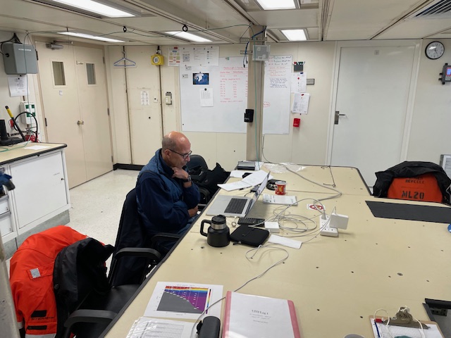
And that brings us to today, 15 September, aboard Roger Revelle. Every day Bob peers at his computer planning where to go next to best measure the fate of the IFSJ, to see if it in fact feeds the other major overflow forming the Deep Western Boundary Current. He ponders illustrations of the TS and velocity data gathered by the hard-working science party and ship’s crew, to date over 300 CTD casts. It wasn’t easy, but I managed to pry him away from the screen for a 15-minute update.
“Right now, we’re sampling the daylights out of the area to establish if in fact the IFSJ goes directly to the overflow.”
“Does it?”
He grinned. “Oh, yeah.” Then he pointed out that there is another current heading to the same overflow point, but it remains unclear how it is related to the IFSJ. “That’s still evolving.”
Right. Still evolving. But that’s another story with the same theme but different plot line. And there will always be another story, but never a denouement. The ocean is just too complex for final resolutions.
Dallas Murphy


IN HARM'S WAY
At sea, 12 September 2025 aboard the research ship Roger Revelle
Bob was worried. From his shoreside WHOI office his thoughts drifted seaward, northeast several thousand miles to the Iceland Sea, where his mooring array lay in jeopardy. Maybe from below, in dreams, he saw the big net materialize out of the gloom, inexorably approach, and then obliterate his moorings like sand castles in a tsunami. Maybe that’s a bit over-cooked, but it’s not hard to empathize. This would be the last North Atlantic mooring deployment of his long career. Deployment is meaningless if there is no recovery.
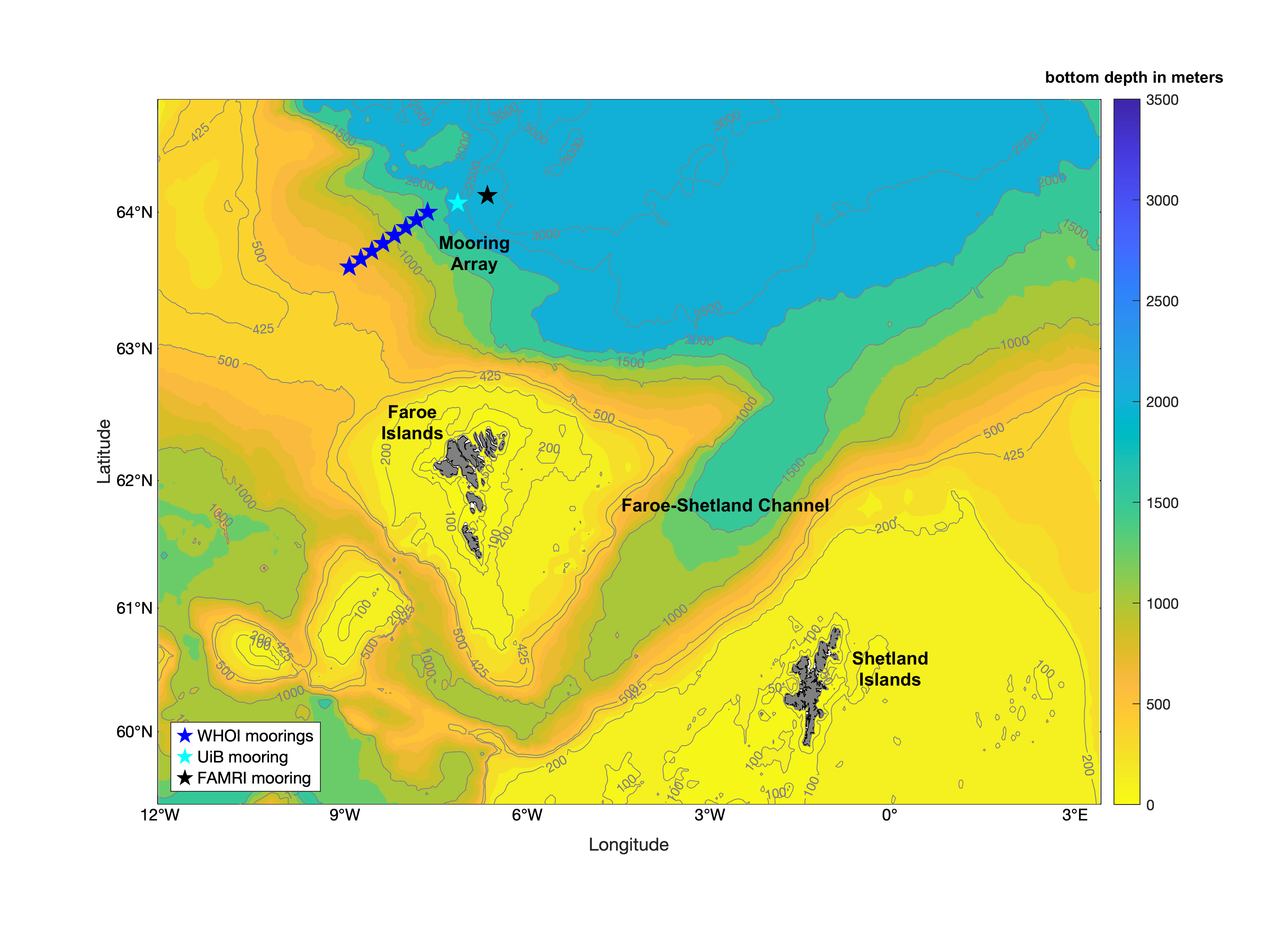
Flashback: At an international ocean sciences conference in 2020, Bob first floated his idea to place a mooring array at the propitious point (see previous post, “Gamble, Always a Gamble”) in the current near the Faroe Islands. He discussed the idea with Faroese collaborators to be, Hjálmar Hátún and Karin Margretha Larsen.
“Well, said Hjálmar, “that’s pretty risky. The area is heavily fished, particularly in summer. Why don’t you deploy it in September and pull it in June?” (I’m paraphrasing throughout).
No, that wouldn’t work for Bob; he needed to capture the full seasonal cycle to understand what’s going on.
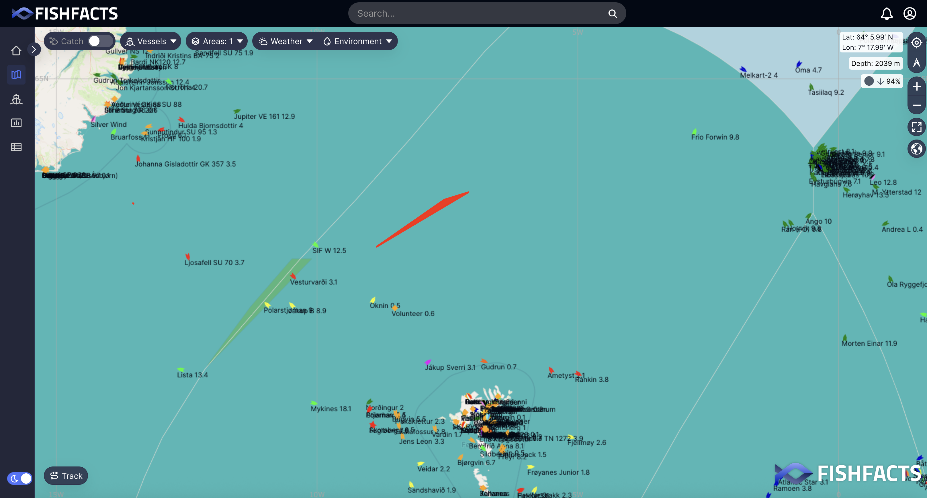
So before the project was even funded, Hjálmar began casting around the small, tight-knit ocean community to see what might be done to protect the moorings. He talked to fishers and Faroese Ministry of Fisheries, and then he remembered a company called FishFacts. Connected to all things fishing in Faroe waters, it runs a chart on its website showing in real time not only the position of all vessels working those waters, but their name, type, course, and speed. Fishfacts might be useful.
Obviously, the project got funded, and Bob deployed the array from Neil Armstrong (WHOI) in 2024. Now it was actual and needed immediate protection. As usual, Bob placed an alert in Notice to Mariners, but not every navigator/captain reads the notice. What else? He asked the head of FishFacts. “Well,” said Hanus Samró, “let’s place a vivid red slash on our chart with a note, ‘Please stay away.’”
Hjálmar and Karin then advised him to go home and relax. He went home, if not entirely relaxed. However, next time he looked at FishFacts, to his dismay the red slash was gone! It was never meant to be permanent. It’s got to be permanent. “How do I make it permanent?” he asked Hanus. (I’ve noticed over the course of our collaboration Bob gets what he wants through gentle, but unrelenting, persuasion.)
It could be made permanent, but it wouldn’t be cheap. FishFacts would have to hire outside programmers and on short notice. “Do it,” Bob said, “I’ll pay.”
Now with the red slash fixed in place, Bob asked his postdoctoral investigator, Jie Huang, if he could monitor FishFacts every single day for a year on alert for any vessels near the array. Jie had a professional stake in this because he will take first crack at analyzing the mooring data. There were plenty of close encounters. A German research vessel was working close by, but its captain, aware of the array from Notice to Mariners, stayed two miles off. Container ships passed nearby, but their draft was short of the top floats. Fishing vessels often steamed over the mooring array, but at cruising speed, which meant they weren’t dragging. Then—the emergency.
“Jie texted me, ‘Bob, we have a trawler going back and forth over the array.’” Palpations ensued.
Bob immediately texted Hjálmar and Karin, but they were on vacation; this was the middle of holiday season. Then he called Hanus at FishFacts, who immediately picked up. A half hour later, Hanus called back: He had contacted the captain, who readily agreed to keep clear. A short time later, Hjálmar wrote to say he, too, had spoken to the agreeable captain. Wow, these people were on it. Bob was stunned, not only by their immediate responses thus alleviating prolonged anxiety, but by the level of cooperation among all concerned at sea and ashore.
The relationship between fishers and scientists has historically been abrasive. To some extent it’s a class conflict. These wiggy scientists with their uncalloused hands, what do they know about real work? More concretely, fishers suspect that ocean research will result in catch-limiting legislation. I hear the conflict has abated somewhat, but in this case, there was none at all. The captain, as requested, had immediately turned his bow away from the array.
After telling me the story, Bob said the mooring array, now safely on deck, will deliver an “incredible amount of data. I don’t know what’s in it yet, but I know it’s going to be revelatory.” (italics mine)
There are few eureka moments in at-sea oceanography. You don’t pull an instrument aboard, everyone gathering around on the aft deck, excited chatter—“There it is, see it? The answer, just as we thought.” No, these instruments collect computer-busting reams of raw data. People like Leah and Frank parse them during the cruise, filtering and refining them, culling that which doesn’t apply to the objectives at hand. Then scientists take the data home—and think. “What is all of this telling me that has not been known before?” When that becomes clear, they report the new scientific contribution to a specialized journal. By that means, science advances. Unreported science is a hobby.
But that’s not the end. It never ends. That new knowledge in hand, other cruises go out, to the Nordic Seas in our case, find something newer still that builds on or maybe contradicts previous knowledge, and step by step we more clearly understand the world we live in—72 percent of which is covered by salt water. In the ocean may lie answers to questions humankind has not yet thought to ask.
Dallas Murphy

A GAMBLE, ALWAYS A GAMBLE
At sea, 9 September 2025 aboard the research ship Roger Revelle
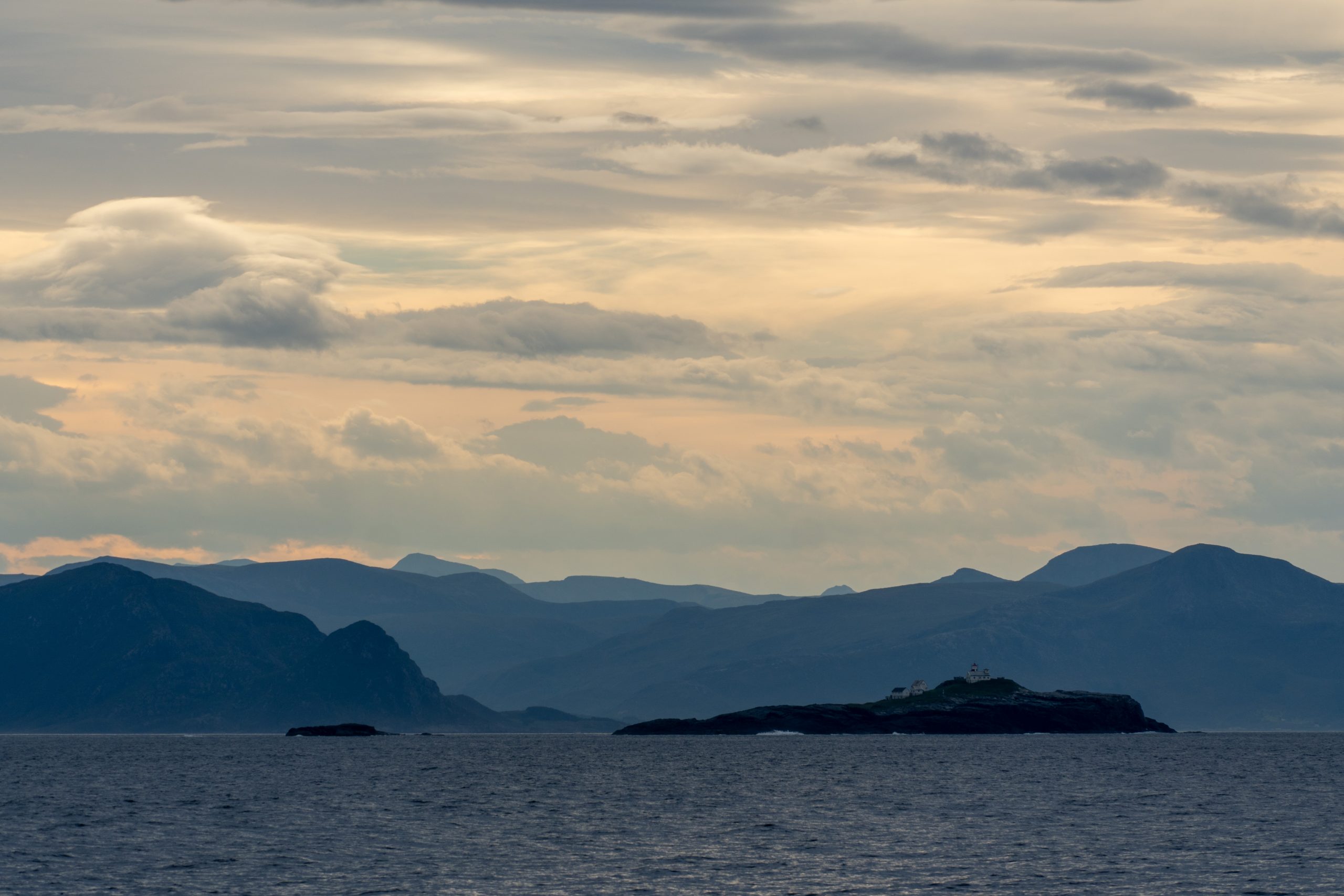
Last night’s sunset, shinning over flat seas, looked like the extravagant work of an over-caffeinated scene painter. Per old-salt tradition, I shouldn’t say this, but the weather the entire trip has been fine. I’ll take the chance of jinxing it, because Bob says we’re well ahead of schedule, thanks to the generous seas and the ship’s efficiency. Tranquility was particularly welcome during the first leg of the cruise devoted to mooring work on the exposed after deck.
A MOORING:
--a long wire, depending on depth, anchored to the bottom and a heavily buoyant top float to keep the wire straight,…
--a foundation to which various devices are attached to measure the water flowing past it,…
--revelatory because it resolves frequent variations in the current’s behavior by remaining in the water for a year.
In one respect, the defiant ocean cooperates with those trying to follow the water. A parcel of water often retains its temperature-and-salinity fingerprint as it travels, even over great distances, with the current. So small sensors are attached to the mooring wire to record its “TS” identity. And velocity, vitally important to glean the current’s behavior, even its very existence, is measured by two devices:
Current meters strung on the wire at various depths tell you the velocity, but only at that particular depth. For a more comprehensive view of velocity, we have the ADCP. Never mind the acronym; it’s a mouthful. Suffice it to say it’s a sonar device that “looks” upward some 400 vertical meters to record velocity over that entire range.
So there’s the mooring and its function. It’s more complicated than that (everything is), but for our purposes, it reveals characteristics scientists need to know about currents—and does so over a long time, necessary because the ocean is frustratingly fickle.
However, once you drop your mooring in the water, you no longer own it; the ocean does. It might return it, might not. Here’s the gamble inherent to moorings: That top float can’t be left on the surface like a yacht-club mooring ball, lest it be run down by ships, carried off by ice, or stolen. So the wire length has to be predetermined, cut such that the float remains a safe distance beneath the surface. On my first cruise, reluctant to reveal my ignorance, I didn’t ask, “Then how do you retrieve the thing?” (I subsequently learned one shouldn’t hesitate to ask questions of scientists; they appreciate your interest and, besides, their work is funded by tax-payer money.)
Retrieval depends on the “acoustic release.” It’s attached to the anchor and the bottom of the wire by a set of jaws. A shipboard tech “talks” to the release via a transponder in a coded series of pings. The release pings back, “I’m awake, ready for instructions.” Okay, “release.” The jaws open and the top float hauls the entire structure to the surface where it’s brought aboard. The anchor remains on the bottom. That’s the way you hope it works. Sometimes the release defies orders. An inevitable air of foreboding hangs over the deck. “What if it doesn’t…you know, release?” No one speaks when that pinging conversation begins.
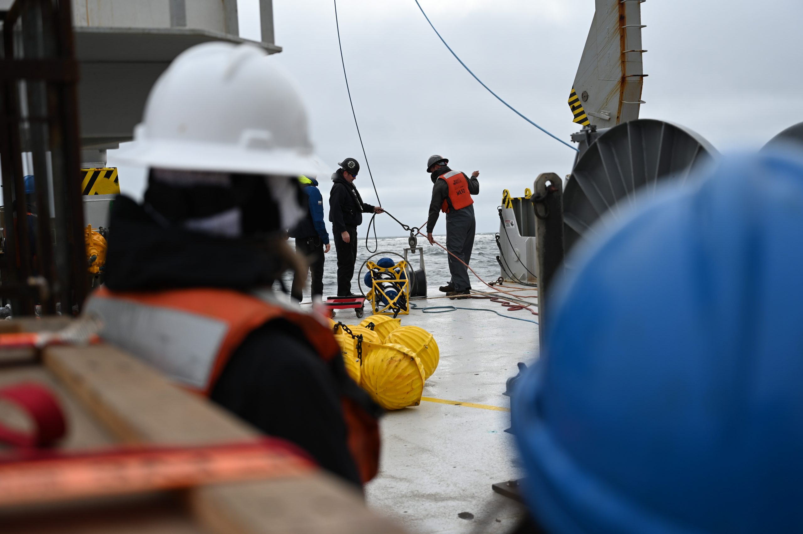
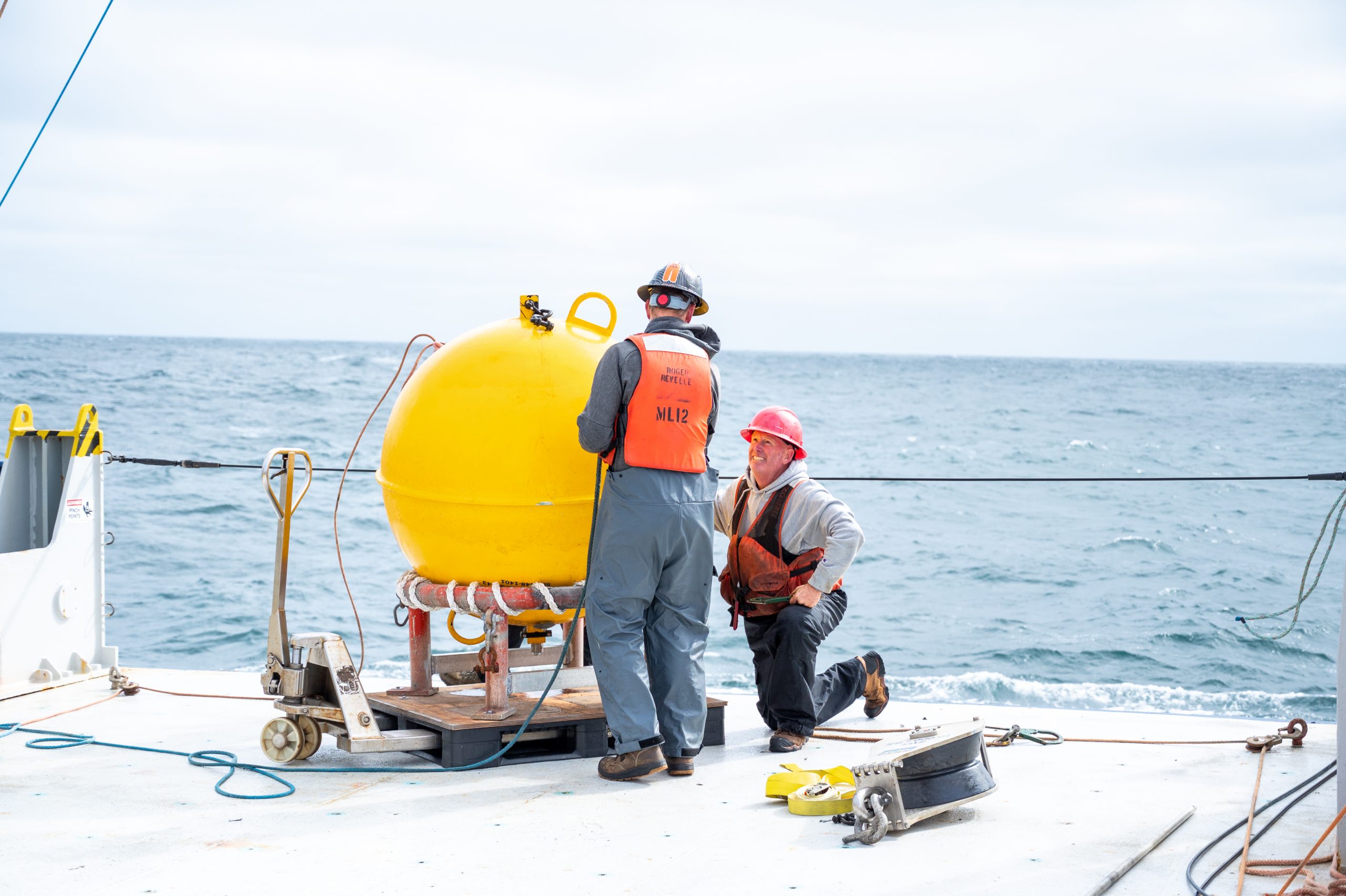
You’re betting the farm on an electronic device that’s been waiting in an environment that feasts on electronic things. “Feed me.” Like the plant in Little Shop of Horrors. Mooring structures are expensive, but instruments can be replaced. The data they’ve gathered, lost to the ocean’s maw, cannot. During the first leg of our cruise, technicians, led by Jim Ryder (WHOI), successfully retrieved all ten of the moorings. That’s easy to say, but retrieval, like deployment, is a big operation, and potentially dangerous. You need skilled, experienced techs to pull off this, the heavy-industry component of at-sea oceanography.
A fundamental gamble
In 2024, the international team of scientists placed those ten moorings picket-fence fashion athwart the current thought to be the main source of dense water flowing through the Faroe Bank Channel, one of the two deep gaps in the underwater ridge between Greenland and Scotland. Eight were Bob’s (WHOI’s), two contributed by University of Bergen and Faroe Marine Research Institute.
The gamble is, the Iceland Sea is heavily fished by mid-water trawlers. So if you place your top float too close to the surface you’re liable to lose your shirt. Bob fretted. He absolutely needed those moorings in that particular place, but, man, to lose one or, God forbid, all….I’d like to tell you next time how Bob’s Faroese colleagues found a way to protect the mooring array. It’s a good story illustrating the special cooperation between “people of the sea” inherent to this business.
Oh, Yes, One More bet:
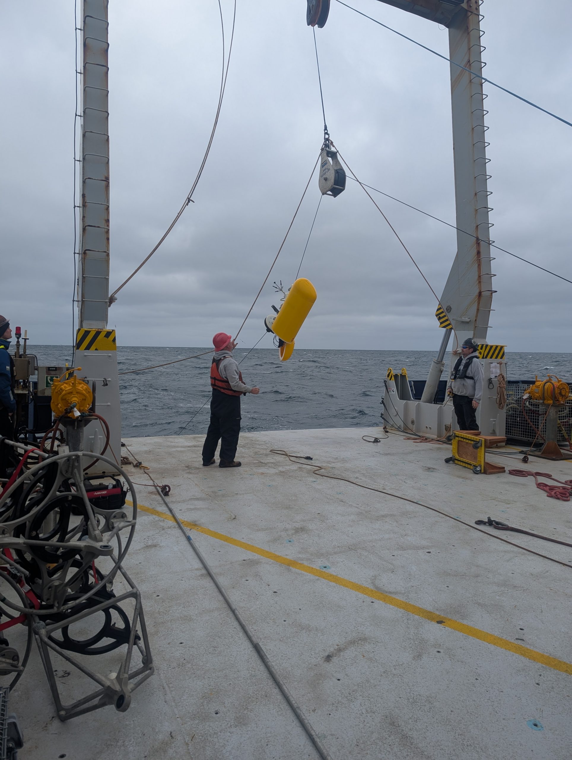
Instead of using a bunch of stationary sensors strung along his moorings, Bob decided to use a “Moored Profiler” (MP). This is a crush proof plastic pod containing a TS sensor and current meter that, with its own motor, climbs up and down the wire continually recording data. It’s a brilliant concept; nothing beats it for the volume of ocean information it can collect. Trouble here is, that very capability requires delicate electronics, accurate programming, and complicated engineering. Therefore, it’s vulnerable; the ocean loves to break things like that. Bob had used MPs on a previous project. A categorical failure. But, perhaps since this was to be his final North Atlantic mooring program, Bob decided to take the chance and put an MP on all eight of his moorings. He then spent the ensuing year anxiously hoping and perhaps fitfully dreaming about all the devilish things the ocean could do to the machine and the precious data it might be gathering.
But he looked pretty cool, arms casually crossed, impassive on the morning that first mooring was winched aboard and Jim Ryder detached it from the wire. Cool is what you want from a chief scientist, or at least the appearance of cool. Mooring tech Brian Hogue immediately checked that each profiler still had battery life. Yes. One by one, the others came aboard—all were alive. So far so good, but that’s happened before, only to find that the data were garbage. Leah plugged in her computer to examine whatever they might contain….The data in all eight were impeccable.
These things had chugged up and down the wire dutifully measuring the current for an entire year. The MP on the longest mooring had covered some 1,200 meters twice each day, every day. On the shorter moorings the lovable device had made four trips every day. “A quantum leap of information,” Bob pronounced, his face aglow.
From my viewpoint on the 0-1, I see the wind’s getting up, lots of whitecaps, air temp has dropped. There’s talk of some weather tonight. But we’ll be fine—Bob says the trip could end today, 7 September, and he’d have most of what he’d hoped for on day one. His bets had paid off.
Dallas Murphy


No man will be a sailor who has contrivance enough to get himself into a jail; for being in a ship is being in a jail, with the chance of being drowned. Samuel Johnson
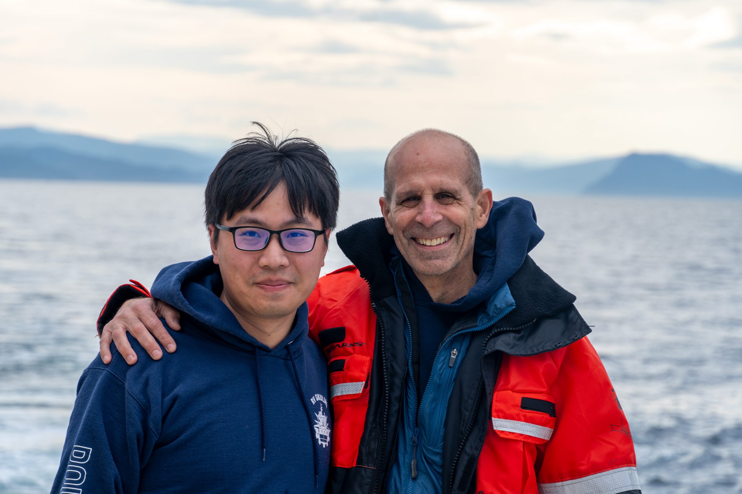
Dr. J. never set foot on a deck; this was just a London coffeehouse witticism. But to be fair to him and his antique writing style, this was 1759, when shipboard life was, well, different. Roger Revelle, 2025, is luxurious by 18th Century standards, of course, and she’s a happy ship. A berth aboard is prized by one and all, scientists, science students, and, as far as I’ve seen, the crew.
“Good morning.” Smiles at 0700.
“Did you sleep well?”
“I saw a pod of pilot whales.”
At breakfast, my glass of OJ flew off the table. The galley staff hauled out mops. I apologized. “Aw, no worries, happens all the time.”
Speaking of the galley, the dining is fine, thanks again to Steph and Ryan. Breakfast 0730, lunch 1130, dinner 1700 (5:00 land time). Mealtimes are important socially as well. Officers, crew, and scientists eat in the same mess. It’s the only time we all foregather. People talk shop, tell sea stories, and conversations with various accents sprawl who knows where. You hear a lot of laughter.
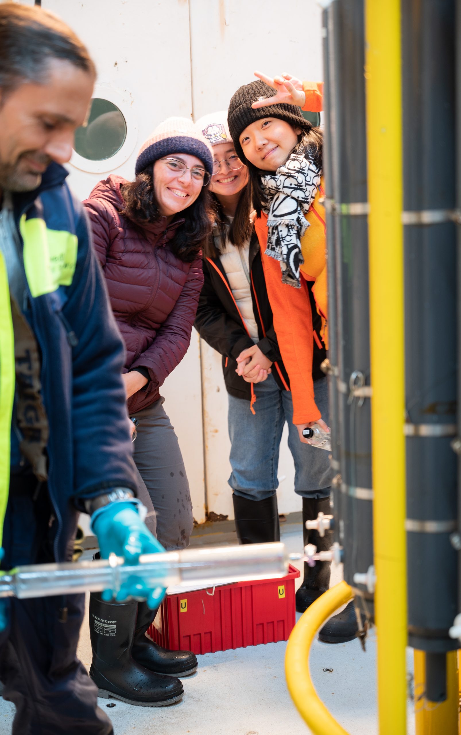
Typical of him, Bob has assembled a fine science staff, a mix of experienced, congenial oceanographers on their umpteenth cruise and students, some on their first. (Here, “students” include undergrads, doctoral candidates, and post-docs; with cell phones and water bottles in hand, they’re always connected and well hydrated.)
Friendships bloom quickly in the close quarters and comradery of common purpose. For most of the experienced scientists, this trip is a reunion. For the students, some of their fresh friendships will abide, and if they pursue careers as observational oceanographers, they’ll meet again on other ships, other oceans, with their own sea stories to tell. A few students, a bit green their first days out, probably pondered ocean-modeling careers, or any gig that doesn’t move. But now they’ve found their sea legs, and most say they want to return.
“I love it,” said Anna, a volunteer from the Canary Islands. Her shift over, she was off to the lounge to watch the next episode of Severance. “What I like—the world goes away. My Ph.D., I don’t even think about it. There’s just the ship.” Yes, just the ship. That’s why ships isolated at sea make good literary microcosms (Melville, Conrad, London). In miniature, they stand for the larger, “real” world.
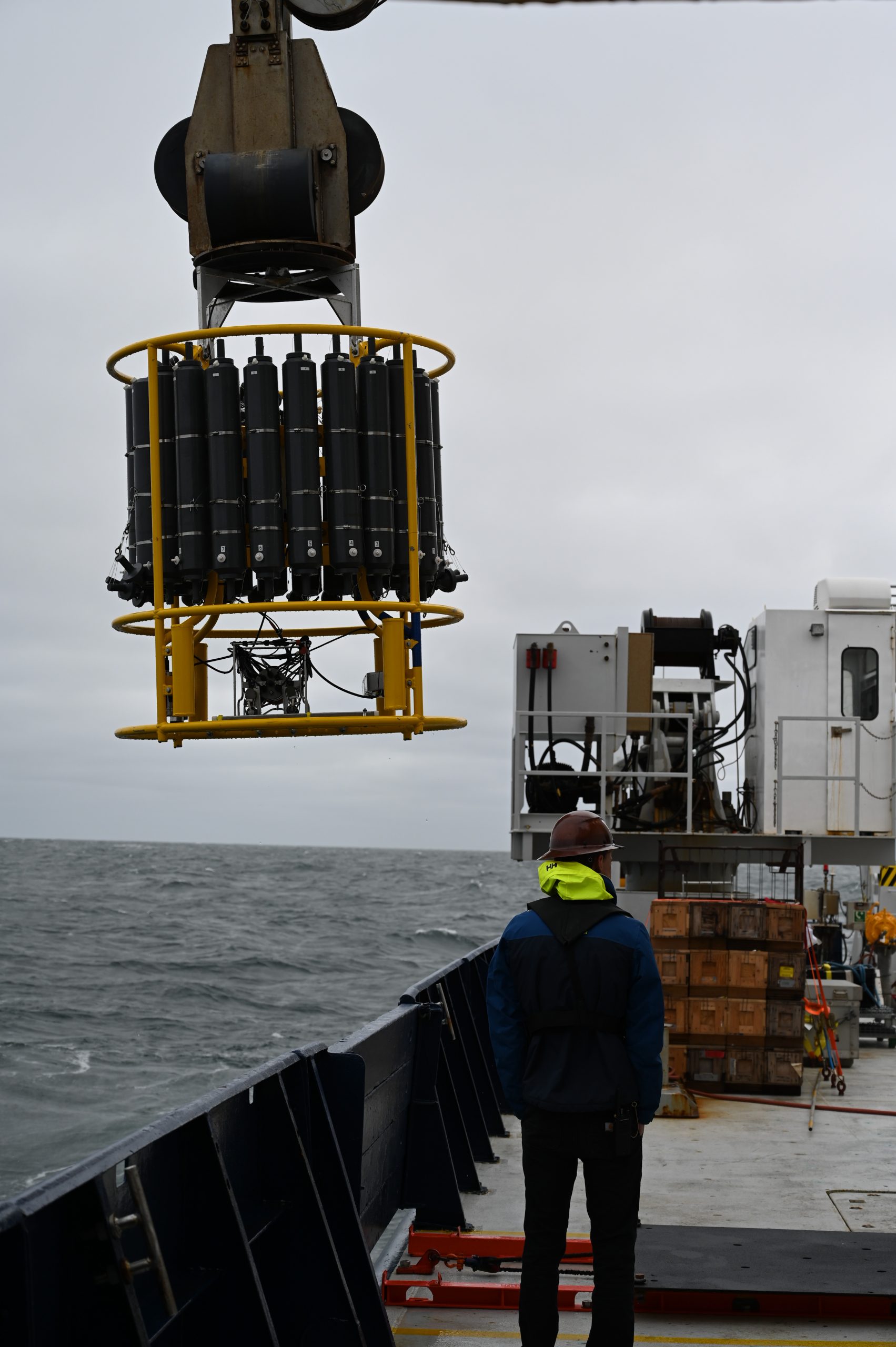
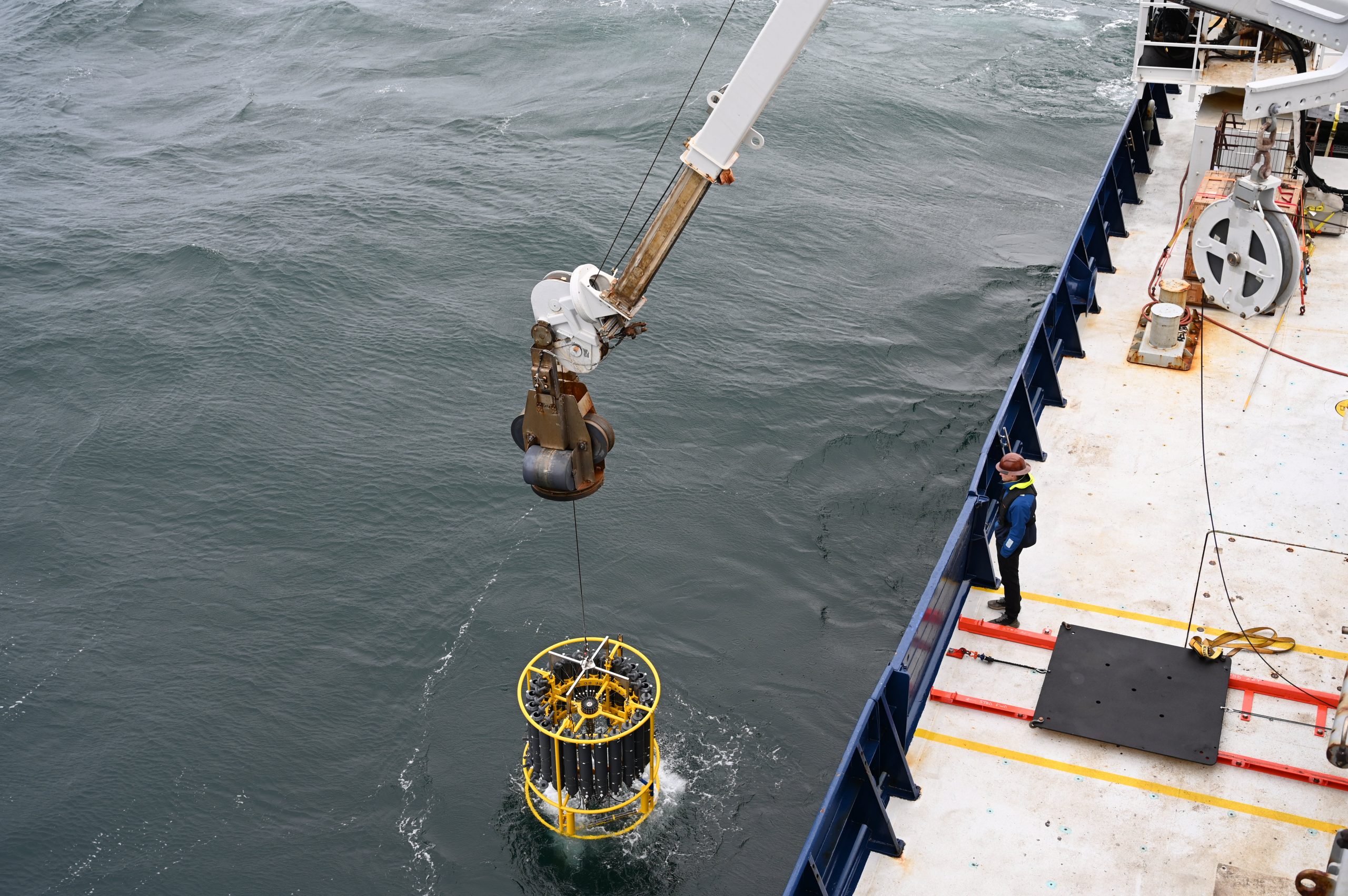
Typically, students are assigned to the “CTD watch.” More about this device next time, but quickly: The ship stops at predetermined points where Bob wants to measure the water column. The CTD “package” is lowered to near the bottom, then winched back up. During its descent it records temperature, salinity and other variables. On the way back up, the package is stopped at regular intervals to collect water samples such as CFC’s and carbon. The electronic data are sent up the wire in real time to the computer lab, where the students run the CTD casts—in 8-hour shifts.
This is serious business, the only source of the raw data, which, when analyzed by Bob and the other scientists, produce new ocean knowledge, the reason we’re out here. But it’s not just work-sleep-work-sleep. While the scientists go off singularly to attend their specialized projects, the student watches become, in the middle of the night especially, little milieu unto themselves. They have their own special frames of reference, inside jokes, sometimes giddy from sleep deprivation, diversions, and games—Catan, cards, and something with werewolves. It’s fun to watch their relationships evolve and their expertise develop from, for some, complete CTD ignorance to old-hand status, where now, halfway through the cruise, they stand.
Disney Cruise Line passengers forking over big bucks for a jaunt to the Bahamas would blanch at the frill-less functionality of our cabins (and the prohibition on alcohol). But they’re perfectly adequate with bunk beds, plenty of stowage space, and adjoining heads. Disney Line cruisers wouldn’t relish the cabin noise. Rory, Anna, and Matt, who berth forward on the “1st platform,” one deck below the main deck—and the waterline—were imitating the swish of passing water and particularly the loud whirrs and clanks of the bow thruster. That’s a deployable pod with a propeller used to help keep the ship stationary during CTD casts. There are a lot of those. Fiona sleeps with earplugs.
Once a week we have drills—fire, abandon ship, particularly fire, the worst nightmare at sea. The other day it was a piracy drill required by the Navy, even in these pirate-less waters. For the crew, drills are made as realistic as possible. For us, it’s just a matter of mustering in the main lab with our life jackets and immersion suits (“Gumby” suits) for roll call by Andrew or Royhon, the resident technicians.
One day bleeds into the next. “Shipboard routine” is an age-old term. Routine is essential for this 24-hour-a-day operation. It allows scientists to do their work and thinking, to “geek out on the data,” as Frank Bahr, a research specialist, puts it, without the press of the clock, shoreside obligations, or domestic requirements. Breaks in routine are unwelcome, because they often mean something is wrong or broken. “I like boring bridge watches,” said Chief Mate Tom, so when we pass in the hall, I wish him boredom.
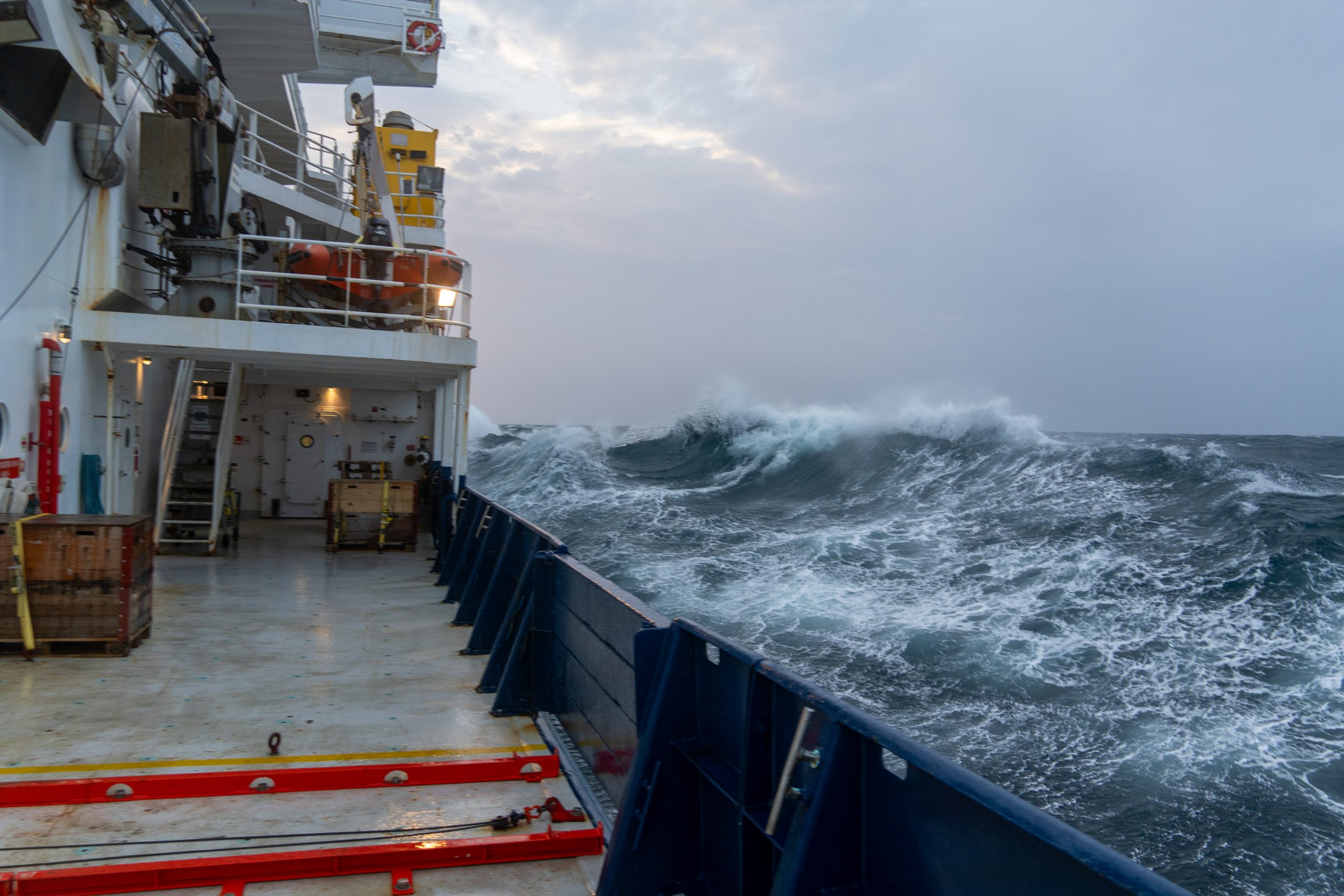
But, then, there is that other routine-breaker no one can control—the purpose of our presence, the ocean itself. When it’s rough, work goes on, but be careful on the stairs (called “ladders”), wait for the top of roll to move, hang on to your OJ. When it’s really rough, when green water washes over the bulwarks, weather decks secured, work stops.
Yeah, it’s the ocean. The sea state is the determinant agent. That’s what attracted me here in the first place, before I ever thought to ask why the Gulf Stream exists, before I was old enough to read sea stories. But the science quickly captured me, enriching my view of and enchantment with the ocean. It’s reductive, almost meaningless, to talk about life aboard a research vessel and skip the ocean. I’m watching it now from the O-2 deck. The wind is up some, and the surface, plunging white-capped waves, looks as hostile as we’ve seen so far this trip. Still beautiful.
***
Here’s a nautical tidbit you might like, the origin of “head” to mean toilet: On old sailing ships two stout beams protruded outward on either side of the bows. The anchor was hoisted up to one of those beams before it was stowed aboard for sea. They were called “cat heads”; the anchor was said to be “catted.” And up there was where the sailors went to, uh, you know. We don’t do that on this ship. We have flushable heads. It’s a luxurious new world, Dr. Johnson.


THE PIONEERS. PART TWO.
THE DEEP
At sea, 31 August 2025 aboard the research ship Roger Revelle
From the 0-1 deck, that is, one above the main deck, I’m watching the ocean. The surface is calm. My “height of eye” is about 20 feet, so the horizon lies some five nautical miles away. On the 0-4 deck it would be farther. For sailors that’s enough ocean area to know what’s going on and what to do in response. For the scientists aboard Revelle, the surface reveals almost nothing of what they want to know: what’s going on down deep.
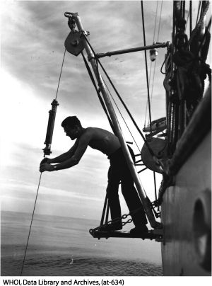
In 1751, the English slave-ship captain Henry Ellis becalmed in the Gulf of Guinea doldrums wondered what the ocean was like far beneath his keel. He cobbled together a mile of line, lowered a weighted bucket rigged with a thermometer and a closable flap, then retrieved his water sample. It was cold. He and his crew took “vastly agreeable” cool baths, he logged (his human cargo did not). Other mariners took similar samples. It became apparent that the deeper ocean was uniformly cold. Why?
Well, that was pretty easy: Cold water had to come from the polar region. And further, that the layer of cold water beneath the sun-warmed surface had projected all the way to the equator where Ellis and others found it, must mean that there was some kind of flow in the abyss. Yeah, but what kind? Probably it was some kind of slow seepage. But even in the 18th century, scientists understood that if water flowed one way, it had to return the other way, if it sank in the north, it had to come up somewhere in the south and go around again. They had enough physics to recognize that nature insisted on circles. But that was about it, because there was no way to learn more about deep ocean circulation. There existed no instruments more sophisticated than Ellis’s “bucket sea-gage.” Centuries passed. The ocean rolled on.
Then, in 1944, a great American genius showed up at a sleepy little Cape Cod village called Woods Hole.
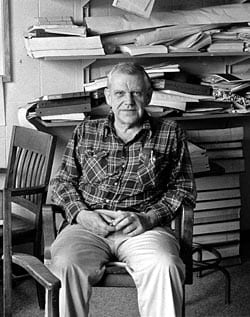
Henry Stommel
Henry Melson Stommel had graduated from Yale in 1942, considered a career in the ministry, did some graduate work in astronomy, taught it for a while at Harvard, when he found his way to the Woods Hole Oceanographic Institution (WHOI). It was founded in 1930, when oceanography was an infant science. None among its first generation had a degree in oceanography, because there was no such thing; few of its “scientists” were even scientists.
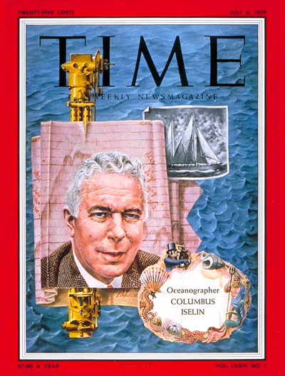
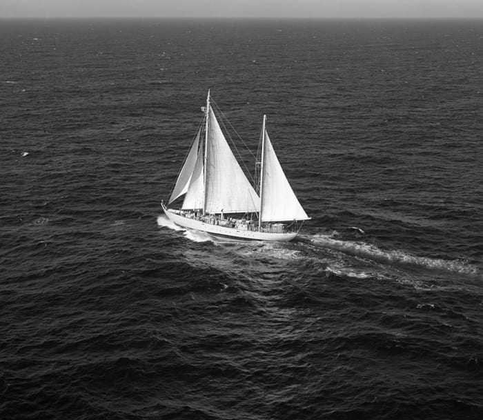
Columbus Iselin, its first director, was a wealthy yachtsman and adventurer, Frederick Fuglister a painter and musician, and Val Worthington had flunked out of Princeton for lack of interest. Some people dismissed WHOI as the “Harvard Yacht Club.” But these guys proved them wrong. Through force of will, intellect and the excitement of discovery, they became ground-breaking sea-going scientists. Fuglister became an expert in measuring the Gulf Stream, and Worthington on all aspects of the North Atlantic. They conducted their oceanography from the decks of a sailing ship, the legendary Atlantis.
With only four years’ experience, Henry Stommel published a paper in 1948 that explained why the Gulf Stream exists. It was suddenly clear to anybody interested in such things that a very special mind had burst on the scene. Brilliant as it was, that discovery pertained to wind-driven surface circulation, while our subject is the deep. Then in 1960 he pointed his intellectual fervor and creative insight downward into the depths.
He and his collaborator Albert Arons scrutinized the old notion of slow, basin-wide seepage of cold bottom water, and said, no, it couldn’t be that way. Down there, no wind riffled the water, but Earth still rotated. The force of its rotation demanded that, after it sinks, the cold water must congeal into a narrow, relatively fast current that flows along the bottom under the Gulf Steam back toward the equator. Stommel named it the Deep Western Boundary Current.
Say what? Jaws dropped internationally. A deep, cold current hugging the very bottom of the continental shelf beneath the Gulf Stream! Astounding. Incredible. But there was no way to verify this theory at the time of its conception. It was a current on paper alone, and both men knew that. But it wasn’t long before other more technically minded ground breakers invented instruments capable of actually measuring deep circulation. And today every grad student in Oceanography 101 knows of the Deep Western Boundary current (DWBC).
But what remains largely unknown is the nature, pathways, and mechanisms by which the cold water in the polar regions establish the DWBC. And that brings us aboard Roger Revelle, August 2025. Parsing that complex interplay of polar currents is our objective. We have aboard all the instruments that for so long were lacking. We have the ship and the motivated scientists and students, and we’re in the right spot to fill in the blanks in the magnificent system that delivers cold water back southward after it sinks from the surface—thus this grand natural system balances warm and cold to stabilize our climate on a hemispheric scale.
In the days to come I’ll do all I can to explain the ways and means of this at-sea oceanography in action, without, as Bob likes to say, going too far into the weeds.
Dallas Murphy

WEATHER
At sea, 28 August 2025 aboard the research ship Roger Revelle
“It’s comin’ on to blow, m’ son. Ye best be battin’ her down.” (Heard while aboard s/v Quetzal, Bugeo, Newfoundland, 2010)
“You know what I hate?” said Captain Sheasley, r/v Knorr, some years ago.
“What’s that, Skip?”
“When TV weather reports say, ‘The storm has gone safely out to sea’”
When sailors speak of weather, it’s seldom of precipitation or temperature; those are largely terrestrial concerns. It’s wind that matters to their lives and its sister, waves, the “sea state.” When it’s rough, you stagger down the hallways as if walking were an unpracticed act, and objects fly from their places with spiteful will. When the heavy waves meet her beam, she rolls like a bottle.
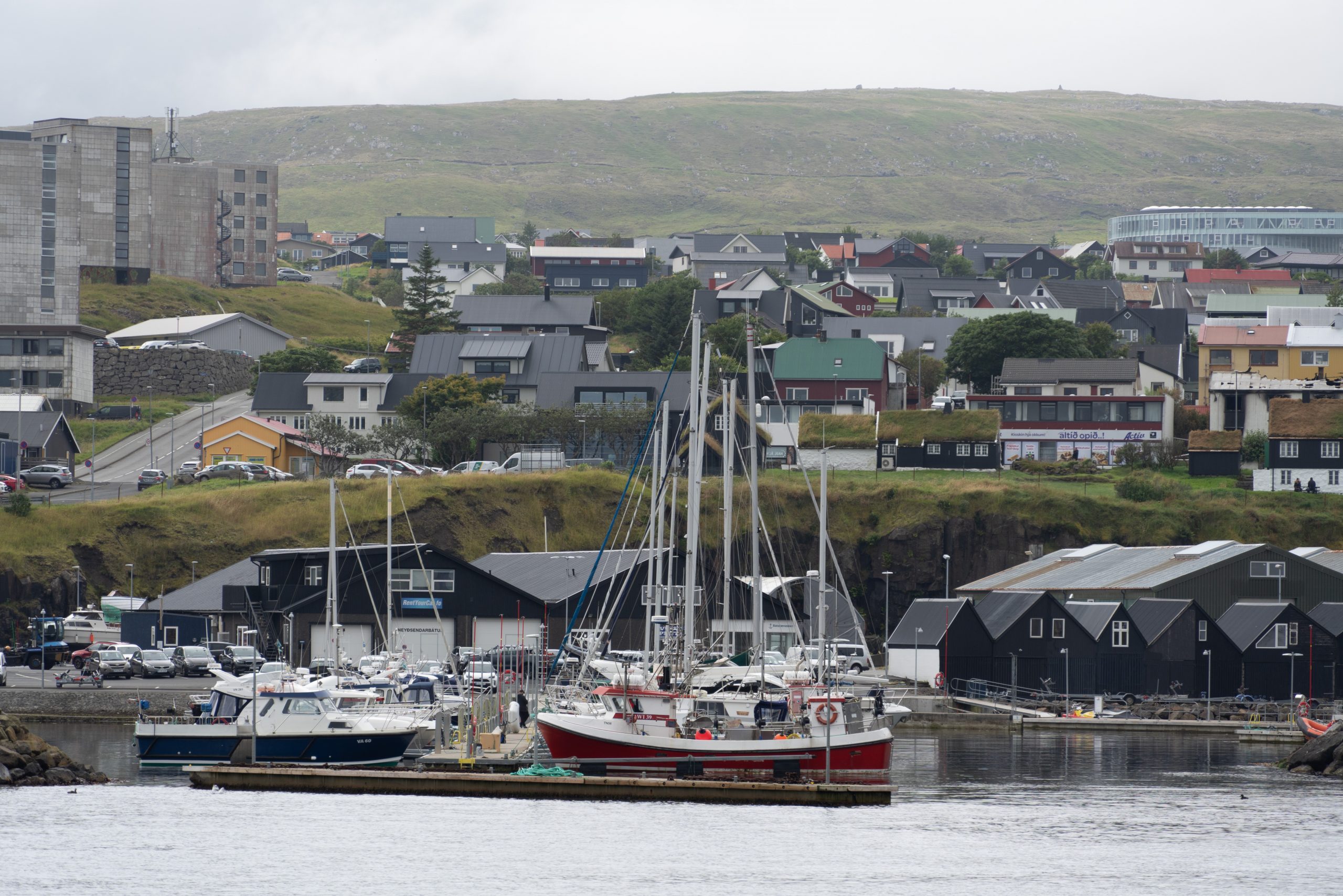
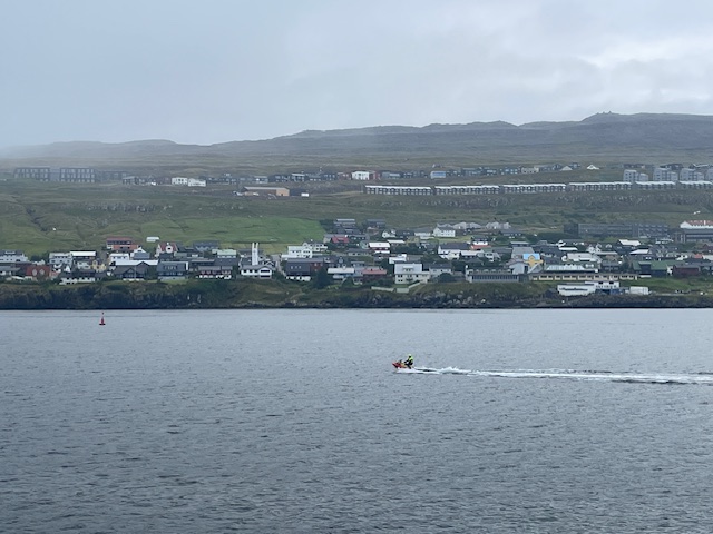
I bring this up because Hurricane Erin is supposed to sideswipe us sometime after midnight. We had stopped briefly at Torshavn, capital of the Faroe Islands, where the technicians, having successfully recovered ten “moorings,” left the ship and several new scientists came aboard. (More later about the moorings and the scientific data they gathered during a full year in the water.).
We’re heading seaward from the Faroes, where Erin is predicted to generate 20-foot swells. I haven’t heard any reliable forecasts of wind velocity. People are taking it seriously. Joe the bosun is stalking the decks with tie-down straps slung over his shoulder looking for anything movable. Bob sent a group email to the science party, “Secure your computers and everything else.” Visibility is reduced to a ship length in woolen fog.
It’s midnight now, and the fog has thickened. The horn blares every two minutes. But whatever we’re in for, has not yet arrived. If you peer too long into the fog, your eye conjures objects from their absence. Is that a whale’s spout?... A container ship crossing our bow?...Naw…. Anyway, if it comes on to blow, I’ll let you know.
* * *
It didn’t. We got lucky for now. Little wind, so no waves, just big swells. (While often used interchangeably, swells and waves aren’t the same things.) She took some heavy rolls during the night, but not enough to curtail the ocean measuring that goes on around the clock, weather permitting. It’s 0600 and I’m watching long, languorous swells heave up at the horizon and sort of ungulate their way to her starboard side from a little north of east. They’re large but soothing after our expectations of violence, and beautiful. The ship has fallen into their regular rhythm. The fog has softened to haze.
It’s midafternoon now. The swells have sagged. The sky is blue, clouds white for the first time since Iceland slid astern beneath the horizon. Delicate kittiwakes in flocks have joined the ever-present fulmars. The ocean changes its mood faster and maybe more abruptly than that of humans, the romantics who gaze at it and the scientists busy to understand it.
Dallas Murphy

THE PIONEERS. PART ONE.
At sea, 26 August 2025 aboard the research ship Roger Revelle
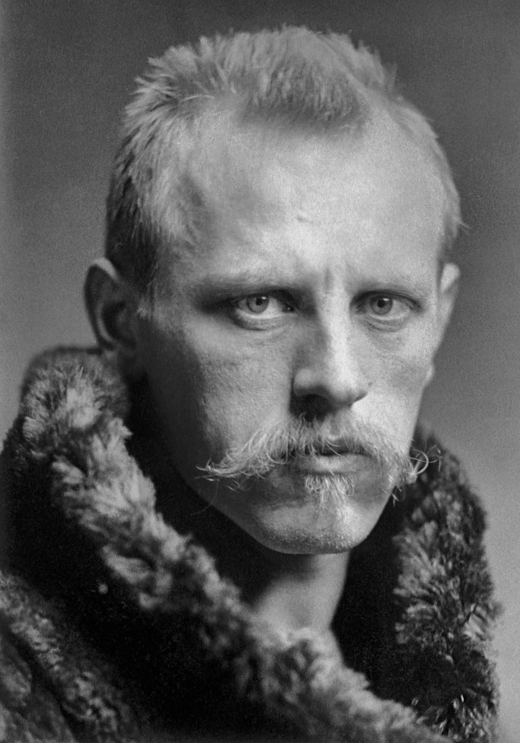
By 1890, Fridtjof Nansen, not yet 30, was growing melancholy, as was his wont, brooding that his greatest accomplishments were behind him. He was already famous for the first-ever crossing of the Greenland Ice Cap, on skis, of course, a feat judged impossible at the time. Tall and handsome, blond and blue-eyed, not only did Nansen look and act the part of the of the romantic explorer-hero-scientist, his timing was ideal. Not much of international note had happened in Norway since Viking times, but now with a list of world-class scientists and artists including Ibsen and Grieg, Norway was ready to assume her place as a modern European nation. Talk of Norwegian independence (from Sweden) was in the crisp air. Though Nansen was keenly aware of his symbolic importance and responsibility to the burgeoning nationalism, he wanted more for himself. The ice-cap crossing three years behind him, he fixed his melancholic gaze on the North Pole.
A stubborn myth was still kicking around geographical circles of an ice-free Polar Sea containing land, perhaps even another continent. Nansen didn’t buy it. There was no land, only a perpetually frozen Arctic Ocean. And there was empirical evidence for an east-setting current. Most compelling was the wreckage of the American exploration vessel Jeannette which had been trapped in the ice near the Bering Strait and crushed during an 1879 attempt to attain the North Pole. Everyone aboard this ill-equipped, poorly planned, and fecklessly executed expedition starved to death on the Siberian coast, but the bones of Jeanette had fetched up on the east coast of Greenland. Maybe, Nansen surmised, she had drifted right over the Pole. That’s what he decided to do.
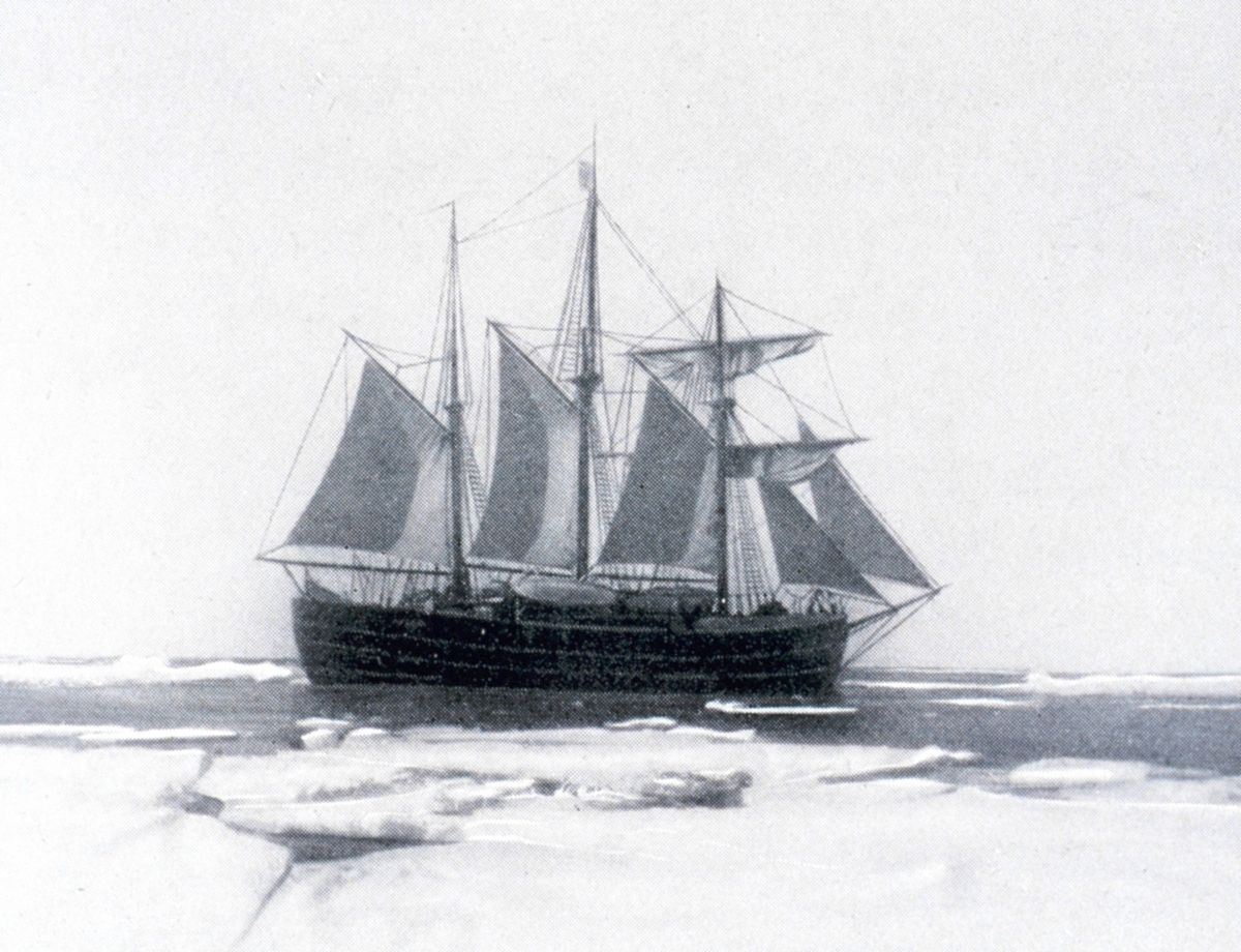
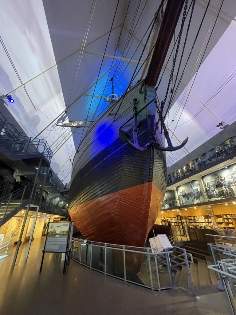
With funding from the Norwegian Parliament, he commissioned the Norwegian marine architect Colin Archer to design a boat specially for the wild idea—the immortal Fram, “Forward” in Norwegian. She lives now in the Fram Museum, Oslo, and to see her was, for me, a kind of pilgrimage. (Peigen Lin, a scientist now aboard Revelle named his son Fram.)
The boat, 128 feet long, captained by the brilliant seaman and later explorer, Otto Sverdrup, entered the pack ice on 21 September 1893 north of the Bering Strait, 683 straight-line miles from the Pole. With her round bottom, she rode atop the ice as if it were a drydock. However, eventually Nansen realized that she would not drift over the Pole as hoped.
Then Nansen, the scientist, gave in to Nansen, the ambitious, fame-driven explorer—and he left the ship, knowing he’d never regain her. With a hard case named Hjalmar Johansen and 15 dogs he made a dash for the Pole, toward immortality or a miserable death. They reached 86°11”, the farthest north any human had ever traveled. But that was it. The dogs were dying, the ice conditions dreadful. To continue would have been suicidal. They retreated toward a desolate, uninhabited string of rocks called Franz Josef Land, that “cold, congealed, frozen land,” as its discoverer, Julius Payer, described it a few years earlier.
“Land! Oh wonderful word!” Nansen exclaimed in his journal. It had been 132 days since he’d left Fram. He and Johnassen spent the winter in a hole covered by polar bear skin and driftwood, subsisting on anything they could kill (You had to be Norwegian). On 17 June 1896, Nansen heard dogs barking; all his dogs were dead. He ran toward the sound, and he saw—a man. “We quickly approached each other, I waved my hat, he did the same….I came closer, and then I… recognized Mr. Jackson.”
“Aren’t you Nansen?” Jackson asked.
“Yes, I am Nansen.”
“By Jove, I am devilish glad to see you,” as Jackson recorded, “We shook hands again very heartily.” (From the biography Nansen by Roland Huntford.)
The history of Polar exploration is marbled with moments like these, which if posed as fiction readers would roll their eyes at the implausibility. Frederick Jackson had applied to the Fram expedition but was politely turned down because he wasn’t Norwegian, so he formed his own expedition. Its purpose was to prove the existence of the ice-free Polar Sea, the very myth that the Fram expedition had exploded.
Nansen and Fram returned almost simultaneously to Trondheim, and, reunited, sailed to Christiania (now Oslo) and a hysterical welcome, “a tumult of applause,” he wrote. Nansen mania broke out, worldwide. But after the confetti had been swept up and international paeans quieted, Nansen fell into a funk. The fame he’d sought didn’t really suit his temperament. And he was troubled by this irony: Fram had drifted just 19 miles short of his farthest north record. Had he stayed aboard, sparing himself the pain and mortal danger, he still would have broken the record. Further, he felt he had squandered time that could have been devoted to oceanography.
That’s Nansen for you. But had he a brighter temperament, he might have been a bit more cheerful. Quite a lot of science had been accomplished. They had sounded the Arctic Ocean for the first time, found it much deeper than expected, and had produced the first full-depth temperature measurements. They took hundreds of water samples with the new “Nansen bottle,” forerunner of the Niskin bottle we’re using aboard Revelle.
And here in Norway, before the advent of modern technology, Nansen’s contemporaries ignited the theoretical sparks in an explosion of ocean knowledge about the general shared characteristics of all the world oceans.
Explorers continued to seek fame and “firsts” in the Arctic, particularly the North Pole, and sometimes found only death. But these high-latitude oceans persisted in defiance of scientific knowledge. Understanding their circulation—and the relation to climate—had to await modern technology. We carry that technology aboard Roger Revelle. And it’s pleasing to think of this expedition as heir to the pioneers’ work when armed only with physics and imagination. Still, much remains to learn, but it’s also pleasing to know that we will contribute a chapter, or even a few pages, to the journal of ocean circulation in these high latitudes.
Dallas Murphy

SHIPS IN PURSUIT OF WATER
At sea, 20 August 2025 aboard the research ship Roger Revelle
A promising young doctoral candidate in physical oceanography sits nervously for the oral exam before a committee of prominent ocean scientists. Instead of quizzing the student on the principles of ocean circulation, one of the elder professors, a famous figure in the field, asks, “Now that you’ve completed you course work and have been to sea aboard our research vessels, how would you describe the oceanographer’s primary job?”
Surprised, the student pauses, ponders, then replies: “To follow the water.”
The story is probably apocryphal, a device composed to sum up the science. But when I first heard it, I didn’t fully appreciate its subtext: Following water is a lot easier said than done. As Carl Wunsch, a renown figure in the field, put it, “One of the reasons oceanography has a flavor all its own lies in the brute difficulty of observing the ocean.”
Oceans are sometimes frozen, often rough—and they’re vast in two dimensions (the entire world’s land mass could fit into the Pacific Ocean, with room to spare). And there are other factors of difficulty. The things oceanographers want to know about water in order to follow it—temperature, salinity, current velocity, chemical components—vary constantly. Take a measurement of them today, chances are they’ll be different day after tomorrow. Also, to understand much of anything requires highly sophisticated, expensive, and specialized solid-state instruments, which have gone to sea only relatively recently. Physical oceanography is a young science for that reason.
Rapid advances took place during the Cold War, when the Navy sought to hide our submarines and find theirs. While the Navy knew a lot about the surface of the ocean, they didn’t know much about its depths, so they essentially wrote oceanographers a blank check to devise technology and techniques with which to learn for them. Oceanographers then applied those tools of strife to peaceable scientific inquiry about the ocean for its own sake. (As someone put it, “The Navy got answers to questions it didn’t ask.”) Only then could the science reach adulthood.
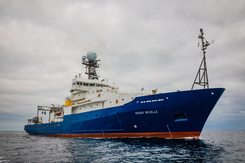
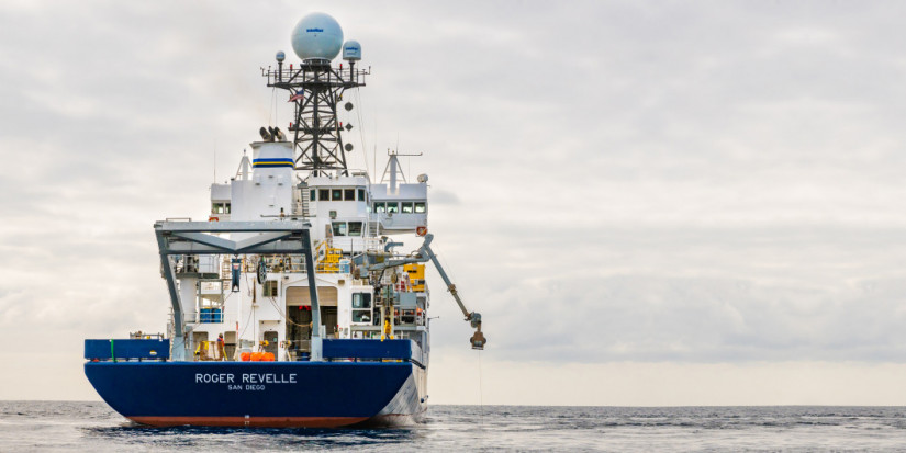
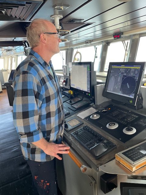
However, one element abides: the ship. Not just any ship, but one designed from keel to masthead to serve ocean research. She must do things typical deep-sea ships can’t or don’t want to do, stop, for instance, at a particular point in the middle of the ocean while scientists probe its depths. She has to go to remote regions with rotten weather, such as the high latitudes remaining safe and entirely self-sufficient. She must be highly maneuverable, able to turn in her own length, so technicians can deploy or retrieve various instruments from the aft deck, even in surly seas. She needs stout winches and cranes to handle heavy gear. Thus, she demands diverse levels of seamanship unnecessary on ships that go from point A to B and back again.
Over meals, we talk of other research ships we’ve known. Knorr. Melville. Kristine Bonnevie. James Clark Ross. “I was on Healy when the ice—” “Remember how Oceanus snap-rolled?” Sally Ride. Neil Armstrong. Kronprins Haakon. I miss the WHOI ship Knorr (retired). I can go all runny and sentimental over these vessels, but it’s not cool to show it.
As chief scientist, Bob has enlisted Roger Revelle with a grant from the National Science Foundation. Everybody in this tight-knit but international business knows him. And everybody likes his chief-sci style. He’s calm, at least outwardly, no matter the adversity, such as when heavy weather steals his expensive ship time. And he doesn’t meddle. He delivers his plan-of-the-day to the captain and science party, then let’s people go about their jobs. Though the ship goes where he needs her to go, Bob is not in charge of Roger Revelle.
Captain Eric Wakeman runs the ship, assisted by his three mates: Chief Mate Tom Grose, 2nd Kirsten Hervey, and 3rd Hi’ilei Robinson. Second in this and every ship’s hierarchy, for obvious reasons, is the Chief Engineer, Tom Johnston. These officers and their crew have been all over the world. They’d probably make more money on, say, a Maersk container ship, but wouldn’t see much, since merchant ships tend to work one route over and over.
Asked what he likes best about research ships (R/Vs), the chief mate doesn’t miss a beat: “Travel.” Tom has been on about everything that floats, including fishing boats, captain on Seattle ferries, and merchant ships. “There’s a saying on merchant ships: cargo is king. That gets boring. I like the variety on R/Vs. Not only of the places we go, but also the variety of science.” For the crew Roger Revelle is home. Science parties come and go, usually in month-long stints with all sorts of different objectives and needs. “Everybody feels a responsibility to help make the science successful. I like that too”
Veteran chemical oceanographer Emil Jeansson, a Swede who works at the Bergen (Norway) Geophysical Institute points out that, “All ships are generally the same, but each is a little different.” Each brings aboard a piece of its own national character. “Yah, Yah, particularly in the food.” (Emil was surprised to learn that Americans use two bed sheets.)
There’s an age-old saying that all ships run on the stomachs of their crews. This one is no exception. We eat well, and a lot, thanks to Stephanie Brown, Senior Cook and, Ryan Mann, Cook. Theirs is the hardest job on the ship, and they do it skillfully. We appreciate that.
____________________________
Roger Revelle, Some Particulars:
Owner: Office of Naval Research
Operator: Scripps Institution of Oceanography
Built: 9 December 1993, launched 20 April 1995
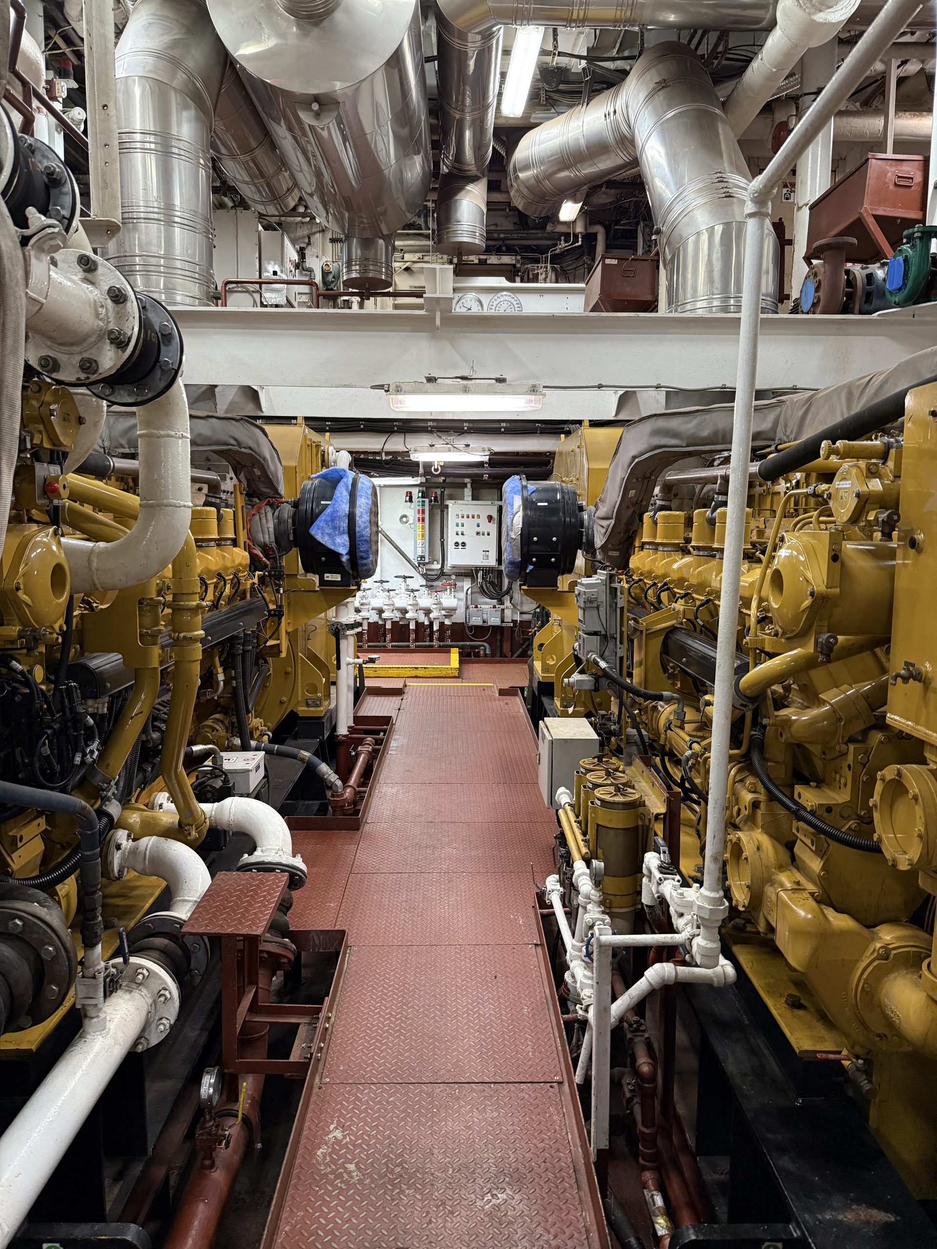
Propulsion: Twin 3,000 hp Diesel electric motors
Length: 277 ft (84.4 m)
Beam: 52 ft. (16 m)
Cruising Speed: 12 knots
Range: 15,000 nautical miles (28,000 km)
Endurance: 52 days
Dallas Murphy

SOMEWHERE OUT THERE
At sea, 17 August 2025 aboard the research ship Roger Revelle
Let’s imagine that in, say, the year 700, a monk strolls a rocky crescent beach at the mouth of Bantry Bay in the west of Ireland. The tide is flooding fast, and a scatter of rain is falling. About to turn back, he notices a peculiar object in the line of wet, black sea wrack at the high-tide line, and picks it up. It’s a heart-shaped bean with a hard, shiny brown shell about the size of a child’s fist. He dries it, turns it over in his hand, and holds it to the light. He has never seen such a thing before. Did it come from across the Western Sea? Or from beneath the sea? Is it a sign, a symbolic heart? He squints out at the horizon as if for an answer. Finding none, he marvels still again at the ineffable mystery of God’s creation.
The bean, technically Entata gigas, originates in the tropics where, the monk’s Bible tells him, the seas boil, but enough made the ocean crossing to have been used as teething rings in medieval Europe, hollowed out to make snuffboxes, and, in powder form, taken as a laxative. Midwives used them as talismans in birthing rituals bearing gigas around the infant’s bed in the direction of the sun. Having drifted across the unknown, unknowable sea, they were attributed magical powers (or in the case of constipation, efficacious results.) We called them lucky beans in southeast Florida, where I first fell under the spell of the ocean.
Other drift objects crossed the Atlantic and fetched up on the shores of Great Britain, Ireland, Spain, and Norway, but none is so nautically well found as gigas for the voyage, its seed surrounded by a thin airspace for buoyancy and encased in a hard, impermeable shell for watertight integrity. It thrives on vines along sun-bright river banks between the Costa Rican rain forests and the Orinoco Delta. When the season is right, the vine drops its seeds into the rivers, and to begin its transatlantic voyage all gigas needs to do is reach the sea and the system of currents that will take it north. A few ride the current 900 miles to the Yucatan Channel, then over the north coast of Cuba, and into the Straits of Florida—the “beginning” of the Gulf Stream. About 35 million cubic meters of water every second blast through this half-pipe trench between Florida and the Bahama Banks. If it really were a “river in the sea,” in Benjamin Franklin’s term, it would transport a volume of water 80 times greater than all the rivers on Earth combined.
Clearing the Bahamas, the eastern bank of the “river” falls away, but the Gulf Stream still hugs the continental shelf of the U.S., and the Monk’s bean will cover some 120 nautical miles a day all the way to Cape Hatteras. There everything changes. There the Gulf Stream puts to sea. It casts off all terrestrial association, and will never again approach dry land. In technical lingo, the Gulf Stream becomes a “free zonal jet.” In utterly unscientific language, it seems to celebrate liberation with exuberant display. It wavers and undulates, casting off giant eddies, and long meanders. Over time, its net transport remains northeastward toward the Grand Banks of Newfoundland. But in the short term, there’s no predicting its whims.
However, to reach the shores of Ireland, Great Britain, or Norway, gigas must find its way into the North Atlantic Current (NAC), a sort of offshoot arm of the Gulf Stream itself. Twenty to 40 million cubic meters of warm, salty water deliver to the west-facing shores of Europe a moderate climate they don’t deserve, given their latitudes. For instance, the latitude of Bantry Bay, Ireland, is 51° North, where palm trees can survive, and farther north, much of the coast of Norway above the Arctic Circle remains ice-free year-round. (On the west side of the Atlantic, that latitude slices across the frigid coast of Labrador.) So here’s a clear-cut example of how the ocean, in collaboration with the west wind, strongly influences climate over a large swath of the Northern Hemisphere. And it’s only one example.
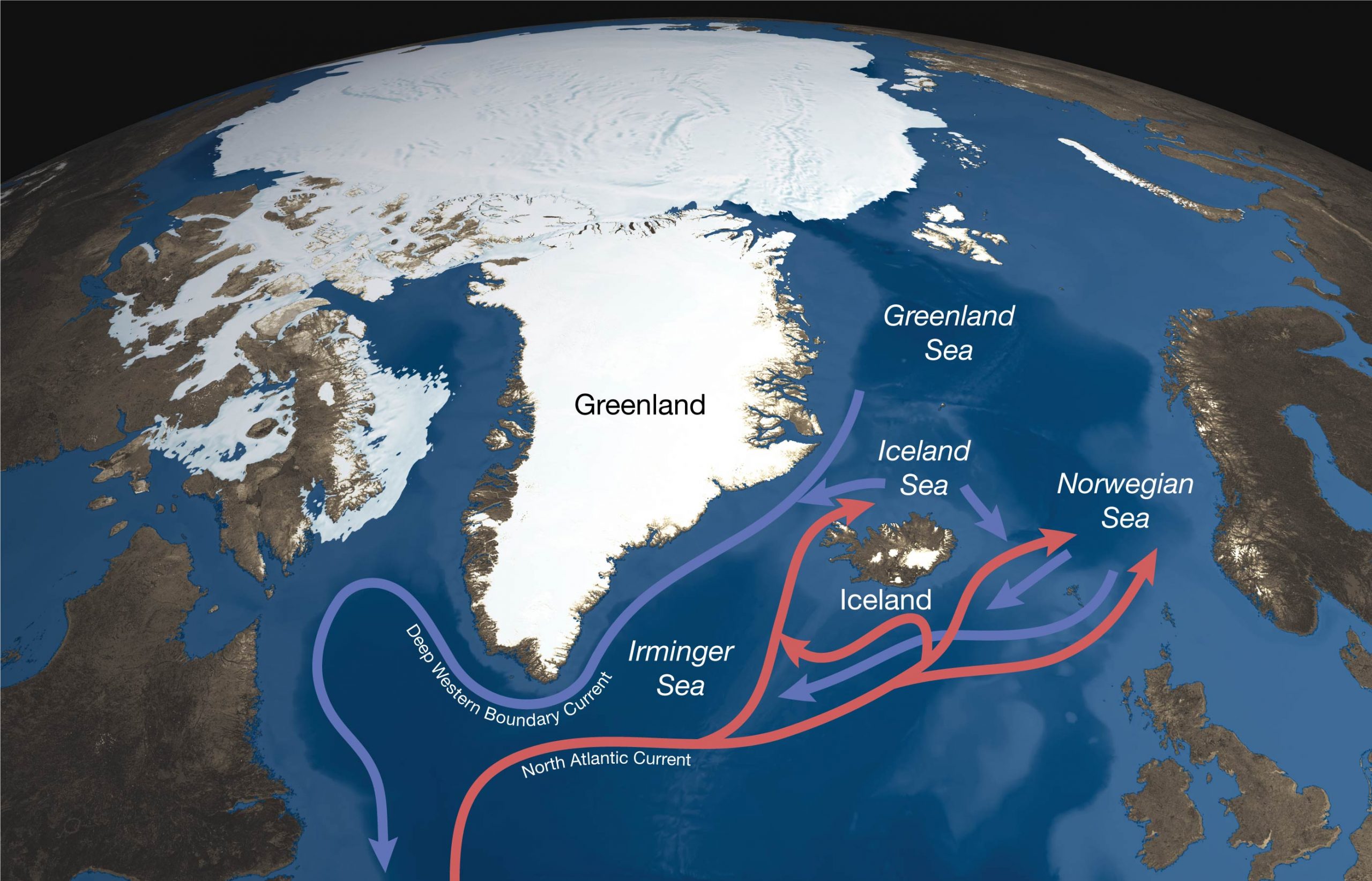
But now we must leave behind the monk, his sea-heart bean, and religious musings to follow the NAC into the Nordic Seas, our study area. There the NAC melds with a complex mix of currents, some flowing down from the Arctic Ocean, others originating in the Nordic Seas. And now the ocean delivers a truly fantastic performance:
All that water flowing northward must somehow find its way back south. If it didn’t, Europe would have been submerged eons ago. So what does it do? Come Arctic winter, the inflowing tropical-origin NAC water, already heavy with salt, further “densifies” from heat loss to the atmosphere—and sinks. Then, simply because Earth rotates, the water forms into a narrow stream and flows south beneath the Gulf Stream all the way to the equator. It’s called the Deep Western Boundary Current.
In a real sense, the existence of the Deep Western Boundary Current is the reason why we’re out here. Bob and his science party want to understand the headwaters of the DWBC. Specifically, they want to measure how the densified water finds its way from the relatively shallow Nordic Seas to the very deep North Atlantic Ocean. This requires the water to negotiate its way through canyons in the submarine mountain range between Iceland and the Faroe Islands to the east.
How astounding it would be to see this waterfall, dwarfing all on land, combined. To visualize the elegant, even magnificent, ways of the ocean requires imagination to translate the necessarily level-headed language of science into pure wonder.
Dallas Murphy
A BEGINNING
Reykjavik, Iceland, 15 August 2025 aboard the research ship Roger Revelle
Chief Scientist Bob Pickart wants to understand the ways and means of the ocean. He always has, devoting his long career at Woods Hole Oceanographic Institution to the endeavor. Of course, no one can understand the entire World Ocean; scientists must specialize. Bob has looked north to the high-latitude seas, the Beaufort, and on this side of Canada, to the Greenland, Norwegian, and Iceland; together, they constitute the Nordic Seas—our destination.
These can be unruly waters. I was with Bob during a 2007 expedition, a “cruise” in the parlance, when a storm blew hurricane-force and higher for 24 hours, driving before it magnificent 60-foot breaking waves. Even on the calmest days, the dynamics of the Nordic Seas are dizzyingly complex and confusing as if to intentionally defy scientific understanding. So, “Why bother?” is a reasonable question for non-scientists to pose. On one level, it’s because that’s what oceanographers and other Earth scientists do—they seek to understand nature. On another, there is a degree of urgency these days to glean the wild array of hot and cold currents: What happens to salt water in the Nordic Seas redounds to and in part determines the conditions of our climate. But to learn anything and then report it to you, we first need to get underway.
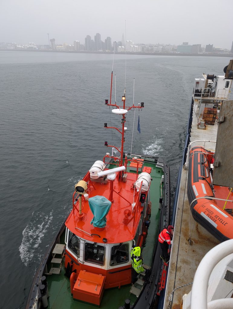
Captain Wakeman has taken in his dock lines, and that’s as good a mark as any for the beginning of a cruise. He cons Roger Revelle away from her berth and points her bow toward the mouth of Reykjavik Harbor. Now, as at the outset of all voyages, expectant questions hang over her decks. What will happen out there above the Arctic Circle? Will the winds and seas allow Bob and his team to do their work or just make us miserable? Will the electronic tools essential to measure oceans fail when we need them the most? And what about the ship? Ships occasionally breakdown through no one’s fault. In any event, fair or foul, we’ll have sea stories to tell—and if all goes to plan, ocean secrets to reveal.
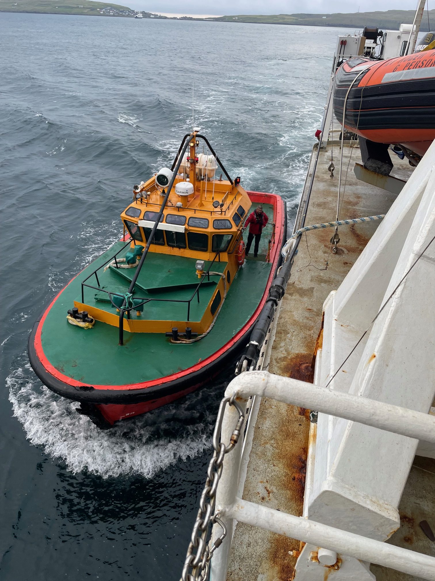
The harbor pilot has come and gone, and now the ship pitches slightly in a gentle seaway. It feels good.
And so we invite you aboard vicariously on this month-long cruise, its unique combination of fine tolerance science, demanding seamanship, and heavy industry. We’ll deliver updates in prose and photography not only to address the science, but to evoke daily life aboard a dedicated research vessel alone on the open ocean. I’m pleased now to welcome you aboard Roger Revelle.
Dallas Murphy
