UFO moorings
The mooring array will, for the first time, provide timeseries of both branches of the Iceland-Faroe Slope Jet (IFSJ) and the Norwegian Sea Gyre (NSG) Rim. The array was deployed in autumn 2024 and consists of 8 tightly spaced profiling moorings that resolve and bracket the two previously documented IFSJ branches. The NSG Rim will be measured simultaneously by other members of UFO.
WHOI moorings:
The location of the mooring array on the Iceland-Faroe Ridge was chosen based on the 2011 shipboard hydrographic/velocity survey that first resolved the IFSJ. The array is near one of the 2011 sections where the continental slope is gentle, upstream of the standard section occupied by the Faroese Marine Research Institute (FAMRI). Each mooring contains a McLane moored profiler (MMP) with a Sea-Bird SBE37 conductivity-temperature-depth (CTD) sensor and Falmouth Scientific Instruments acoustic current meter (ACM) for measuring velocity. An additional SBE37 MicroCAT is positioned immediately above/below each top/bottom stop of the MMPs for increased temporal resolution and for calibration of the MMP data. On the central 6 moorings of the MMP array, upward-facing long-ranging acoustic Doppler current profilers (ADCPs) are be positioned at the base of the moorings. On the two endpoint MMP moorings an Aquadopp will measure velocity at the bottom.
UiB and FAMRI moorings:
In 2024 UiB and FAMRI each deployed a mooring in the NSG Rim using an upward-facing long-ranging ADCP and MicroCAT. Hence, the composite WHOI/UiB/FAMRI moorings plus glider will nicely capture all of the eastward flow potentially feeding the Faroe Bank Channel overflow (FBCO). To measure the NSG Rim, UiB is operating a Seaglider repeating a line from the offshore-most MMP mooring to the 3200 m isobath for the same year-long period.
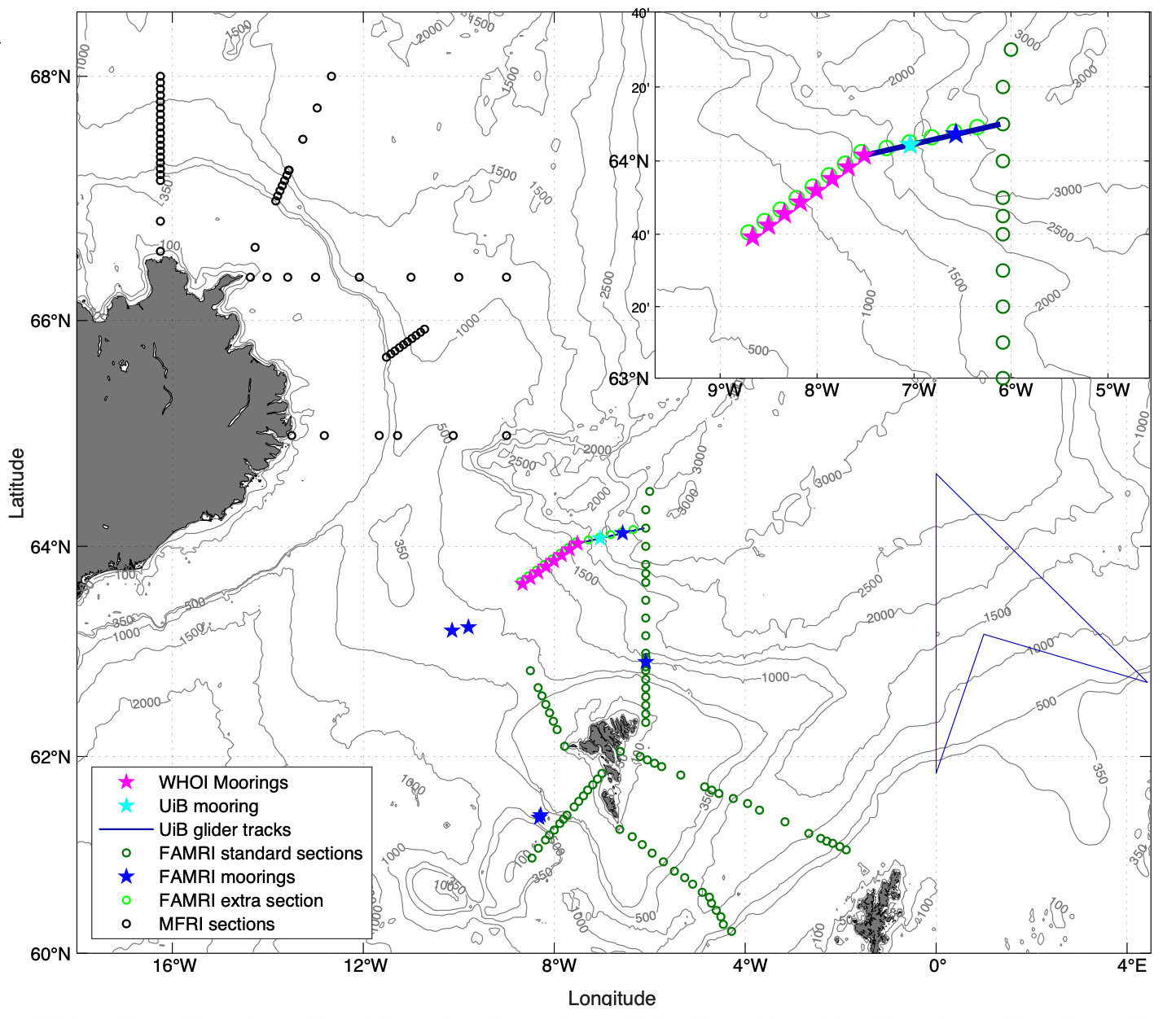
Location of the international UFO mooring array, along with the other components of UFO. The WHOI profiling moorings are the magenta stars, which capture the two previously identified branches of the IFSJ. The UiB Seaglider (blue line) and UiB and FAMRI moorings (cyan and blue stars, respectively) measure the NSG Rim. The inset shows an enlarged view centered around the composite mooring array.
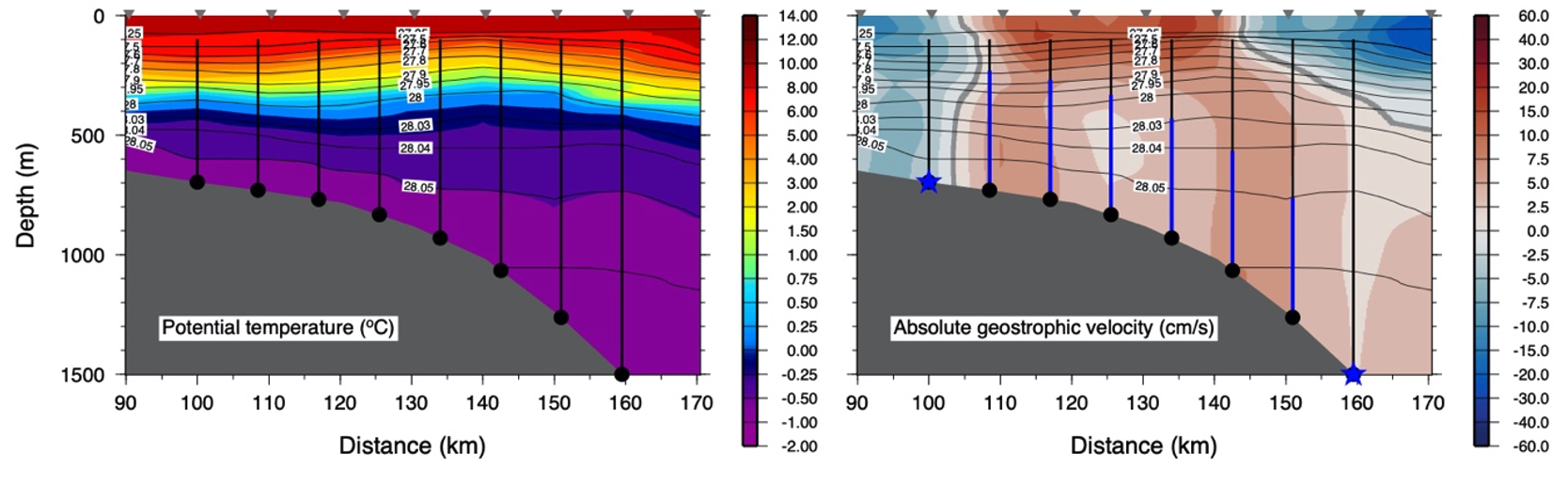
Configuration of the profiling array in the vertical plane (black lines), overlain on the shipboard potential temperature section (left) and absolute geostrophic velocity section (right) occupied in 2011 near the array site (the triangles are the 2011 CTD stations). The contours are potential density (kg m-3). The thick blue lines in the right-hand panel denote the ADCP coverage. The blue stars are Aquadopps. The MicroCATs (not shown) are located above and below the MMP bumper stops.
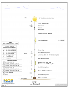 Mooring Diagrams