Quaternary Paleoseismicty in Jamaica
Quaternary Paleoseismicity Research // Sediment Properties and Velocity Research // Lake Flooding Research
Neotectonics of Southeastern Jamaica Derived from Marine Seismic Surveys and Sediment Cores
[Paper]
Tectonics in Southeast Jamaica is poorly understood, but the region may contain currently unknown faults that could generate large‐magnitude earthquakes. This study constrains tectonics in Southeast Jamaica by collecting and analyzing seismic and shallow sediment core data in and around Kingston Harbor. Seismic results reveal a previously unrecognized strike‐slip fault system that accommodates strain via a complex mix of compression and extension. The faults appear to be a blind extension of one major fault (i.e., The Bull Bay Strike‐Slip Fault) within the Enriquillo‐Plantain Garden Fault Zone. This fault system may represent significant hazards to Kingston Jamaica because the fault is active, located less than 5 km from the city, and a complete rupture of the fault could generate a Mw 5.8–6.9 earthquake. The analyses highlight the need for continued paleoseismic studies, both onshore and offshore Jamaica.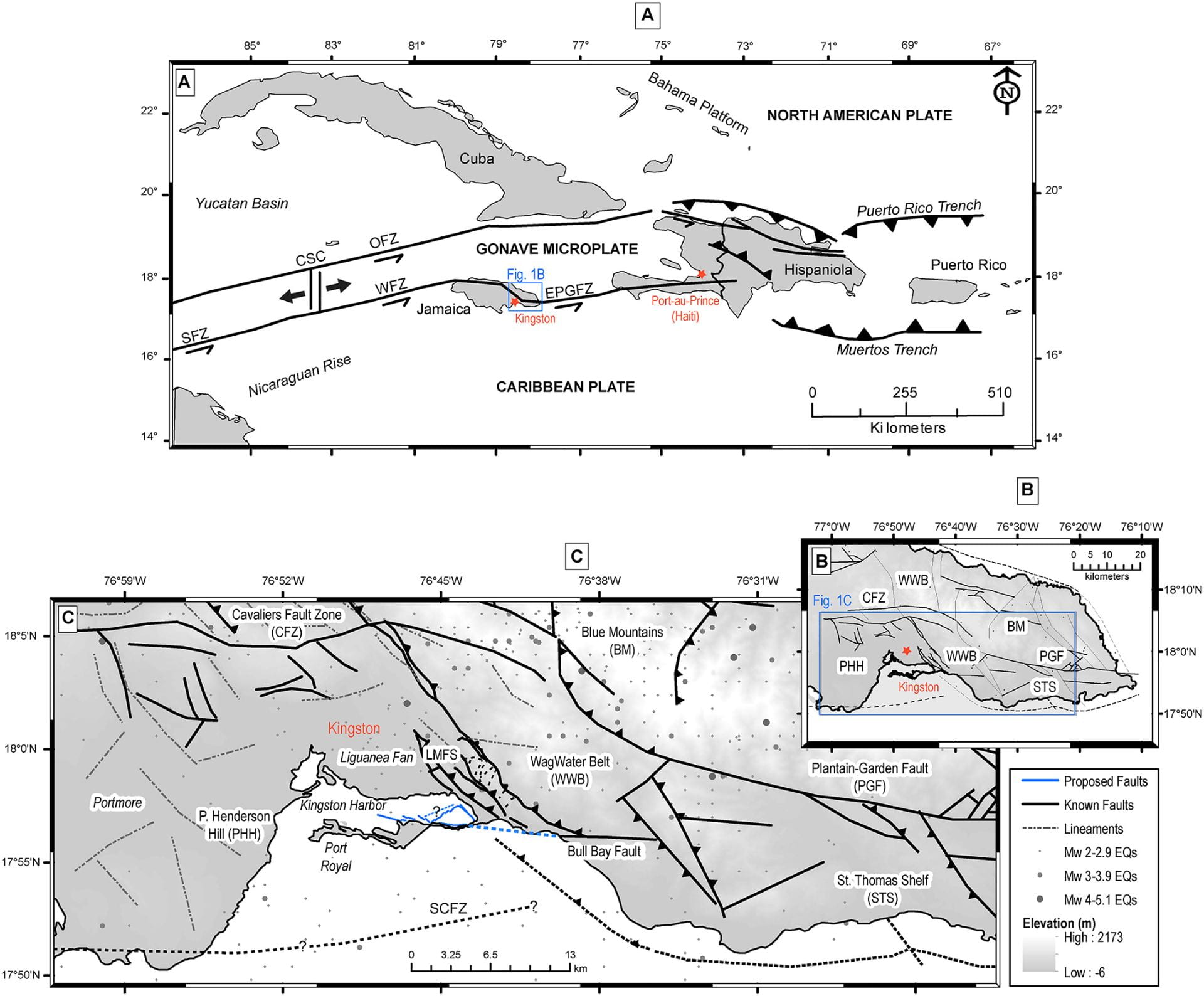
Figure 1. (a) Regional map shows that Jamaica is bisected by the Caribbean Plate and the Gonave Microplate. The country experiences intraplate shearing as a result. Map also shows the locations for the major plates in the region. These plates are bounded by the Enriquillo‐Plantain Garden Fault Zone (EPGFZ), the Walton Fault Zone (WFZ), the Oriente Fault Zone (OFZ), and the Cayman Spreading Center (CSC). (b) Map of Eastern Jamaica showing the locations of mapped faults and major tectonic structures that create the restraining bend flower structure. The abbreviation LMFS refers to the Long Mountain Fault System, which comprises of the Long and Dallas Thrust Mountains (see Figure 2a). (c) The figure is a more zoomed‐in map (blue box in Figure 1b), showing the faults, lineaments, and earthquakes locations in the region.