Multimedia
Discover how New York City – overwhelmed in 2012 by Superstorm Sandy – has learned from that disaster, and must defend itself against rising seas and the next big storm. With 520 miles of shoreline and no coastal protection, engineers and urban planners are tackling the problem with urgency and creative engineering.
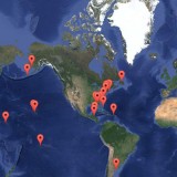
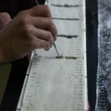
When Geologist Jeff Donnelly of the Woods Hole Oceanographic Institution (WHOI) hunts for hurricanes, he does it safely at ground level, or just slightly below. He is even able to do it without having to encounter so much as a drop of rain or a gust of wind. With funding from the National Science Foundation, Donnelly leads a team that studies long term global hurricane patterns. They travel to coastal areas where a hurricane's storm surge has washed over beaches and left sediment deposits, such as sand, in areas where there normally wouldn't be any. By drilling and studying cores from different points around the Atlantic Ocean, he and his team have been able to paint a picture of long term global hurricane activity. They've unearthed some interesting findings about past hurricane activity which might give us a hint about what we can expect in the future.
Thatch Point Blue Hole, Bahamas : Bird’s Eye View
http://science.whoi.edu/users/coastal/Media/Thatchpoint2.wmv
Thatch Point Blue Hole has been tempting the scientists of the Coastal System Group for years. In 2011 Dr. Pete Vanhengstum enlisted the aid of local divers to recover a short sediment core from the hole. Analysis of that core yielded a high resolution overwash record suggesting that there was a much longer story buried in the bottom of that hole, if only there was a way to sample it. The location of the hole, it’s depth, and the shallow surrounding lagoon make it an ideal target for the group’s paleo-hurricane reconstructions. Yet it’s those same traits that have stood in the way of any major coring attempts. With a depth of 80m Thatch Point blue hole is too deep for shallow water coring techniques, but with the surrounding waters only a few meters deep there was no way to transport the more robust coring systems needed to the site.
In 2015 a team consisting of Dr. Vanhengstum, Dr. Donnelly, graduate student Tyler Winkler, and research technician Richard Sullivan finally managed to recover a 9m core from Thatch Point. Utilizing a custom built light weight coring frame and platform mounted ontop of two 6m inflatable rafts they successfully deployed a coring system intended for use on boats larger by several orders of magnitude. The ability to deploy large systems in locations traditional research ships can’t reach opens up numerous sites that had previously been beyond the group’s grasp. The potential for finding detailed climate records is high helping us better understand what past climate conditions have been and what sort of storms the future may hold.


