High-resolution marine gravity measurements with AUVs
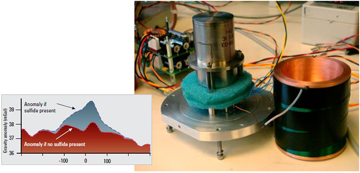
Measurements of variations or anomalies in Earth’s gravitational field provide valuable information about the structure of the sub-seafloor that can help identify economically valuable mineral deposits and petroleum reserves. These measurements are routinely obtained using satellites or gravimeters aboard surface vessels, but these methods cannot detect small-scale gravity features because the magnitude of the anomaly decreases as the distance the seafloor and the sensor increases. Characterizing these anomalies requires gravity measurements from submerged platforms capable of operating near the seafloor. Piloted and remotely operated vehicles are too costly for such measurements; autonomous underwater vehicles (AUVs) provide a cost-effective alternative.
Engineers at WHOI and a commercial vendor are developing a new class of gravimeters that is compact and low-power—necessary attributes for AUV instrumentation—and tightly coupled to the navigation sensors on the vehicle. Concurrent to this effort, is research into improved navigation and control methods that will improve the accuracy and spatial resolution of AUV gravity measurements. Control work focuses on combining existing bathymetric maps and realtime sensor data to minimize both the distance from the seafloor (to increase the gravity signal) and the vehicle acceleration (to reduce noise resulting from vehicle motion). Navigation improvements focus on new methods for estimating vehicle acceleration to increase the ability to correct vehicle motion and thereby improve the quality of underway gravimeter measurements.
Principal Engineer
James Kinsey
Assistant Scientist, WHOI

