Big Ice: Ice Cliffs and the Marine Ice Cliff Instability
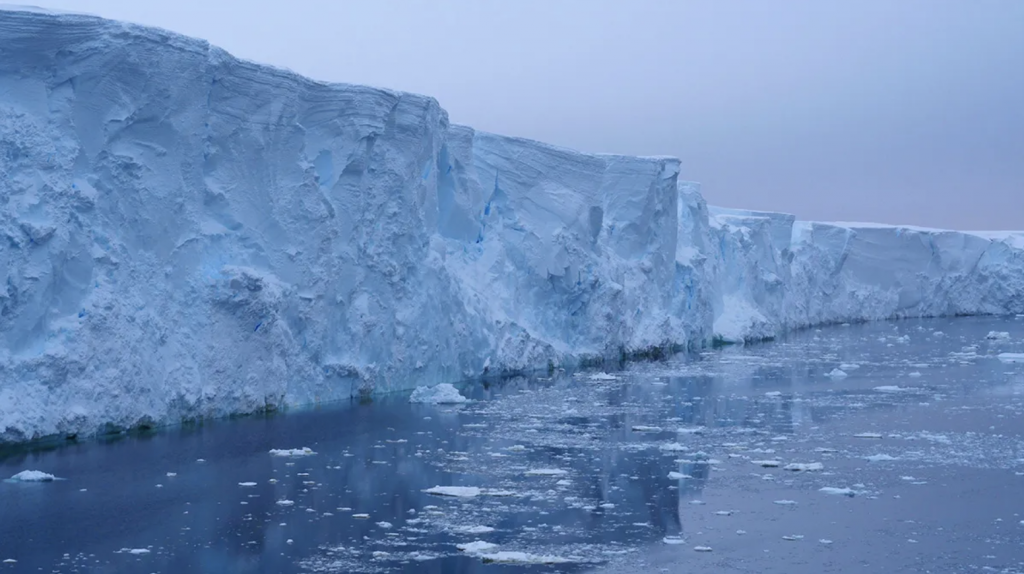
An ice cliff at Thwaites Glacier in West Antarctica. Credit: Rob Larter
What is the maximum height to which an ice cliff can persist on Earth? Theory and related models suggest a subaerial stability limit at ~100 m, beyond which a cliff could undergo collapse and trigger runaway retreat [1,2]. The Marine Ice Cliff Instability (MICI), as this scenario is known, has been employed in several model scenarios that predict a potentially catastrophic future for the Antarctic Ice Sheet in terms of collapse [3]. Anecdotally and in small sample sets this height limit appears to hold true [2,4,5], but has yet to be empirically tested against a larger, diverse set of cliffs in different physical and environmental settings.
This study seeks to determine properties of existing ice cliffs, and to better understand regions where ice shelf collapse or glacier retreat could expose tall cliffs with the potential to collapse in the future. Using satellite and airborne laser altimetry over a variety of ice shelves and marine-terminating glaciers, we will determine calving front surface topography and overall ice cliff height. With existing bathymetry measurements, we will determine associated seafloor depth. We will determine crevasse characteristics, extent of proglacial mélange, and glacier geometry (e.g., calving front changes). These observables will be used to understand how ice cliff height, and relatedly stability, relates to grounded depth, water height, crevasse population, proglacial mélange extent and climate forcing (from reanalysis data) over time among different glacier settings. At locations with floating ice shelves, we will use these datasets to determine where future collapse of an ice shelf might create an unstable ice cliff.
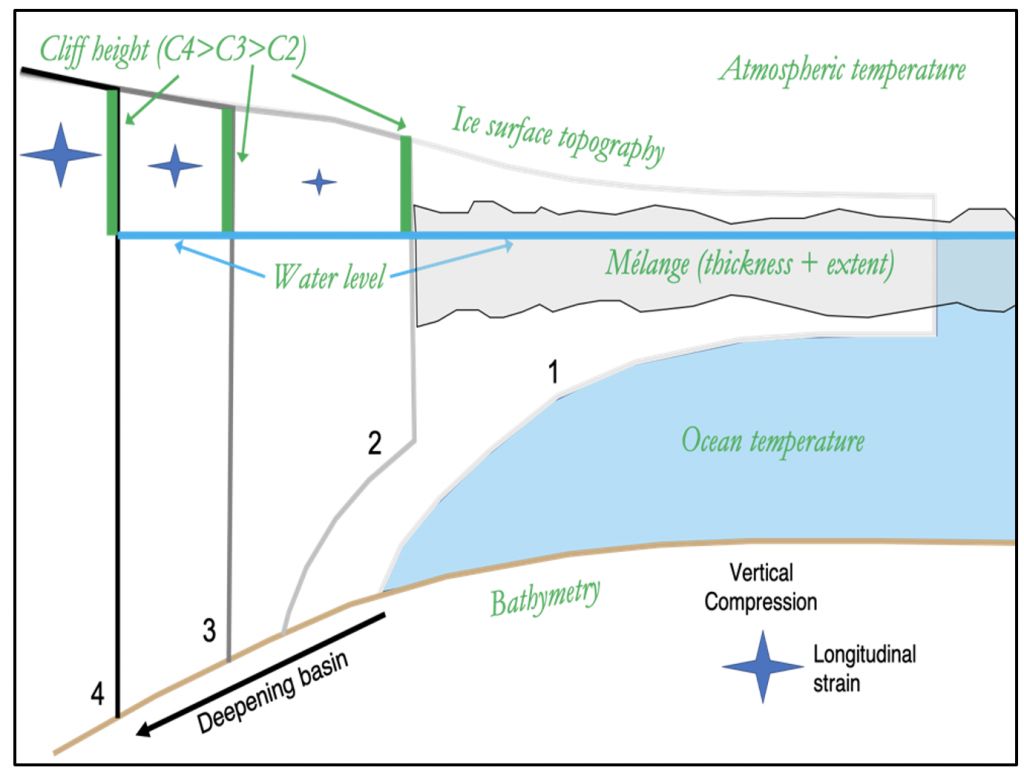
Observing the Marine Ice Cliff Instability. Shades-of-gray lines outline ice shelf (1) retreat (2), which forms a vertical ice cliff (3) that retreats into a deepening basin (4). Ice cliff height above water line is traced in green, showing cliff height C4>C3>C2, an increasingly unstable configuration when we consider the increasing stress and strain (star symbol). Observables to be collected in this study are labeled in green. (cartoon inspired by Crawford et al., Nature Communications, 2021).
This project is focused on placing observational bounds on structural ice stability through a large-scale survey of ice topography, crevassing and cliff height at glacier termini using remote sensing and modeling efforts. A variety of marine-terminating glaciers will be surveyed, both with and without floating ice shelves/ice tongues, through the following two research prongs:
(1) Observations. We are collecting a variety of remote sensing measurements over target locations to catalogue ice cliff heights and structural and environmental characteristics. We use best-known bed depth values from digital elevation models. Contemporaneous measurements of water height in front of the glacier are also used to determine ice cliff height above the water surface. Variability in cliff heights will be contrasted against variability in mélange thickness to understand the correlation between wasting rates/magnitudes/styles (proxies for stability) and cliff height.
(2) Modeling. To complement the observational component, a modeling effort is employed to predict calving front position, velocity, calving front uplift, and slumping based upon observational inputs. While experimenting with a range of ice strengths and cliff-face melt profiles, we can test the model and calibrate the failure strength of ice for a range of glaciological and climate regimes to determine the broader-scale implications for our observational results.
Put simply, the main objective of this study is to use observations to empirically test the hypothesis that ice cliffs above a certain height are unstable, and determine how glacier geometry, atmospheric and oceanic forcing, and glaciological characteristics contribute to states of (in)stability, relating to the potential of MICI.
This work is funded by the NASA Cryosphere Program.
References:
[1] Pollard, D., DeConto, R.M., and Alley, R.B. (2015) Potential Antarctic Ice Sheet retreat driven by hydrofracturing and ice cliff failure. Earth and Planetary Science Letters. 412 112–121.[2] Bassis, J.N. and Walker, C.C. (2011) Upper and lower limits on the stability of calving glaciers from the yield strength envelope of ice. Proceedings of the Royal Society A: Mathematical, Physical and Engineering Science.
[3] DeConto, R.M. and Pollard, D. (2016) Contribution of Antarctica to past and future sea-level rise. Nature. 531 591.
[4] Ma, Y., Tripathy, C.S., and Bassis, J.N. (2017) Bounds on the calving cliff height of marine terminating glaciers. Geophysical Research Letters. 44 (3), 1369–1375.
[5] Wise, M.G., Dowdeswell, J.A., Jakobsson, M., and Larter, R.D. (2017) Evidence of marine ice-cliff instability in Pine Island Bay from iceberg-keel plough marks. Nature. 550 (7677), 506–510.