Atmospheric and Climate Research
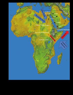
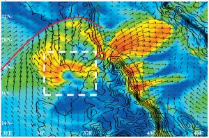
Northwest Africa and Arabia are home to a variety of fascinating atmospheric phenomena that have strong climatic and socio-economic consequences. These include the summer Monsoon, mesoscale convective complexes, wind jets and dust storms. My work with Shannon Davis and Houshuo Jiang centers on an atmospheric model of the region and the pathways of moisture transport that wind their way through the East African and Ethiopian Highlands, the Red Sea Hills and the Red Sea corridor.
Davis, S., L. J. Pratt, and H. Jiang. Numerical Simulations of the Tokar Gap Jet: Regional Circulation, Diurnal Variability and Moisture Transport. Submitted to The Journal of Climate.
Figure 1. Primary EARSAP topographic influences in relation to the Tokar Gap as seen in the NASA SRTM map of Africa. Labeled features include the Ethiopian Highlands, the East African Highlands, the Great Rift Valley/Turkana Valley region. The large-scale and high resolution domains are also indicated (black rectangles), as are the principle lower wind patterns of the summertime lower tropospheric circulation across the region (blue arrows) and orographic jets (red arrows). Stations providing atmospheric data for model verification are indicated by black dots and points used to evaluate model profiles and vertical cross sections in the analysis are indicated by red dots/lines.

