1992: IOEBs Deployed
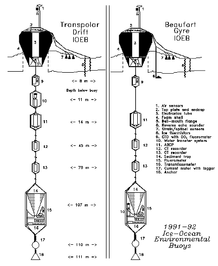
In 1991 two IOEBs were designed to acquire and transmit (in near-real time) data from numerous meteorological, ice, and ocean sensors. Suspended from the surface apex, the 110 m mooring systems comprised three SeaCat C/T recorders, a 150 khz ADCP (with data compression module), a S4 electromagnetic current meter, two fluorometers, a transmissometer, a water transfer system, and sediment trap. Electronically, all the sensors were configured to communicate their latest data over a RS-485 network to a pair of controllers which provide this information to platform transmit terminals that telemeter to the ARGOS satellite system. The satellite calculates locations nearly every hour, and combines this information which is typically available within several hours via telephone. Daily the locations and data are dumped over the Internet to our laboratory computers. Monthly the data is also archived on floppy disks.
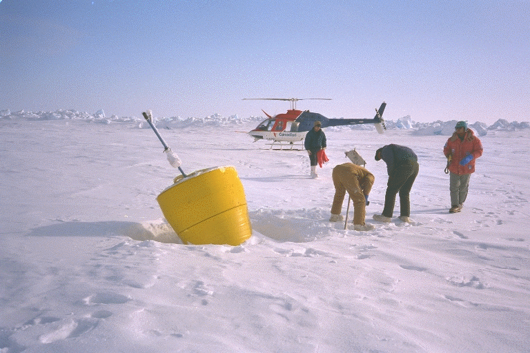
One IOEB was deployed from the LEADEX ice camp in the spring of 1992, approximately 150 miles north of Deadhorse, Alaska. On April 23, two WHOI scientists arrived with an IOEB and deployment gear at the LEADEX camp during backhaul of the main program. By April 26, 03:00 Z, the surface apex was in position with the complete mooring system suspended below. Shortly thereafter, the ice sensors and meteorological mast were installed, and the LEADEX camp was abandoned by all.
After the deployment, it became apparent that a problem existed on the RS-485 sensor network, since data from the sensors was not being updated. Later it was determined that the SeaCat recorders created glitches over the network when entering and exiting low power mode. This problem did not disrupt communications until the mooring system was put under tension, however, and therefore was not detected during testing. After a month, the SeaCat batteries became exhausted, and noise on the network disappeared. The excessive network noise caused the water transfer system and sediment trap to halt their programs almost immediately, but other instruments began reliably updating after May 1992, including the ice module, meteorological module, ADCP/DPM, and transmissometer/fluorometer module at 108 m. While most instruments were outfitted with two to three year battery packs, data continued to be transmitted by some into 1995. The platform transmit terminals were provided with the most power and continued to provide locations into 1996.
After 1993, the IOEB drifted away from the North American coast and could only hope to be visited by icebreaker, although this opportunity did not occur. But in the summer of 1995, it appeared that the buoy would eventually drift to within Twin Otter aircraft range from the Queen Elizabeth Islands. Consequently a recovery/refurbishment operation was planned for the spring of 1996 as part of the AREA 96 program.

