Credit: Sheri N. White © WHOI.
Credit: Sheri N. White © WHOI.
Credit: Sheri N. White © WHOI.
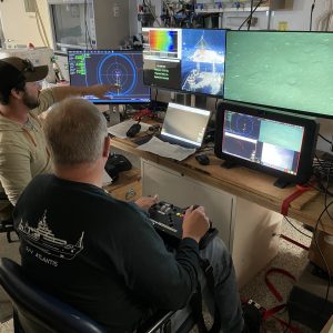
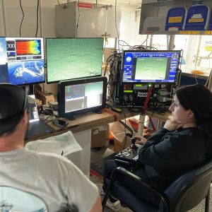
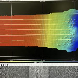
The OOI-CGSN team surveyed the seabed to better understand the layout of the proposed moorings sites. The RV Neil Armstrong operated a hull-mounted acoustic equipment to collect bathymetry (depth contours), backscatter imagery (seabed characterization), and subbottom data (seabed profile and geophysical layering). Chris Basque, Irene Duran, and John Lund also piloted the ROV over the mooring locations to collect images, video, and high-resolution sonar of the seabed.
Posted in Pioneer MAB At-Sea Tests, Updates
Recent Updates