Working at sea brings unique challenges. The one we commonly experience on RCA cruises is weather, specifically wind and waves. When wind and waves combine, they create swells, groups of waves with an average height and period that can travel long distances. At our sites, the average wave height is usually around 3 to 6 feet, but weather systems can build those heights to 9 feet or more. When the height of swells gets too much, or they are very irregular in their timing, it becomes unsafe for the ROV to go in and out of the water. Over the weekend, a high-pressure system in the area caused the local wind and waves to increase above those workable limits. Wind was sustained at 25 knots, with gusts over 30 knots, and the sea height was 9-12 feet on August 10th and 11th. Conditions like these are one of the reasons we plan our cruises in a modular fashion. We also plan each leg with a mixture of operations that need various levels of weather. The ROV can dive in rougher conditions if it has no equipment or only light equipment onboard, than it can when a heavy package is latched below it. There are also shipboard operations that can be done even when the ROV cannot dive, such as acoustic multibeam surveys or CTD casts.
With sites between 14 and 300 miles off the coast, the exact weather conditions can vary quite a bit, particularly between our furthest site, Axial Seamount, and the sites closer to shore. We left Axial on August 10th just as the weather was getting to become rough. We had a relatively quick 16-hour transit to Slope Base, the tailwind speeding us along. Since arriving, we have been bouncing around between Slope Base, Southern Hydrate Ridge, and Oregon Offshore. The three sites are only about an hour apart, so we have been able to easily move between them, assessing the weather, and diving when we are able. At Slope Base, we dove on the deep and shallow profiler moorings. At Oregon Offshore, we also dove on the deep profiler mooring, unplugging it in preparation for another group from our team to recover it on the R/V Sally Ride later this month.
A challenge to operations that is new to the RCA team this year is krill. On the evening of August 11th, we arrived at Southern Hydrate Ridge, a methane seep ~50 miles off the coast of Oregon. The site is a highly dynamic environment with multiple locations where methane gas bubbles are issuing from the seafloor, derived from methane hydrate in the subsurface. The hydrates are compounds that form when methane (CH4) and water combine to form an ice-like lattice in which CH4 is concentrated in a solid form. Under the right temperature-pressure regimes, such as those that exist at SHR, free methane gas issues from the seafloor as bubbles. The bubble plumes rise several hundred meters above the seafloor where the methane is oxidized by microbes, creating a highly biologically productive environment as evidenced by swarms of krill and larger fish at this horizon. The plumes can be mapped by an acoustic multibeam sonar on the ship, which is often our first operation when we arrive at the site. Using the multibeam, we can identify which sites are still actively venting methane and are of interest for visual survey and potential deployment of equipment. We began this routine 1-2 hour survey just before midnight on the 11th and detected several plumes coming from known locations. When the multibeam survey was complete, we moved over to the location of our main equipment at SHR, intending to dive with the ROV to visually survey the dynamic site. However, before we could begin, we received calls from the engine room… the engine’s cooling intakes, which brings seawater in to cool the engines, was being overrun by krill. The strainers on the intake were filling up every few minutes. While these many, many little invertebrates posed no danger to the safety of the ship, the krill swarm had overtaken the cooling intake system so thoroughly that one of the ship’s generators had to be shut down. This meant that the visual survey using the ROV was cancelled due to insufficient power.
This was a new experience for all of us, even folks who have been working at this site for years. The krill are only a concern at night, when they come to the surface to feed, safer from their predators than they would be during the day, a phenomenon known as diel vertical migration. We’re not entirely sure what caused the krill numbers to be so high this time, perhaps the earlier storm caused more methane to be released or mixed the water layers, so nutrients were abundant leading to the swarm we encountered. Through the night of the 11th and early in the morning on the 12th we switched to another multibeam survey at the northern summit of Hydrate Ridge. On the afternoon of the 12th, we were able to do our visual survey dive at Southern Hydrate Ridge.
This dive was as well attended as our dives at the ASHES hydrothermal vent, with the back row packed with VISIONS students eager to see another chemosynthetic ecosystem. At SHR, the subsurface hydrate results in a rugged sedimented terrane marked by abundant hummocks, formed by the underlying hydrate. White bacterial mats cover the seafloor, fueled by a series of reactions based on the escaping methane. Beds of clams that host symbiotic chemosynthetic bacteria and carbonates formed by the chemical and microbial reactions at the site are scattered amongst the mats. All of this activity attracts a variety of larger animals like rockfish, hagfish, eelpouts, crabs, skates, and more. We still have two more dives at the site to swap the digital still camera and recover uncabled osmotic fluid samplers deployed last year, but those will have to wait a little while longer for the swell to come down.
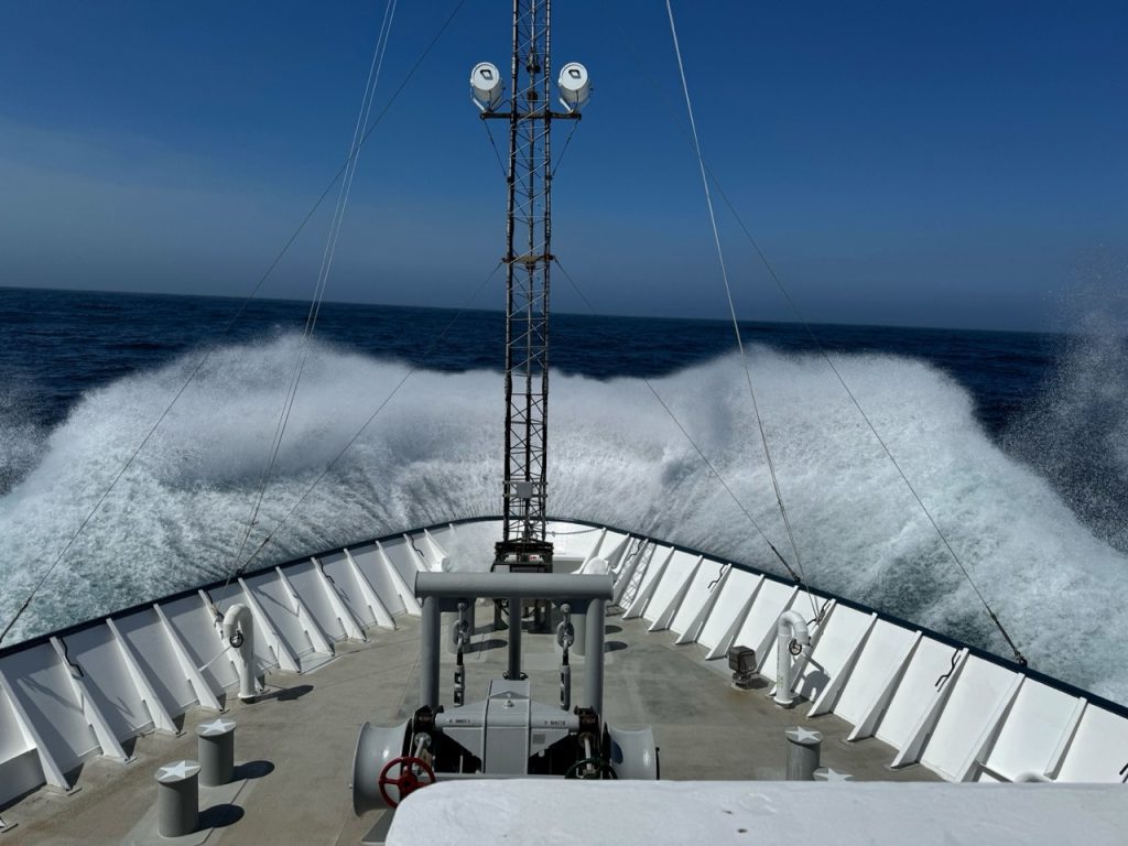
Rough transit from Oregon Offshore to Southern Hydrate Ridge. Credit: J.Tilley, UW-APL, V25.
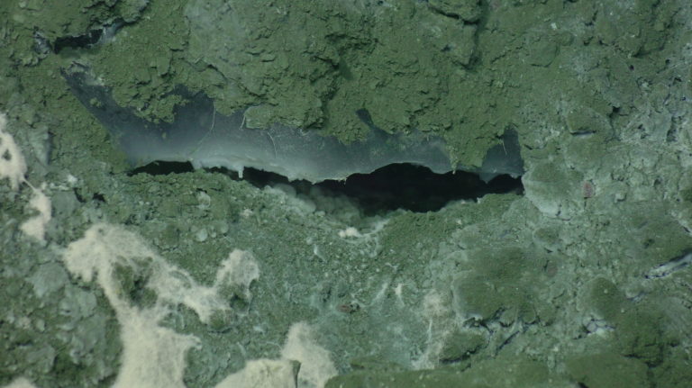
Exposed methane hydrate at Southern Hydrate Ridge seen during V25. Credit: UW/OOI-NSF/WHOI; J2-1715; V25
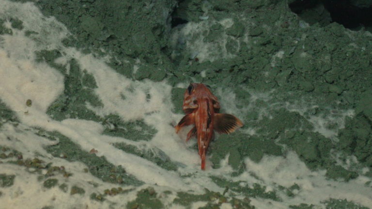
A rockfish resting on bacterial mat at Southern Hydrate Ridge. Credit: UW/OOI-NSF/WHOI; J2-1715; V25
Recent Updates