REMUS 100
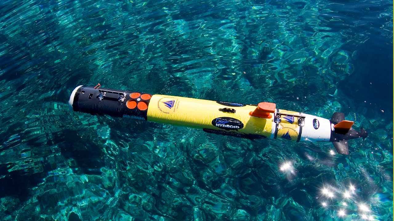
REMUS (Remote Environmental Monitoring UnitS) 100 is a compact, light-weight, autonomous underwater vehicle designed for operation in coastal environments up to 100 meters in depth. The REMUS 100 can be configured to include a wide variety of standard and/or customer specified sensors and system options to meet your unique autonomous mission requirements.
| Vehicle Specifications | |
|---|---|
| Diameter | 19 cm (7.5 in) |
| Weight | 37 kg (80 lbs.) |
| Max Depth | 100 m (328 ft) |
Applications
- Hydrographic surveys
- Scientific sampling and mapping
- Very Shallow Water Mine Counter Measures (VSW)
- Pollution Detection and Monitoring
- Pipeline Inspection
- Undersea Search and Survey
- Homeland Security
- BIOMASS Survey
- Fishery Operations
Standard Sensors
- Bathymetry
- Temperture
- Water Velocities
- Salinity
- Sound Speed
- Optical Backscatter
- Diver Visibility
- Sidescan Sonar
- Fluorescence
Data Products
- Sensor Data is available immediately upon recovery of the vehicle.
- Combining the sensor data with the navigation data provides instant two and three dimensional visualization of the environmental parameters measured by the vehicle.
Survey capabilities
- Both Search Classify and Map and Reacquire and Identify capabilities
- Adaptive (proactive) path planning –following a plume to its source
- Multiple Vehicle Operations: Up to four vehicles simultaneously in an area
Navigation
- Long Baseline Transponder Navigation
Used most often for survey work. Needs at least two transponders. - Ultra-Short Baseline Transponder Navigation
Used for homing, docking, and recovery. Only one transponder is required. Fix is based on range, bearing, and heading. - Dead Reckoned Navigation
Used to estimate position between acoustic fixes, or when transponders are not available. Based on lateral and axial velocities from ADCP, combined with heading from compass/rate gyro. Inertial navigator extends dead reckoned accuracy to approximately 5 meters per hour of error.
Low Speed Control Hover Capable REMUS 100
Hull and Harbor security applications:
- Unobtrusive
- Fast, Detailed Look, in Zero Visibility
- Saves Time/Money
- Locate Suspicious Objects
- Increases Confidence
Key Features of Hover Capable REMUS 100:
- Low drag, allows long transits to target, followed by hover survey or station-keeping.
- Can hold station in a strong current
- Ability to autonomously maneuver at velocities between 0 to 0.5 m/s in and around ships and piers
- Ability to autonomously follow a set of pre-programmed track lines while utilizing an acoustic navigation system at short ranges (10 - 100 m)
- Ability to maintain precise heading when operating near large metallic objects
- Ability to fly at a constant offset below or to the side of a ship’s hull
- Ability to detect, locate and identify objects that are located on complex structures in a highly cluttered environment
Sensors include:
- T-16 Inertial Navigation System
- WAAS GPS
- Iridium, WIFI and Acoustic Modems
- Modular Docking endcap with blunt nose
- 1200 kHz RDI ADCP
- Imagenex 837 multibeam profiling sonar
- Delta T Scanning Altimeter
- Forward and Aft Tunnel thrusters
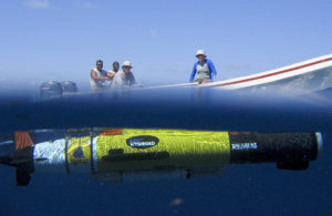
The REMUS 100 autonomous underwater vehicle works just below the surface in Glover's Reef Marine Reserve off Belize, while the crew (Faegon Villanueva and Tyrone Lambert, from Belize; and Glen Gawarkiewicz and Harvey Walsh from WHOI) watch from the launch boat. Their effort was part of a study of the larvae of the Nassau grouper, how they are dispersed, and what that means for the connectivity of the populations on various reefs (led by Simon Thorrold). The REMUS vehicle was used to map the bathymetry (shape, depth, and topography) of the seafloor and the water properties around Glover's Reef. (Photo by Andrey Shcherbina, Woods Hole Oceanographic Institution)