Buoy data from the BGEP project
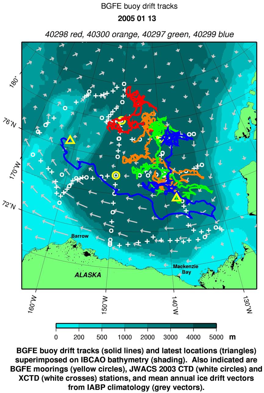
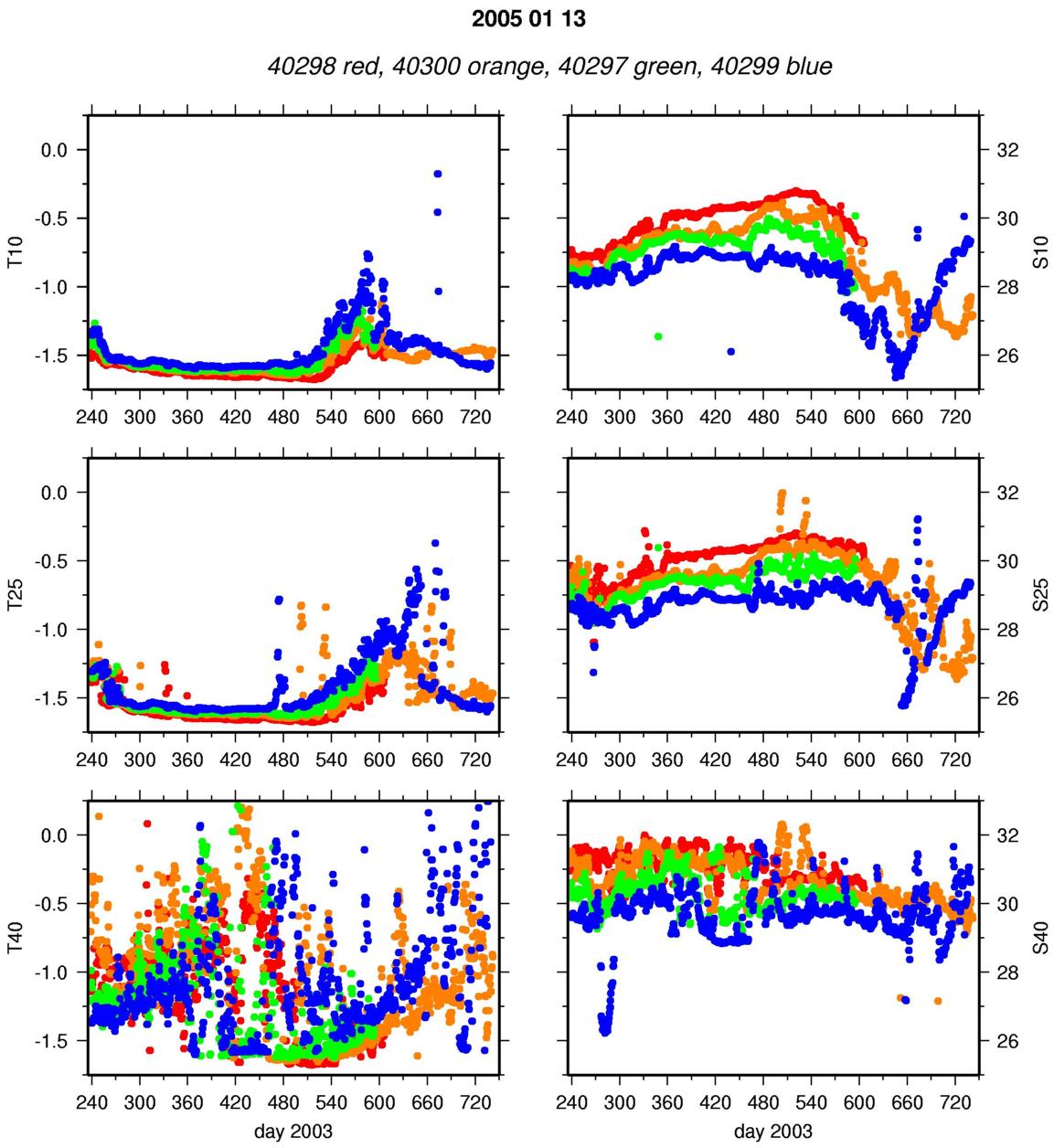
During the JWACS 2003 cruise, 4 ice beacons were deployed in a radial section through the BG upstream of the moorings, so that the ice drift will transport the buoys past the moorings. METOCEAN expendable ice beacons suspend 3 SeaBird MicroCats at 15, 25 and 40 m depths (the deepest MicroCat also has a pressure sensor to determine depth), interrogate each sensor twice per day, and broadcast the data via Argos, which also provides each drifter’s location. These ice drift timeseries are immediately made available to the IABP and GTS. The temperature and salinity data are updated daily on the BGFE website.
Due to relatively thin ice conditions during August, it was difficult to find multiyear icefloes thicker than 2 m. Large icefloes were selected during the cruise from RADARSAT maps and ice reconnaissance flights on helicopter. The actual buoy deployment site was selected after augering several small holes at different locations, on other sides of consolidated ridges. Typically, the ice thickness was about 1.5 m, with the bottom half saturated with water. Somewhat thicker ice was generally found in areas surrounded by ridges.
Buoy data is available here:

