Validation Data - WSC Moorings
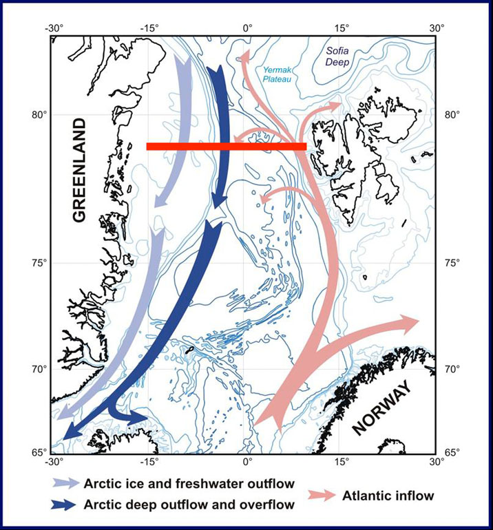
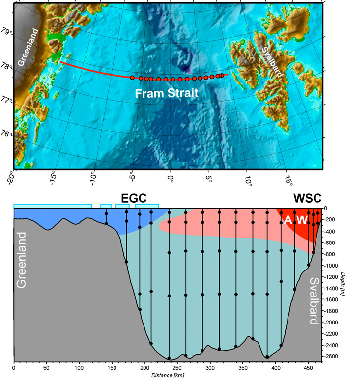
A Fram Strait section, with a focus on the West Spitsbergen Current, has been covered with a varying number of moorings continuously since September 1997 in the framework of the EU projects VEINS (Variability of exchanges in the Northern Seas) and ASOF - N (Arctic Subarctic Ocean Fluxes - North):
- 1997 - 1999 : 14 moorings,
- 1999 - 2000 : 11 moorings,
- 2000 - 2002 : 14 moorings,
- 2002 - 2004 : ASOF - 17 moorings.
The water column was covered from 10 m above the seabed to about 50 m below the surface. The observations extend from the eastern Greenland shelf break (6°51’W) to the western shelf break of Spitsbergen (8°40’E) at the latitude 78°50’N (in 1997-2002 with a shift of the moorings west of 000°E to the latitude 79°N.
A dataset is available comprised of monthly means of temperature and cross-section current (i.e., northward component) at 78°50'N :
- averaged between 5°E and 8°40'E (the total width of the WSC included) within the Atlantic Water layer defined as:
- layer 0-700 m (Mean_T_VC_5degE_700m.dat)
- water with T > 1°C (Mean_T_VC_5degE_1degC.dat)
- water with T >-0.1°C (Mean_T_VC_5degE_-0.1degC.dat)
- averaged between 7°E and 8°40'E (the main core of the WSC included) within the Atlantic Water layer defined as:
- layer 0-700 m (Mean_T_VC_7degE_700m.dat)
- water with T >1°C (Mean_T_VC_7degE_1degC.dat)
- water with T >-0.1°C (Mean_T_VC_7degE_-0.1degC.dat)
The data format is:
- Columns 1-3: year month day (day is not correct because data are centered in the midmonth)
- Column 4: mean temperature [°C]
- Column 5: mean current [cm/s]
Some plots with time series of monthly means (solid lines), and one year running average (dashed lines):
- Mean_T_5degE
- Mean_T_7degE
- Mean_VC_5degE
- Mean_VC_7degE
This data is kindly provided by Agnieszka Beszczynska of the AWI. Technical questions concerning use of the data can be addressed to abeszczynska@awi-bremerhaven.de. Permission to use the data in publications should be arranged through contact with the data provider.

