Dispatch 2: Science Plan
Sarah Zimmerman
September 6, 2020
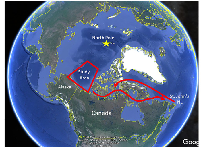
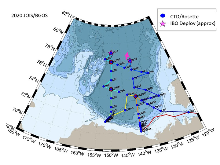
We are in St. John’s Newfoundland now, but our goal is the Arctic’s Canada Basin. Once there, we will sample a set of stations from the shallow coastal shelf of North America out through the large deep basin, up to 80 degrees north (600 nautical miles from shore). This will be the 18th year of this impressive time-series.
We’ll be measuring sea-water properties over a three-week period, taking a snapshot of the Canada Basin’s oceanography. We’ll look at the shape, size and speed of the Beaufort Gyre, the slow clockwise current that can store a great deal of low salinity water coming from rivers, sea-ice melt, and the upper waters of the Pacific Ocean. We’ll look at the heat being brought into the area by both the Pacific and Atlantic derived waters. Is the amount of dissolved oxygen changing? How is the ice cover changing? Are there biological changes associated with these physical changes?
We’ll make our measurements from the surface down to a few meters off the sea floor, almost 4 kilometers deep. Starting at the top, we look at the sea-ice and the very fresh surface waters, below this, the next 200m comes from the Pacific Ocean, and below this a thick ~2000m layer from the Atlantic Ocean. Finally in the bottom 800m or so, we measure the very homogeneous and stable bottom water. In this bottom layer the temperature changes by less than 0.001 degC across the Canada Basin.
The team on board will be measuring physical, biological and geochemical properties of the seawater using electronic sensors together with a suite of Niskin bottles we lower over the side of the ship. The bottles are closed at various depths and brought back on board for immediate analysis or packaged up for analysis when we return to shore.
We don’t look for fish in this program, but we do look at the smaller life, from zooplankton which we catch in fine nets, down to very small bacteria that live even in the deepest waters. Amongst other studies, what happens at this smaller scale is important for understanding the habitat for fish and marine wildlife.
To go along with our shipboard measurements the program has three moorings anchored to the sea floor and buoys floating with the sea-ice, collecting data through the year. We are going to leave the moorings in place until next year (an interruption due to the pandemic) but we will be putting out two ice-buoys.
In the dispatches to come, we’ll cover more of the research and what it is like to work and live aboard the Louis S St. Laurent.


