ITP17 Data Description
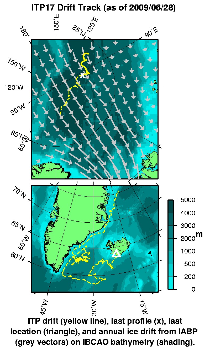
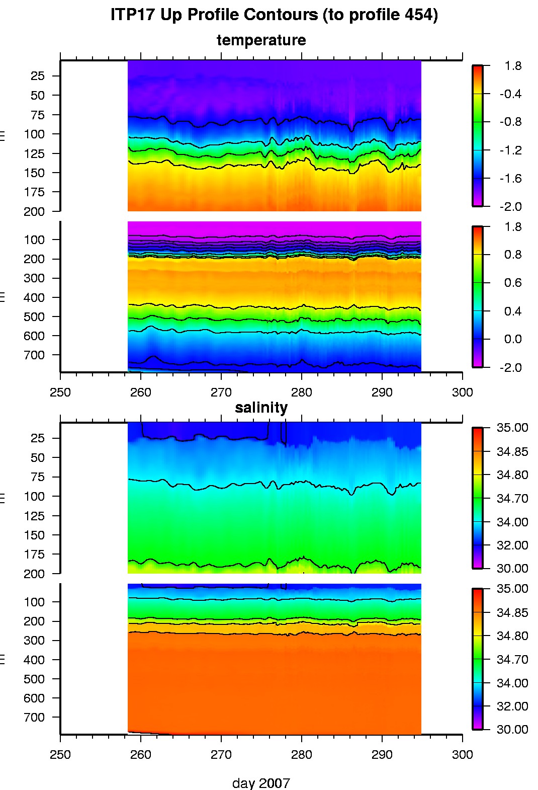
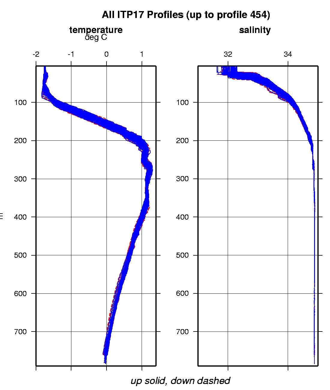
In the surface package, the GPS receiver was powered hourly to obtain locations, and buoy temperature and battery voltage status were recorded. The profiler appears to have suffered from weight gain after deployment, presumably due to a small leak. The up profile motor currents steadily increased, while the down profile motor currents steadily decreased, suggesting that the package was getting heavier. Over the second 20 day period, the profiler also began the profiles in both directions 20-40 m deeper than expected (likely due to the instrument sinking on the wire before starting the next profile). After 36 days the ITP profiler stopped profiling (battery voltage went low), but the surface package continued to transmit GPS locations and status for a total of 652 days (with a 194 day gap in locations from January to June 2008).
The plots to the right are of the final, calibrated, edited data (as opposed to the raw data presented on the active instrument pages).
See the Data Products tab to the left for descriptions of the three levels (I, II, III) of data processing and to access all data.
ITP 17 data can also be found at the links below:
Level II hourly buoy location data in ASCII format: itp17rawlocs.dat
Level III 1-Hz processed profile data in MATLAB format: itp17cormat.tar.Z and itp17cormat.zip
Level III 1-db bin-averaged processed profile data in MATLAB format: itp17final.mat
Level III 1-db bin-averaged processed profile data in ASCII format: itp17final.tar.Z and itp17final.zip


