ITP 33 Data Description
The ITP profiler was configured to operate with a standard sampling schedule of 2 one-way profiles between 7 and 750 m depth each day. In the surface package, the GPS receiver was powered hourly to obtain locations, and buoy temperature and battery voltage status were recorded.
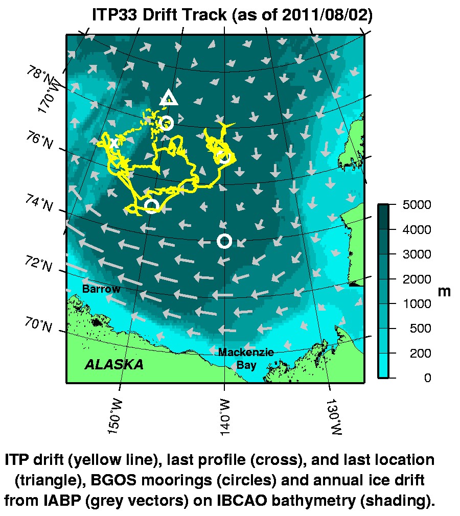
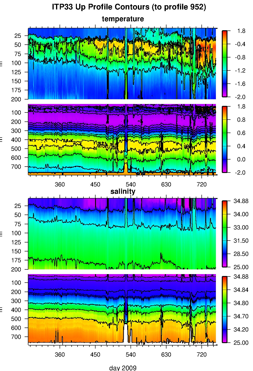
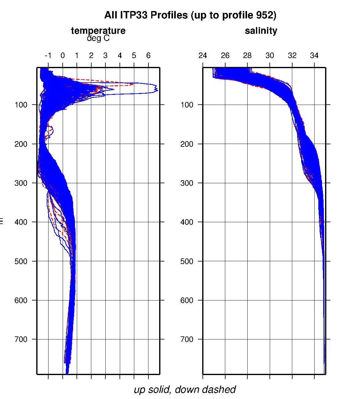
After deployment, the buoy drifted generally south, then west heading out of the Canada Plain (and thermohaline staircase region) during the first six winter months and over the Northwind Ridge for the next three months in spring 2010. Over the next five months in summer and autumn, the system sped up and largely backtracked over its previous drift track back into the basin. During the subsequent early winter months, it then completed a cyclonic loop, and returned to nearly the same westernmost location over the Northwind Ridge that it had visited over 6 months earlier. It is notable that the summer Pacific Water layer temperature maximum detected at this spot was generally below 0 °C in 2010, but several degrees above zero in 2011. Soon afterwards, the system began drifting northeast and communications with the profiler ceased on January 25, 2011. We now know after recovery of the surface package and damaged tether that the mooring likely dragged, and the profiler was probably lost around the same time. The surface unit continued broadcasting locations as it meandered northeastward back into the Canada basin until it was recovered in August 2011.
The plots to the right are of the final, calibrated, edited data (as opposed to the raw data presented on the active instrument pages).
See the Data Products tab to the left for descriptions of the three levels (I, II, III) of data processing and to access all data.
ITP 33 data can also be found at the links below:
Level II hourly buoy location data in ASCII format: itp33rawlocs.dat
Level III 1-Hz processed profile data in MATLAB format: itp33cormat.tar.Z and itp33cormat.zip
Level III 1-db bin-averaged processed profile data in MATLAB format: itp33final.mat
Level III 1-db bin-averaged processed profile data in ASCII format: itp33final.tar.Z and itp33final.zip


