ITP36 Data Description
The ITP profiler was configured to operate with a standard sampling schedule of 2 one-way profiles between 7 and 750 m depth each day. In the surface package, the GPS receiver was powered hourly to obtain locations, and buoy temperature and battery voltage status were recorded.
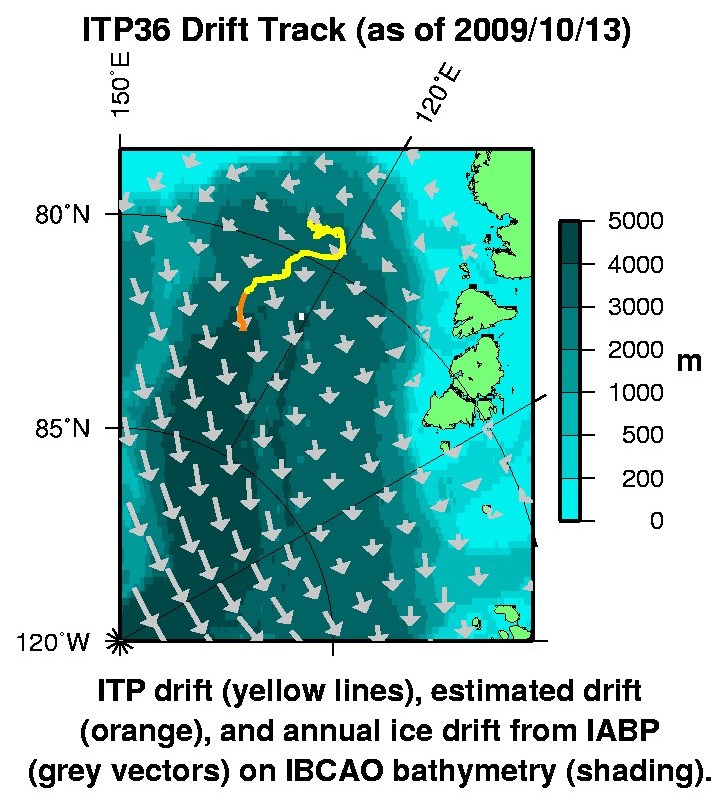
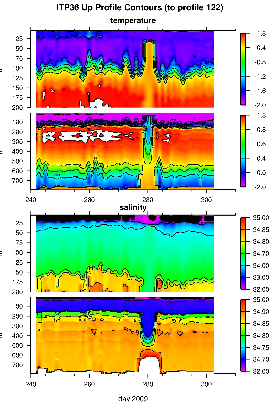
After deployment, the buoy drifted east, then north in the Eastern Eurasian Basin, subject to significant oscillations in drift speed at diurnal or inertial frequencies. Everything was performing well, until 44 days later (October 12, 2009) when the last transmissions of profile 90 data were received from the Iridium transmitter. In February 2012, the surface package and top tether portion were discovered washed ashore in Iceland. While the surface package electronics chamber had been compromised by seawater, information was still able to be obtained from the flash card, so that another 32 profiles (until October 29, 2009) were retrieved, but only one more day of GPS locations (other status information continued to be collected until May 8, 2010). Consequently, it appears that the buoy was encased in a ridge beginning on October 12, 2009 (no Iridium), pushed below the sea ice the following day (no GPS), the tether torn 16 days after that (no profiles), and the surface package flooded 6 months later. It is unknown when the package arrived in Iceland.
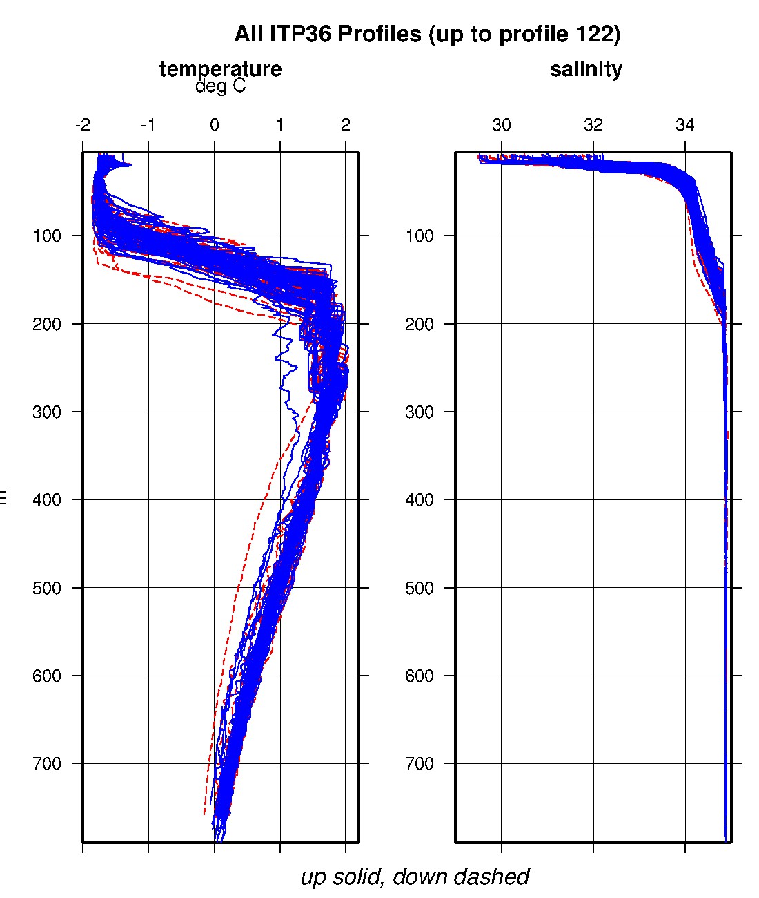
The plots to the right are of the final, calibrated, edited data (as opposed to the raw data presented on the active instrument pages).
See the Data Products tab to the left for descriptions of the three levels (I, II, III) of data processing and to access all data.
ITP 36 data can also be found at the links below:
Level II hourly buoy location data in ASCII format: itp36rawlocs.dat
Level III 1-Hz processed profile data in MATLAB format: itp36cormat.tar.Z and itp36cormat.zip
Level III 1-db bin-averaged processed profile data in MATLAB format: itp36final.mat
Level III 1-db bin-averaged processed profile data in ASCII format: itp36final.tar.Z and itp36final.zip


