ITP44 Data Description
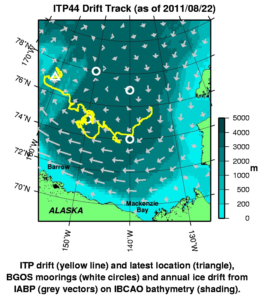
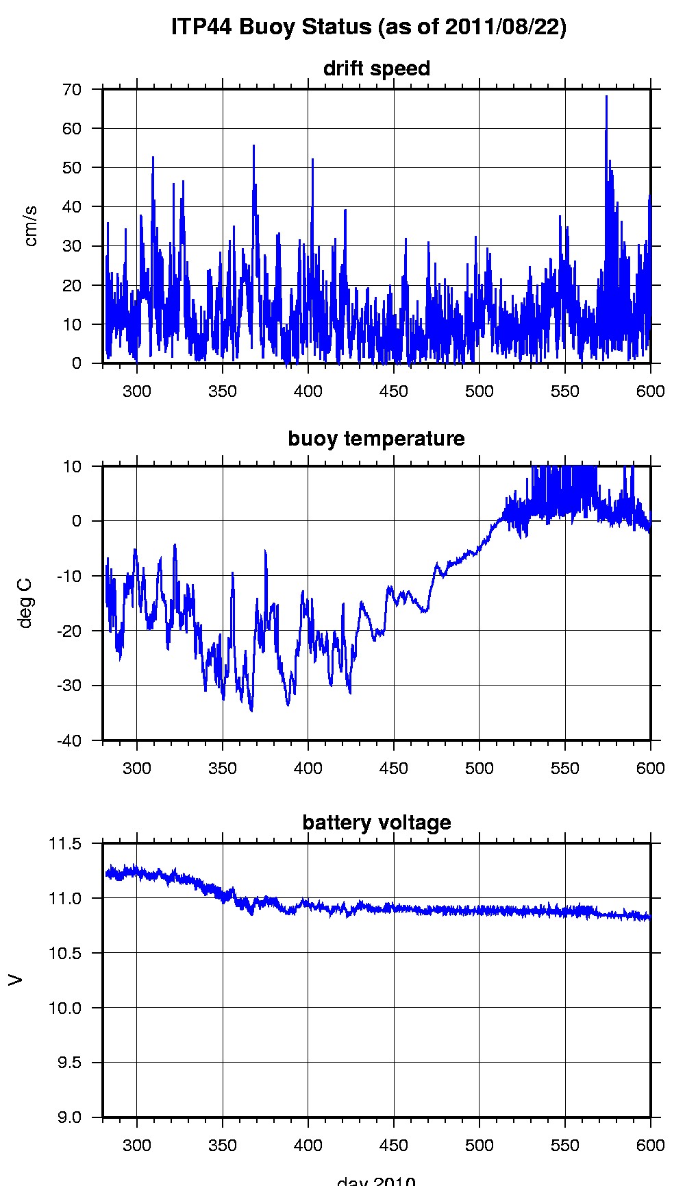
The ITP profiler was configured to operate with a pattern profiling schedule, but communications between the underwater and surface unit failed after the first partial down profile. In the surface package, the GPS receiver was powered hourly to obtain locations, and buoy temperature and battery voltage status were recorded. The transmitted status information indicated that the profiler was likely operating until January 11, 2011 as the tone detector in the surface package was awakened on schedule by the profiler until that date. It is likely that one of the inductive modems failed, or the tether could have been damaged prohibiting the transfer of data between the units. The ITP drifted generally westward until August 22, 2011 when the surface package ceased Iridium transmissions.
The plots to the right are of the final location and status data.
See the Data Products tab to the left for descriptions of the three levels (I, II, III) of data processing and to access all data.
ITP 44 location data can also be found at the links below:
Level II hourly buoy location data in ASCII format: itp44rawlocs.dat

