ITP 1 Data Description
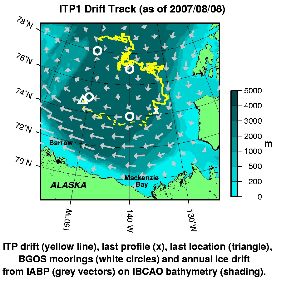
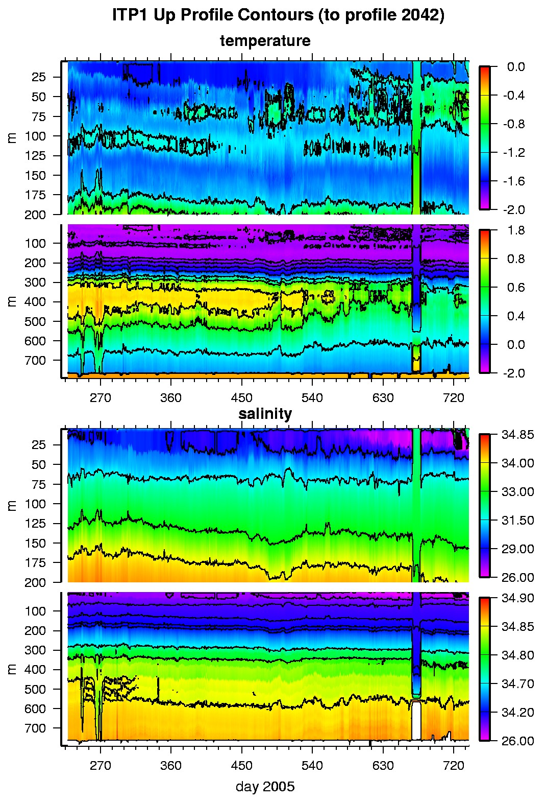
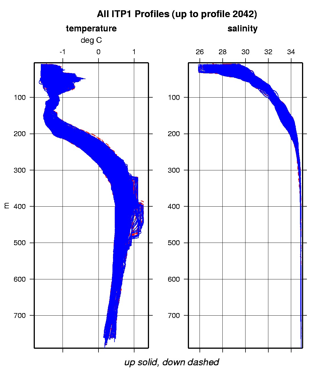
The ITP profiler was configured to operate with an accelerated sampling schedule of 4 one-way profiles between 10 and 750 m depth each day in order to more quickly evaluate endurance and component fatigue, and was outfit with an extra battery slice (50% more capacity than standard). In the surface package, the GPS receiver was powered every two hours to obtain locations, and buoy temperature and battery voltage status were recorded. After 511 days of reliable operation and data telemetry, the ITP profiler stopped profiling and acquiring data when the internal flash card memory was filled (the operation software was subsequently rewritten to enable file deletion after successful transferring of data to the surface package to prevent this situation on later profilers). The surface package continued to transmit GPS locations and status for a total of 723 days, when the system was recovered.
The plots to the right are of the final, calibrated, edited data (as opposed to the raw data presented on the active instrument pages).
See the Data Products tab to the left for descriptions of the three levels (I, II, III) of data processing and to access all data.
ITP 1 data can also be found at the links below:
Level II bi-hourly buoy location data in ASCII format: itp1rawlocs.dat
Level III 1-Hz processed profile data in MATLAB format: itp1cormat.tar.Z and itp1cormat.zip
Level III 1-db bin-averaged processed profile data in MATLAB format: itp1final.mat
Level III 1-db bin-averaged processed profile data in ASCII format: itp1final.tar.Z and itp1final.zip


