ITP20 Data Description
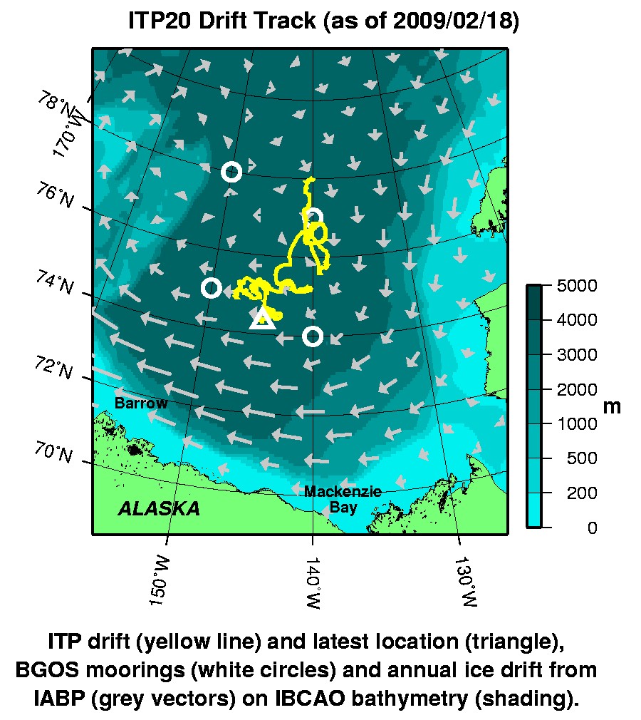
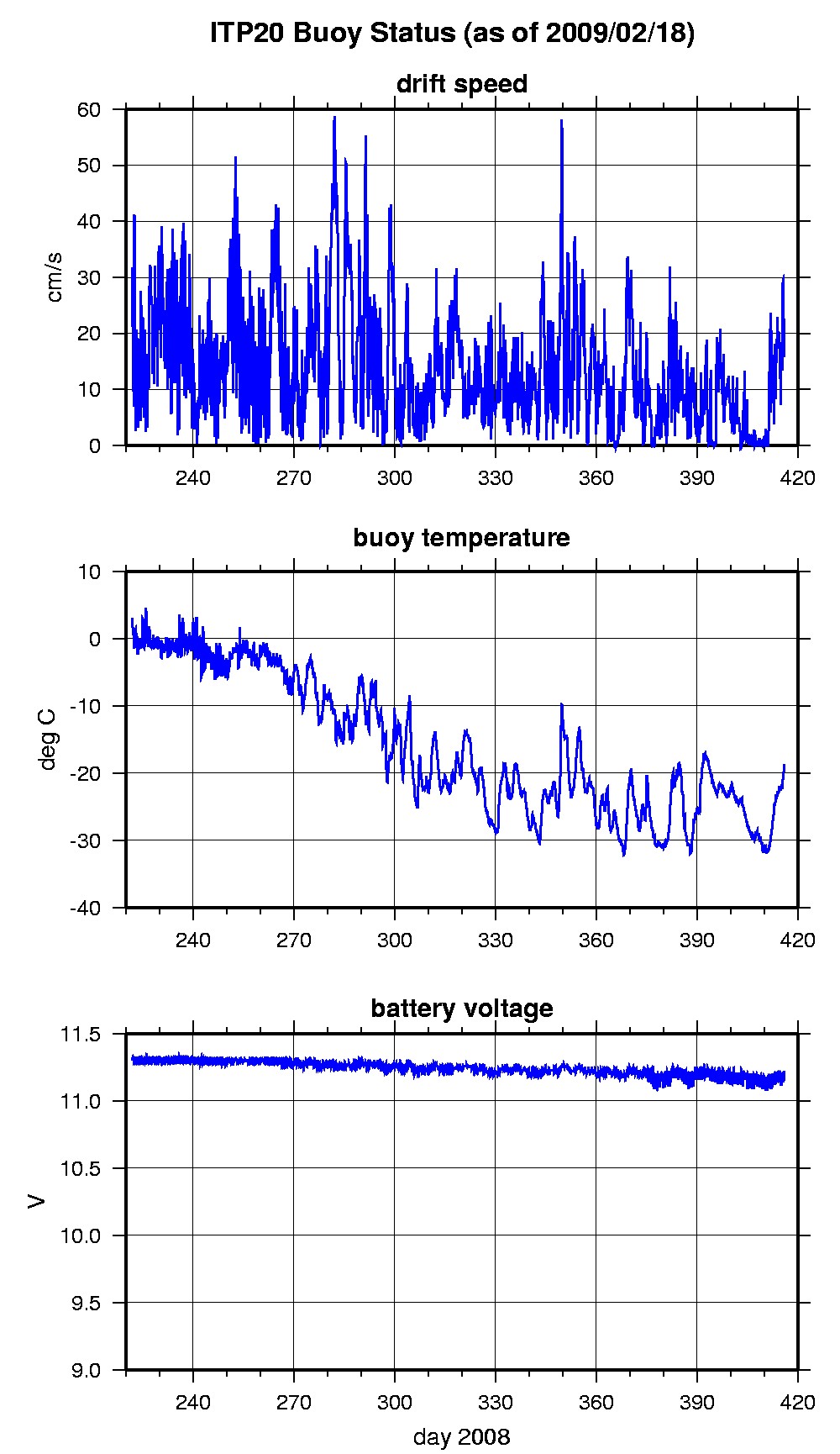
The ITP profiler was configured to operate with a pattern profiling sampling schedule but due to a programming error the instrument start was delayed In the surface package, the GPS receiver was powered hourly to obtain locations, and buoy temperature and battery voltage status were recorded. After only 194 days of reliable operation and data telemetry on a seemingly robust ice floe (and shortly before the profiler would have started sampling), the surface package ceased transmitting GPS locations and status.
The plots to the right are of the final location and status data.
See the Data Products tab to the left for descriptions of the three levels (I, II, III) of data processing and to access all data.
ITP 20 location data can also be found at the link below:
Level II hourly buoy location data in ASCII format: itp20rawlocs.dat

