ITP27 Data Description
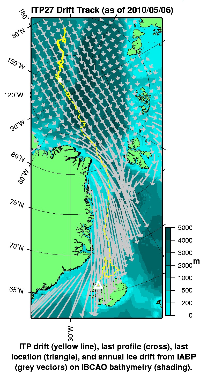
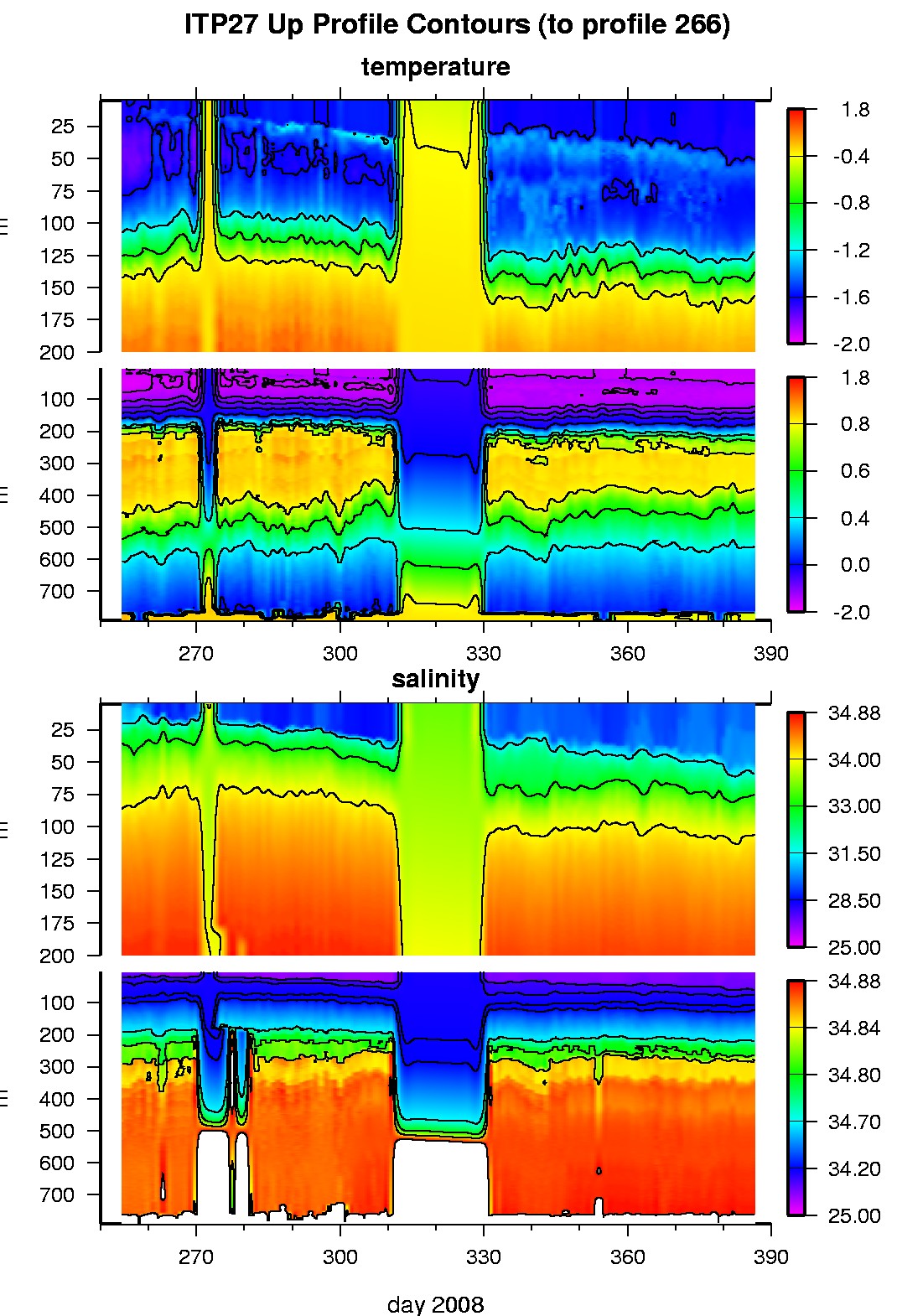
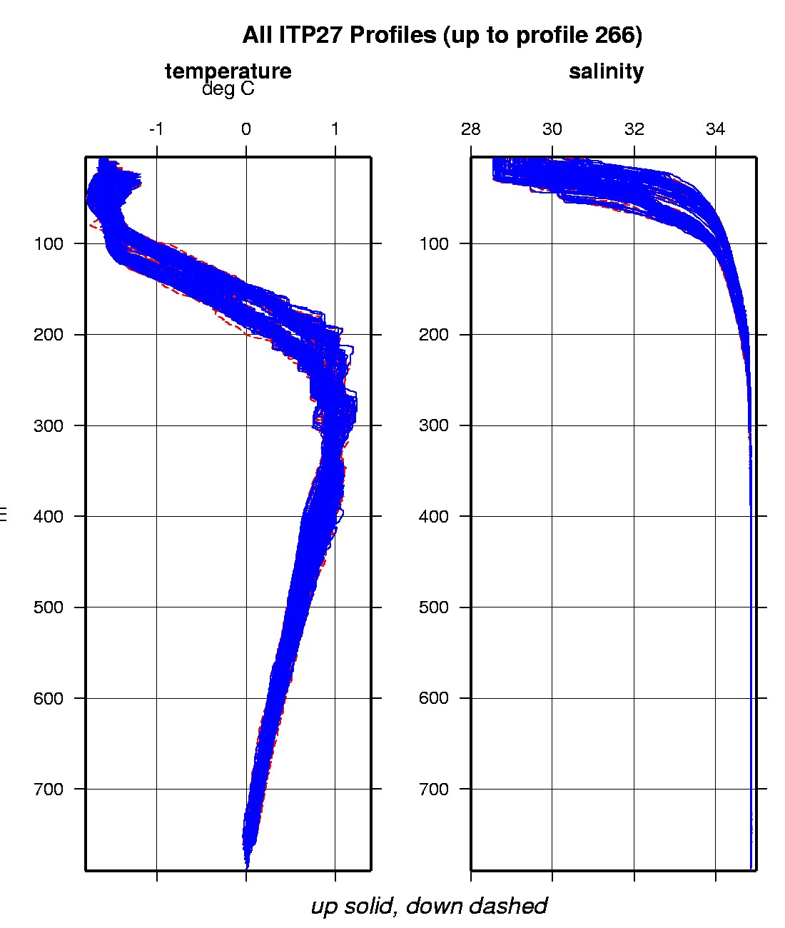
The ITP profiler was configured to operate with a standard sampling schedule of 2 one-way profiles between 7 and 750 m depth each day. In the surface package, the GPS receiver was powered hourly to obtain locations, and buoy temperature and battery voltage status were recorded. Following its deployment, ITP24 recorded 266 profiles while the system drifted north in the Makarov Basin and west of the Lomonosov Ridge until the profiler ceased communicating with the surface package on January 20, 2009. The buoy continued to provide daily status data including locations until March 2, 2009 when Iridium communications ceased (within 140 miles of the North Pole). Buoy drift speeds during this period were mostly between 10 and 30 cm/s, with a few spikes exceeding 40 cm/s.
However, data from the recovered surface package shows that the system continued to acquire GPS locations. The buoy drifted within 6 miles of the North Pole, proceeded through Fram Strait, and washed ashore on Iceland on February 19, 2010 where it remained until it was discovered the following April.
The plots to the right are of the final, calibrated, edited data (as opposed to the raw data presented on the active instrument pages).
See the Data Products tab to the left for descriptions of the three levels (I, II, III) of data processing and to access all data.
ITP 27 data can also be found at the links below:
Level II hourly buoy location data in ASCII format: itp27rawlocs.dat
Level III 1-Hz processed profile data in MATLAB format: itp27cormat.tar.Z and itp27cormat.zip
Level III 1-db bin-averaged processed profile data in MATLAB format: itp27final.mat
Level III 1-db bin-averaged processed profile data in ASCII format: itp27final.tar.Z and itp27final.zip


