ITP34 Data Description
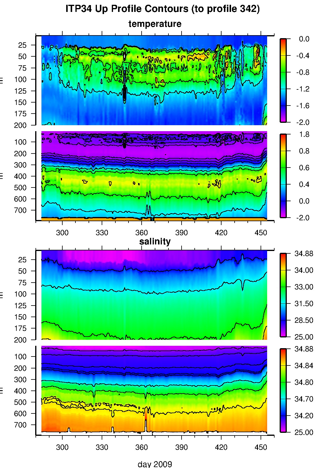
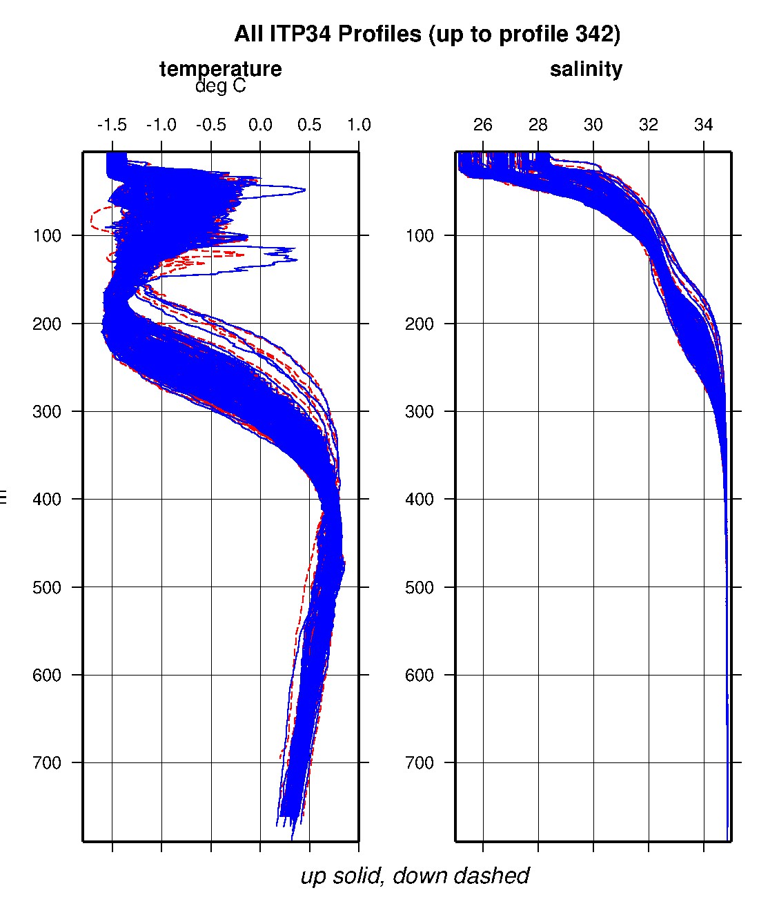
The ITP profiler was configured to operate with a standard sampling schedule of 2 one-way profiles between 7 and 750 m depth each day. In the surface package, the GPS receiver was powered hourly to obtain locations, and buoy temperature and battery voltage status were recorded.
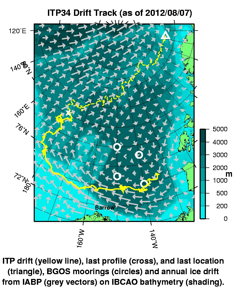
The buoy drifted westward in the Canada Basin for the first 5 months, then climbed the slope in the Chukchi Sea and was dragged along the shelf for another 3 months, before returning to deep water over the Chukchi Plain. Once the mooring climbed the slope, the mooring presumably dragged in the shallow water and the profiler ceased climbing, but apparently was dragged near or along the bottom while continuing to send data from only single or a few meter vertical extents varying in time. Even after returning to the deeper water in June 2010, the profiler was unable to climb and continued to send limited vertical extent data until November 26, 2010, when the profiler ceased communicating with the surface package. The surface package continued drifting across the Arctic Ocean until it ceased transmitting on August 7, 2012 north of Greenland.
The plots to the right are of the final, calibrated, edited data (as opposed to the raw data presented on the active instrument pages).
See the Data Products tab to the left for descriptions of the three levels (I, II, III) of data processing and to access all data.
ITP 34 data can also be found at the links below:
Level II hourly buoy location data in ASCII format: itp34rawlocs.dat
Level III 1-Hz processed profile data in MATLAB format: itp34cormat.tar.Z and itp34cormat.zip
Level III 1-db bin-averaged processed profile data in MATLAB format: itp34final.mat
Level III 1-db bin-averaged processed profile data in ASCII format: itp34final.tar.Z and itp34final.zip


