ITP55 Data Description
The ITP profiler was configured to operate on a standard sampling schedule of 2 one-way profiles between 7 and 750 m depth each day. In the surface package, the GPS receiver was powered hourly to obtain locations hourly, and buoy temperature and battery voltage status were recorded.
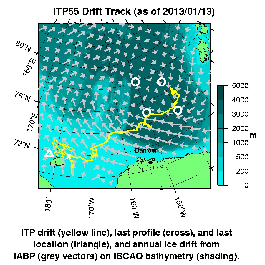
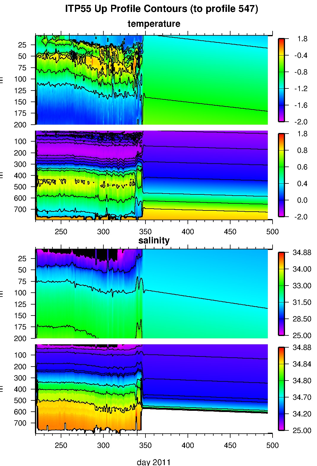
The buoy drifted initially southward then headed generally west from 75 to 74°N latitudes. After 4 months, on December 12, 2011, the tether anchor contacted the shallow Chukchi shelf bathymetry near 74°N, 161.5°W, and the profiler ceased profiling but continued to communicate. At first the instrument hovered around 360 m depth, then gradually rose to hover between 35 and 15 m depth, until it ceased communicating with the surface package on May 8, 2012, at a location just northeast of Wrangel Island. The surface package continued to transmit status and GPS for another 8 months while it skirted generally westward just north of the Wrangel Island shoreline.
The profiler was no longer communicating with the surface package, and the unit finally ceased transmitting altogether nearly 5 months later on October 4, 2012. Almost one year later, in September 2013, the buoy was discovered washed ashore on western Ireland.
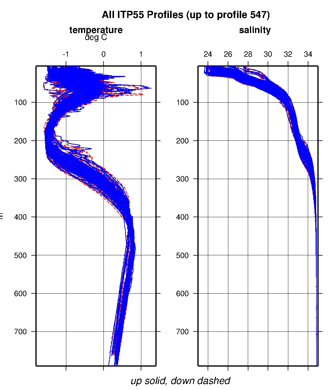
The plots to the right are of the final, calibrated, edited data (as opposed to the raw data presented on the active instrument pages).
See the Data Products tab to the left for descriptions of the three levels (I, II, III) of data processing and to access all data.
ITP 55 data can also be found at the links below:
Level II hourly buoy location data in ASCII format: itp55rawlocs.dat
Level III 1-Hz processed profile data in MATLAB format: itp55cormat.tar.Z and itp55cormat.zip
Level III 1-db bin-averaged processed profile data in MATLAB format: itp55final.mat
Level III 1-db bin-averaged processed profile data in ASCII format: itp55final.tar.Z and itp55final.zip


